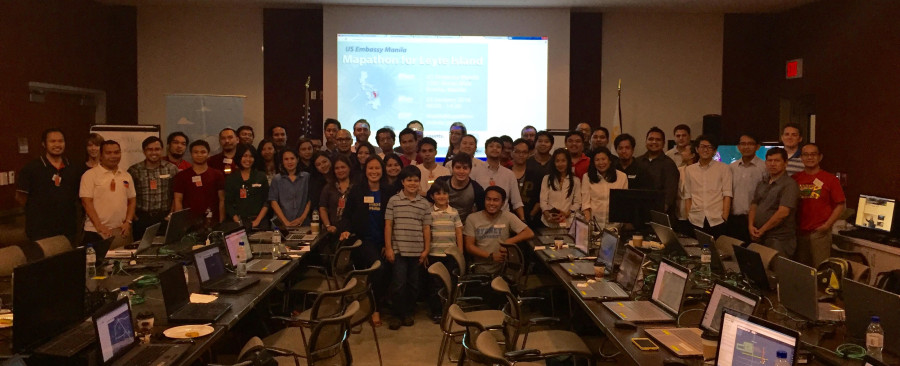
Over 50 participants completed over 28,000 edits at the U.S. Embassy’s Leyte Mapathon on January 23, in partnership with Map the Philippines and OpenStreetMap Philippines. The U.S. State Department’s MapGive program generously provided satellite imagery to improve maps for the Red Cross Typhoon Haiyan Recovery Program in Leyte. They are currently working in 23 barangays or villages on integrated recovery programs including house construction, house repair, community infrastructure, disaster risk reduction, livelihoods and water and sanitation.
Members from Philippine, American, Swiss and French Red Cross teams in Tacloban participated in the mapping workshop. American Red Cross’ Country Representative, Margaret Stansberry and Monitoring and Evaluation Delegate, Will McFall, spoke about how the Leyte mapathon helps create better maps and data for various stakeholders. Many thanks to Erwin, Rally, Eugene and Ervin from OSM-PH for their support.
The Leyte task is 67% complete so we still need your help to edit and verify data. We hope you’ll join us!
Gallery photos courtesy United States Public Affairs Office.