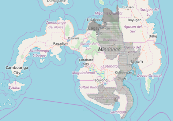
My Canadian consulting company is currently mapping the Mindanao region to support rural farming, gender, healthcare and artisan communities. The Mindanao region grows almost half the country’s food, yet remains the poorest population, with many communities at 30-70% poverty incidence. War and conflict have increased in the region in recent years, with security and safety concerns for girls and women. Our goal is to help map rural agriculture, logistics and the gender gap to plan improved infrastructure with long-term impacts on health, well-being and livelihood for girls, women, Indigenous Peoples and farm families.
This is a coordinated effort across international agencies, government, business, non-profits, academe and community leaders. Our study results will lead the prioritization and coordinated planning between international funding agencies and private investment in the second phase of this initiative.
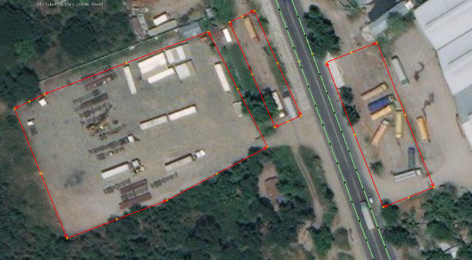
We’ll be working with communities to teach them to map and using geospatial technologies to rapidly analyze infrastructure gaps for validation with local communities.
Local YouthMappers chapters at Far Eastern University and University of the Philippines Resilience Institute, Map the Philippines, George Washington University Humanitarian Mapping Society, and USAID GeoCenter are generously supporting the validation of these tasks.