I presented my local data economy model at the University of Technology Sydney’s Institute for Sustainable Futures Revealing Resilience Series: Exploring synergies between community and individual measurement approaches to resilience.
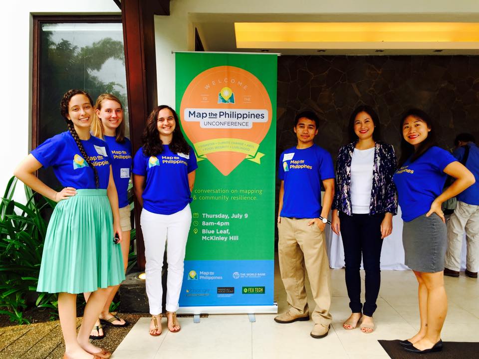
In 2019, I led my largest implementation and field testing of my local data economy model. Research, investment, policy and program development studies are typically conducted in a siloed and uncoordinated fashion that requires a lot of time, effort and expense for local communities. The Philippines is ranked as the most at risk for disasters and climate change, averaging 22 typhoons (hurricanes or cyclones) a year. This places a tremendous burden on local communities who are typically required to travel long, difficult journeys to attend numerous events and workshops that are often located far away near airports or luxury hotels for the convenience of donors and funders.
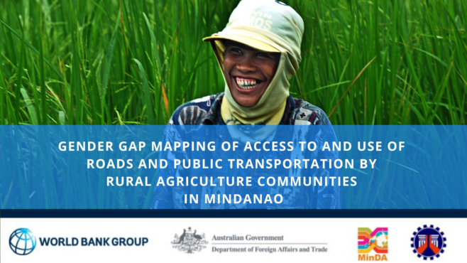
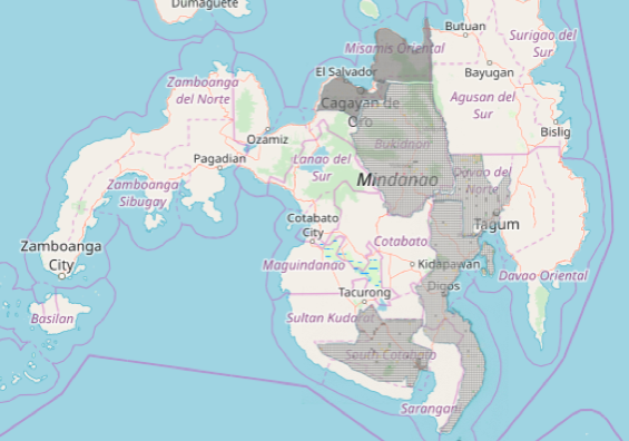
In 2019, with World Bank, IFC and Australian Department of Foreign Affairs and Trade funding, I was able to conduct five simultaneous studies, including World Bank’s first gender gap mapping study, across six provinces in the conflict region of Mindanao in the Philippines as Technical Assistance for the Mindanao Transport Connectivity Improvement Project:
600 Gender Gap Mapping Household Surveys
7000 Agriculture Commodity Flow and Origin-Destination Surveys
Six Province AI Studies on Industrial Logistics Congestion and Challenges
3 Regional Open Workshops for 180 Cross-Sector Participants (including micro enterprise through to conglomerates)
Road, Agriculture, Micro to Medium Enterprise (MSME) to Industrial, Indigenous, Tourism and Creative Industries and Disaster Infrastructure Field and Remote Mapping
These studies required 200 field staff, all of whom were Filipino, and 180 were located in close proximity to the survey sites. For the community-based mapping workshops, I undertook a careful validation process of ensuring the community was represented by progressive cross-sector leaders across government, business, non-profit, schools and university staff and students, and local community leaders. Rather than requiring a technical background, an interest to learn and teach others was the primary criteria, because the best knowledge often comes from people with strong community ties and diverse experiences. Our simplified mapping techniques ensure that anyone can learn to map, and we’ve trained people from age 6-60+ years.
Through our exclusive use of free and open source software and frugal sciencem methods, and hiring local staff and data collectors and processors, we not only strengthen local community engagement, but we are able to increase and improve the standard of data and outputs, at a much lower costs and environmental footprint. This enabled on average, and increase of 2-5 times higher staff and data wages. With every expense designed to directly benefit the local community sites, we create opportunities for research, investment, policy and program development studies, across public and private sectors to be transformed into accelerated impact models.
We were fortunate to compelete the program and report approvals in March 2020. This project enabled and challenged me to further develop inclusive innovations, frugal science, and safer methods that achieve representative data samples at scale, while supporting our highest wages to date, which is US$100 per hour for fully remote recruitment and data collection during the pandemic.
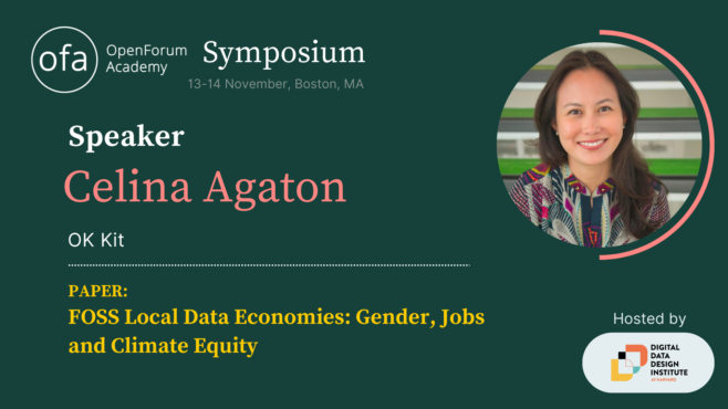
OpenForum Europe (OFE) recently invited me Boston to present my local data economy in partnership with Harvard’s new Digital Data Design Institute. OFE is a European open source software think tank that advises European policymakers and legislators on the merits of openness in computing and provides technical analysis and explanation. OFE promotes open source software, as well as openness more generally, as part of a vision to facilitate open, competitive choice for technology users.
FOSS local data economies are self-sustaining and more equitable economic, social and environmental models that meet the pace and urgency of accelerating global risks. Faster, more accurate, verifiable and representative data enable better public and private sector prioritization, coordination and monitoring across the Sustainable Development Goals (SDGs). The SDGs largely lack geospatial indicators that capture mobility, safety, proximity, infrastructure and service assessments, which accurately reflect the intersecting risks and opportunities communities experience in real-life. 78% of the 231 SDG indicators lack gender data, and despite women’s majority contributions to household and economic tasks, they have the least access to essential household and business infrastructure.
OECD reports that less than 10% of funding is received by local organizations, with 80% of climate research awarded to Western organizations over the last 30 years. Of the $137 billion invested a decade after Super Typhoon Haiyan and the Sendai Framework, only 4 percent was invested in mitigation in Asia Pacific, and the lack of coordination and tangle of overlapping multilateral efforts continues to create further chaos to already traumatized communities.
Rather than a siloed and political approach reliant on glacial grant and funding processes, local governments and cross-sector communities co-develop their own continuous and interoperable SDG map with geospatial indicators to better fast track public and private sector investments and interventions, receive the majority of budgets, and address long neglected infrastructure and the unique needs of marginalized communities.
With the exclusive use of free and open source mapping tools including unique digital twin techniques for infrastructure and disaster modelling, non-technical and technical local communities produce faster, more accurate, representative and verifiable data, at 50% lower cost and environmental footprints, while increasing local daily wages 100-900 percent, starting at 3 months. The highest wage to date is remotely trained World Bank road safety surveys at $100 per hour of work.
This an immediately viable transition to a local data economy, where local communities continuously lead data and knowledge on their community, industry and geography, to depoliticize investments, with greater governance and accountability, especially in technology, engineering and construction, which are among the most corrupt industries.
This bridges the gaps between effective policy, program development, local capacity, data and research gaps.
Thrilled to be invited by the Youthmapper family to write a chapter on my gender, jobs and climate program for Springer’s Sustainable Development Goal Series. Open Mapping towards Sustainable Development Goals
Offers the voices of students or recent graduates in countries where YouthMappers is active
Covers topics ranging from water, agriculture, food, to waste, education, gender, and disasters
Addresses topics at various scales of perspective, from individual/local city level to national and global scopes
This book is open access, which means that you have free and unlimited access
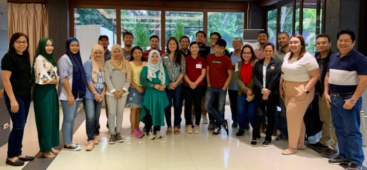
In September 2022, CGIAR funded our Open Knowledge Kit accelerated humanitarian and MSME regeneration program in Bali, Indonesia. We brought together selected technical and non-technical women and Indigenous youth to learn our accelerated program of SDG data collection, mapping, analytics and monitoring, drone operations, and Tourism and Creative Industries micro, small and medium enterprise support and market access.
Our model delivers faster, more accurate verifiable representative data using free and open source tools and low-cost equipment. Training local communities means expensive consultant, equipment, software and travel costs and carbon footprints are greatly reduced, and enable continuous and consistent monitoring while increasing local daily wages by 100 to 1700 percent.
CGIAR is a global research partnership for a food-secure future dedicated to transforming food, land, and water systems in a climate crisis. The Open Knowledge Kit program is supported under their gender and digital divide Digital Innovation Initiative.
Open Knowledge Kit is a global program that addresses long-standing barriers to addressing gender, jobs and climate security gaps. Non-technical and technical cross-sector local communities led by women are rapidly trained across 15 free and open source tools to create local data employment opportunities at 2-17 times higher daily wages, while agriculture, tourism and creative industries are connected to premium and ethical clients.
We’re committed to the long-term well-being of local communities by coordinating donors across multi-year investments and enabling them to make more informed decisions with better data, prioritization and monitoring methods across the Sustainable Development Goals.
Bali Fab Fest is organized by the Fab Foundation, the Center for Bits and Atoms at MIT, the Fab City Foundation, and the Meaningful Design Group. It brings together two major annual events, the 17th edition of the Fab Lab Conference and 7th Fab City Summit 2022. Bali Fab Fest is a learning experience for both international participants and local stakeholders who invest their efforts into inventing and realizing the world that is coming next, responding to global challenges such as climate change and social exclusion through small scale interventions in situated communities. The event aims to promote and enable meaningful collaborations between innovators, makers, entrepreneurs, organizations, and the public sector.
Early warning weather alerts, real-time traffic maps, ride-hailing services. Technology has quietly become part of our daily lives.
SEAsia is home to the world’s fastest growing e-commerce market. As a result, there is a pressing need to ensure that communities are not left behind in an increasingly digital world.
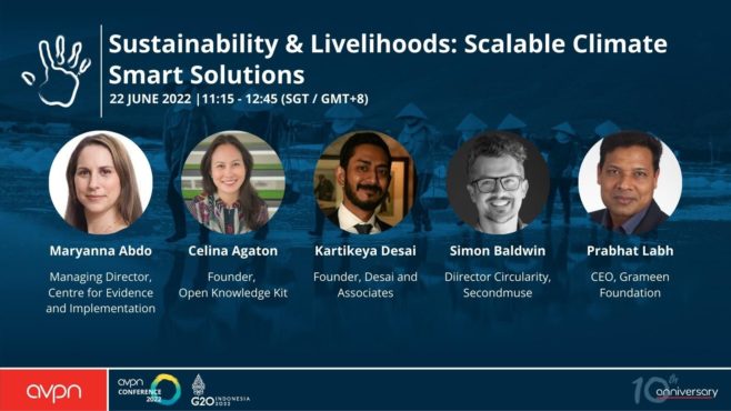
In this session we will talk about climate smart solutions that contribute to achieving the Sustainable Development Goals (SDGs) of reducing hunger, closing the gender gap and improving environmental management.
Access to technology can level the playing field for struggling rural farmers, new low-cost data collection models result in 17 times higher wages for local communities and an app for informal waste workers can contribute to a clean ocean.
What needs to happen to fully utilize the potential of green tech for our planet and our societies? What can funders do to empower local communities to develop their own solutions? How can bold innovations be fostered?
Key Takeaways:
How green tech can open a path towards sustainable growth across the spectrum of climate, gender and livelihoods
Beyond free and open source technologies, placing cross-sector communities at the centre of knowledge stewardship and employment models provides the stability critical to bridge successful policy and program implementation, while dramatically reducing costs and carbon footprints
Initiatives to improve recovery rates of plastics in the ocean need to take into account the social and economic impacts on informal waste worker
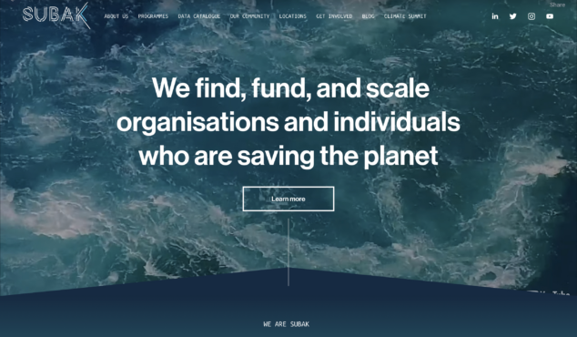
In 2022 I was one of six people awarded with a fellowship at Subak Australia. Subak’s Fellowship funds innovative climate data specialists. This funding partially supported outputs for my G20 presentations, to show that my OK Kit local data economy and MSME program can provide better data, local revenues and social impacts at significantly lower costs and climate footprints, in just 3 months.
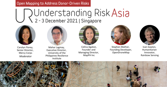
We were invited to present at two sessions at the 2021 Understanding Risk Asia conference hosted by World Bank and National University of Singapore.
I led a solo session talking about our Open Knowledge Kit program and four career tracks and also curated the panel presenting the developers behind our technology and implementing partners.
Open Knowledge Kit (OK Kit) is a free and open-source tool kit to empower local communities with digital employment through geospatial data collection, analytics and monitoring toward the stewardship of their economic, climate, and social prosperity. Surveys, disaster and climate change modeling and 3D reconstruction are now possible at much lower costs, training local and non-technical communities.
OK Kit Addresses the key barriers to achieving the SDGs:
1. Short-term and uncoordinated donor projects led by community outsiders 2. Expensive, proprietary and closed technology systems 3. The gender gap 4. Decent Work
The Open Knowledge Kit Regeneration Program addresses key challenges in the pandemic and climate crisis: How to collect near real-time data, how to create research, policy and programs that reflect the central role of women in the economic and social prosperity of their communities, how to address the political and funding barriers in hazard and climate change modeling, and how to develop fully local research teams to address revolving door outsider and expat models in vulnerable communities.
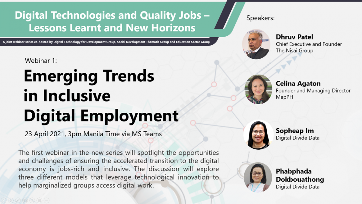
On Friday, April 23, 3pm Manila time, I will discuss our women-led open knowledge stewardship program using free and open source data collection, mapping and analytics tools and pioneering technologies. Effective humanitarian and development action should be led by the women who are at the center of the social and economic prosperity of their communities. Mapping and data science jobs also provide meaningful and productive work with fair wages, while working safely from home.
This the first Asian Development Bank webinar in a new series that will spotlight the opportunities and challenges of ensuring the accelerated transition to the digital economy is jobs-rich and inclusive. The discussion will explore three different models that leverage technological innovation to help marginalized groups access digital work.
Objectives
The webinar will:
Share findings from the experience of leading innovative digital skills and employment organizations in the region
Highlight opportunities and challenges to scale what works to support inclusive and sustainable recovery from the COVID-19 pandemic
Identify how governments and the private sector can work together, including opportunities for ADB engagement
There is 06:00 UTC session and a 16:00 UTC session. Select the ticket for the session you want to attend. Both are 1:30 long.
About this Event
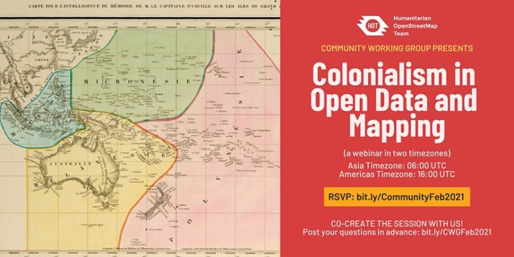
“And while maps may be missing from digital platforms and social networks, we are still here.” – David Garcia, 2020
Maps and digital data have played crucial roles in humanitarian aid eg. disaster response. Although it is of best interest to help local communities through generating data and features on the map, humanitarian actors and mappers should take note that we are not only mapping features (houses, roads, waterways, etc), but also mapping the land, oceans, and communities who live and are stewards of that space. With this webinar, we want to examine and discuss this balance (community digital information), decolonizing open data and open mapping, and representation and power in humanitarian mapping, among others.
There are two sessions so that people in every time zone can attend. You are welcome to attend either or both of them. You must register to attend. You will receive an email a couple of days before the event with a Zoom link to attend.
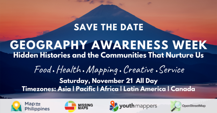
This year’s Geography Awareness Week helps bring together regional communities to discuss shared histories in food, work and now, Covid. Hear the stories of nice people doing good work. Connect with friendly local and regional communities, learn about free training, resources and funding opportunities. Short talks and discussions will run throughout the day across regional time zones. Everyone is welcome. More details to come soon!
Stay updated on events on Facebook https://fb.me/e/1NBreSiPv
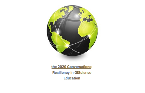
Join the first Asia Pacific series on resilient Geographic Information Systems education on Monday Aug 17th 2am UTC.
Asia – Pacific Panel 1: Pedagogies for Resilient GIScience Education.
Monday August 17, 2020, from 2:00 – 3:30 pm New Zealand / 12 – 1:30 pm Sydney / 10 – 11:30 am Beijing
Click here to watch a recording of this panel discussion and here to read a transcript of the chat discussion.
Panelists:
Yinghui (Cathy) Cao is a Lecturer in Geography at Qingdao University, China. She earned her PhD from the University of Western Australia, and M.A. from Temple University (US). With an experience of teaching and learning GIS related subjects from three countries, she is able to reflect on the distinctions in university culture and programs and their influence on GIS pedagogy. Cathy’s research focuses on the use of geographic information and geovisual techniques for improving public education and communication concerning climate change and disaster risk.
David Garcia (social media: @mapmakerdavid), originally from the Philippines, is a Geospatial Science PhD student at the University of Canterbury, New Zealand. He is a prolific mapmaker with a background as a geographer and urban planner in cities and communities hit by disaster or war. His PhD project is an ethnography of crowdsourcing and GIS by working with the OpenStreetMap community. He is a member of the Ministry of Mapping (social media: @mappingministry), a geospatial collective that cares about equity, diversity, and regeneration in Asia and the Pacific.
Celina Agaton (Twitter: @CelinaAgaton) helps revitalize local economies around the world through heritage preservation, food security, gender, sustainable tourism, open data and free and open source geospatial technologies. Her programs coordinate efforts across community sectors and funders. She loves creating vibrant, accessible and sustainable creative spaces that connect people to the things they care about in their communities. Her projects take her around the world, working with CEOs, farmers, government leaders, doctors, artists and students. She consulted as the community engagement director and strategist for innovation thought leader, Don Tapscott’s initiatives including Open Cities and Global Solution Networks at the Martin Prosperity Institute, and was a contributor to social innovation bestseller, Macrowikinomics: New Solutions for a Connected Planet.
Martin Tomko (Twitter: @dinomirMT) is a spatial information scientist specialising in computational approaches to spatial communication problems (i.e., the communication in and about our spatial environment with a primary focus on cities. Beyond that, he has a keen interest in spatial databases, and in cultural heritage documentation. He is currently Senior Lecturer at the Department of Infrastructure Engineering and part of the Geomatics Discipline team at The University of Melbourne, Australia. Martin is also a founding member and member of the board of directors of OSGeo Oceania.
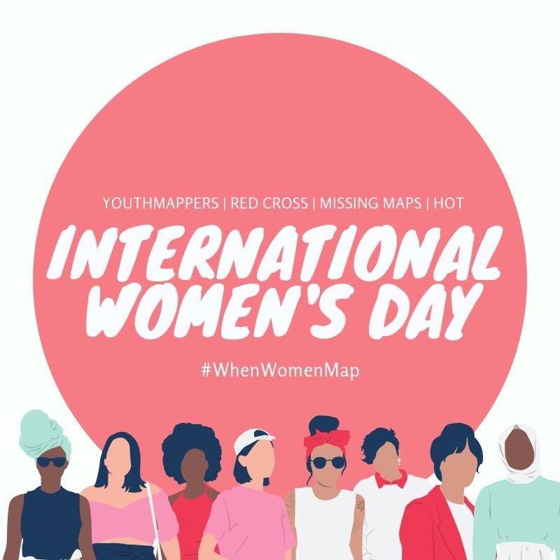
This year, Humanitarian OpenStreetMap invited me and my colleagues, Nathalie Sidibe of OpenStreetMap Mali and Jinal Foflia of Grab Asia to discuss the importance of mapping and open data to women during a webinar for International Women’s Day.
I’m excited to connect with more female leaders and mapping groups and to learn about exciting projects to strengthen our communities. Follow female mapping news with the #WhenWomenMap hashtag.
My Canadian consulting company is currently mapping the Mindanao region to support rural farming, gender, healthcare and artisan communities. The Mindanao region grows almost half the country’s food, yet remains the poorest population, with many communities at 30-70% poverty incidence. War and conflict have increased in the region in recent years, with security and safety concerns for girls and women. Our goal is to help map rural agriculture, logistics and the gender gap to plan improved infrastructure with long-term impacts on health, well-being and livelihood for girls, women, Indigenous Peoples and farm families.
This is a coordinated effort across international agencies, government, business, non-profits, academe and community leaders. Our study results will lead the prioritization and coordinated planning between international funding agencies and private investment in the second phase of this initiative.
We’ll be working with communities to teach them to map and using geospatial technologies to rapidly analyze infrastructure gaps for validation with local communities.
Para sa pagmamahal sa bayan! Alang sa paghigugma sa atong nasud! Thanks to your amazing efforts, in two days we were able to complete 120,500 map changes! Keep up the good work, we can do this!
Many thanks to Youthmappers in Bangladesh, Washington and France for joining us remotely!
* Learn how to map with OpenStreetMap, the Wikipedia model of maps * Meet mappers from the public and private sector
* Join the international humanitarian mapping community
* Won prizes of free mobile data for a month and enjoyed free pizza
Learn about OpenStreetMap at https://youtu.be/suk8uRpIBQw and learn more at https://learnosm.org/
Learn how to use iD Editor to edit maps https://learnosm.org/en/beginner/id-editor/
Learn how to be a humanitarian mapping volunteer with Humanitarian OpenStreetMap https://youtu.be/8wdzGKmZu-k
Learn how to help with humanitarian mapping tasks https://learnosm.org/en/coordination/tasking-manager3/
Learn about the World Bank DRIVER Road Safety Platform https://www.roadsafety.gov.ph
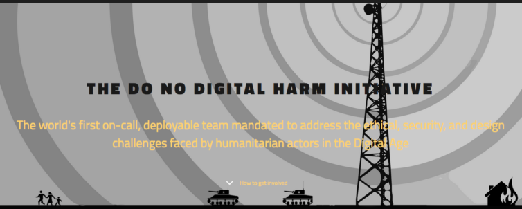
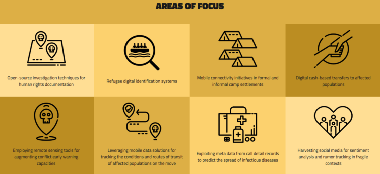
I’ve just joined the board for the Do No Digital Harm Initiative, the world’s first on-call, deployable team mandated to address the ethical, security, and design challenges faced by humanitarian actors supporting highly vulnerable civil society groups, crisis-affected populations and the humanitarian practitioners who serve them. Our mandate is to reduce harm resulting from information activities and digital services deployed in natural disaster and protracted conflict environments.
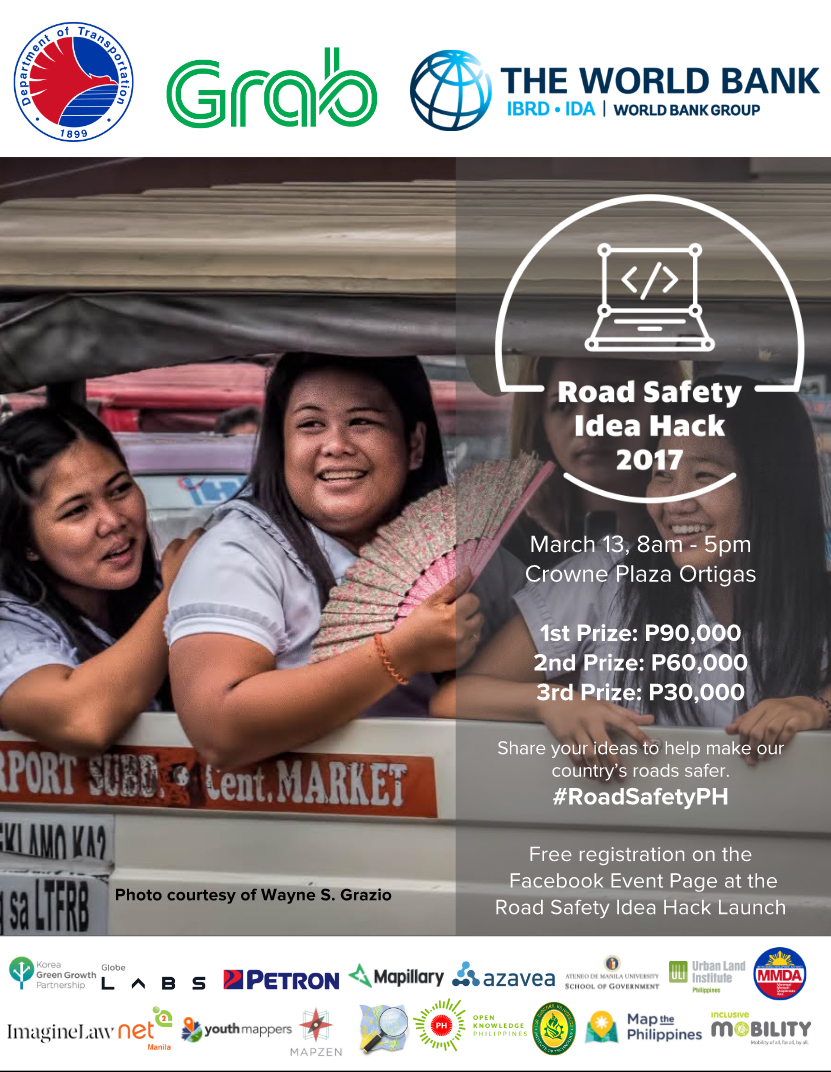
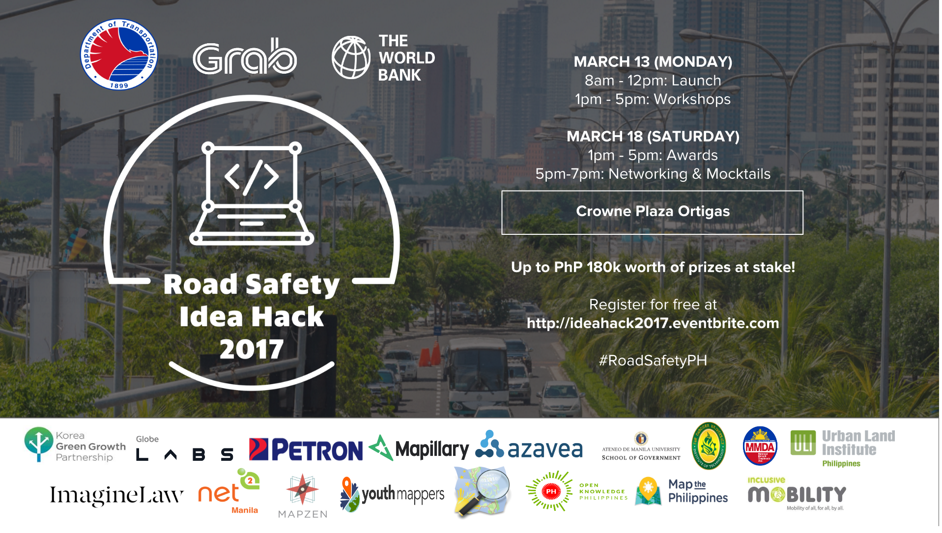
Let’s help each other to make our roads safer! Together with the Department of Transportation, World Bank and Grab, join the Road Safety Idea Hack 2017 Launch this Monday, March 13th from 8am to 5pm at Crowne Plaza Manila. Cash prizes: 1st Prize P90,000, 2nd Prize P60,000 and 3rd Prize P30,000. Come join us for the kick off talks and contest mechanics in the morning, lunch, then workshops in the afternoon where you’ll learn about how you, community groups, open data, mapping and government can work together to make our roads safer. Free registration at http://ideahack2017.eventbrite.com/#roadsafetyPH
I’ve been asked to work with World Bank’s Road Safety Hack in partnership with the Department of Transportation and Grab. The launch and orientation starts on March 13th at 8am, with participants learning about the role of open data, health, road safety and community groups in addressing the Philippines issues with road safety. Attendees are invited to participate in creating solutions to road safety with P180,000 in prizes.
For more details, visit http://ideahack2017.eventbrite.com
To make the conference more accessible, tickets for Philippines’ based attendees are P2,500 including 3 days of conference + 2 field visits!
Organized by the International Network of Crisis Mappers, The International Conference of Crisis Mappers (ICCM) is the leading humanitarian technology event of the year, bringing together the most important humanitarian, human rights, development and media organizations with the world’s best technology companies, software developers and academics. Everyone from every sector is welcome to attend the conference.
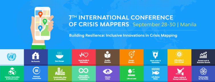
2016 marks the first year ICCM is being held in the Southeast Asian region, so please help us showcase the Philippines and make the conference a success! This year’s theme, in partnership with Map the Philippines is Building Resilience: Inclusive Innovations in Crisis Mapping, is focused on the United Nations Sustainable Development Goals and will highlight how local citizens, business, NGOs, schools, government and technical communities can work better together with more accessible tools to strengthen the resilience of our communities.
Last year I was grateful to be invited to the First White House Mapathon and was able to thank the U.S. State Department for sharing satellite imagery and mapping support for Super Typhoon Haiyan. I’m thrilled to have been invited back to the White House for their Second White House Mapathon under the Obama Administration on July 7, 2016. #WHMapathon
The Philippines is the third most disaster prone country in the world, and the number one most at risk from climate change. With Map the Philippines readying for launch in the coming weeks, we aim to map the Philippines’ 81 provinces by December 2017 for better transparency, prioritization, coordination and monitoring of public and private infrastructure needs and projects. Beyond disaster management, our mapping, training and programs focus on building community resilience to help achieve the United Nations 17 Sustainable Goals.
The Office of Science and Technology Policy invites you to the Second White House Mapathon to celebrate and actively do Open Mapping on Thursday, July 7, 2016 from 1:00 PM to 4:00 PM.
Open Mapping, or collaborative mapping, is where participants use a wiki-like approach to contribute to maps of the world. Open, accessible data -— including geospatial data — has been a key component of the Administration’s Open Data initiatives. During this event, we will highlight exciting initiatives that collect, create and use open geospatial data and participate in mapping projects to further those initiatives.
Increasingly, tools like citizen science and crowdsourcing are opening up the ability for the public to contribute to government datasets, and for government to support the creation of open data. Agencies including the Department of State, the Department of Interior, the U.S. Agency for International Development, the Peace Corps, the U.S. Geological Survey, and the General Services Administration are working on crowdsourced mapping projects.
Crowdsourced mapping projects and participants are part of a growing innovation movement, transforming the relationship between the government and the public, and supported by United States commitments in the Second and Third Open Government National Action Plans. The White House Mapathon will highlight the successes and invite participants to contribute to the rising efforts in Open Mapping.
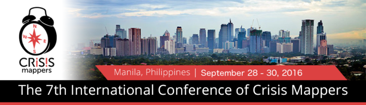
I’m thrilled to be co-organizing the 7th International Conference of Crisis Mappers in Manila on September 28-30, 2016. The week of October 1st sends our participants to field sites across the Philippines to connect with local communities and collaborate on mapping tasks.
This year’s theme is Building Resiliency: Inclusive Innovations in Crisis Mapping. The Philippines is the third most disaster prone country in the world and the most at risk from climate change. Its geography is spread over 7,000 islands, which are home to 12 ethnic groups and over 100 tribal groups. In contrast, it is also the fasted growing economy in Asia and our communities are one of the top users of social media in the world. In spite of our many challenges, Filipinos maintain a remarkably resilient and warm culture, even Anthony Bourdain dedicated a show episode to our resounding spirit.
Everyone is welcome to attend the conference, we hope to have a good representation of all the sectors providing their insights and feedback. We hope many Filipinos will participate, and we are offering a 3-day conference rate of P2500 to improve accessibility and will open scholarship opportunities as well.
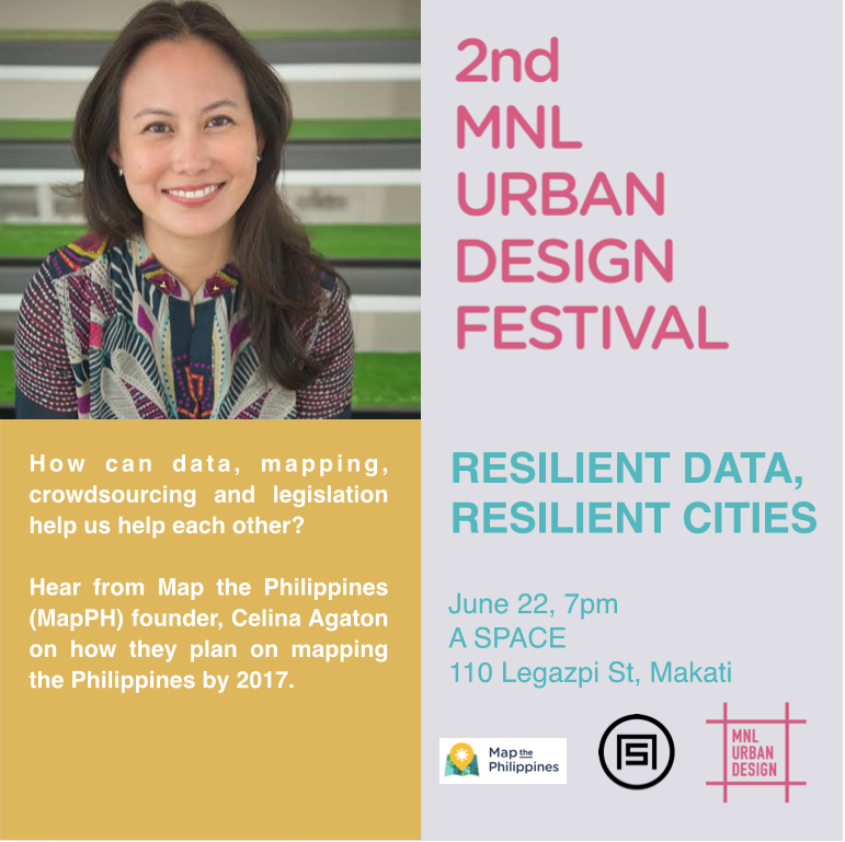
“A Resilient City is one that has developed capacities to help absorb future shocks and stresses to its social, economic, and technical systems and infrastructures so as to still be able to maintain essentially the same functions, structures, systems, and identity.” ResilientCity.org
To become a resilient city, coordinating the efforts of the public and private sectors is essential to the well-being of our communities, and to achieve Sustainable Development Goals. How can data, mapping, crowdsourcing and legislation help us help each other? Hear from Map the Philippines (MapPH) founder, Celina Agaton on how they plan on mapping the Philippines by 2017.
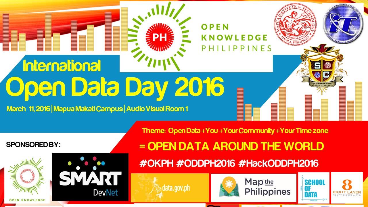
Come join me for Open Data Day Philippines at Mapua Institute of Technology Makati Campus on March 11th from 9am to 5pm. I’ll be speaking about Map the Philippines at 11:30am.
Open Data Day is a gathering of citizens in cities around the world to write applications, liberate data, create visualizations and publish analyses using open public data to show support for and encourage the adoption of open data policies by the world’s local, regional and national governments.
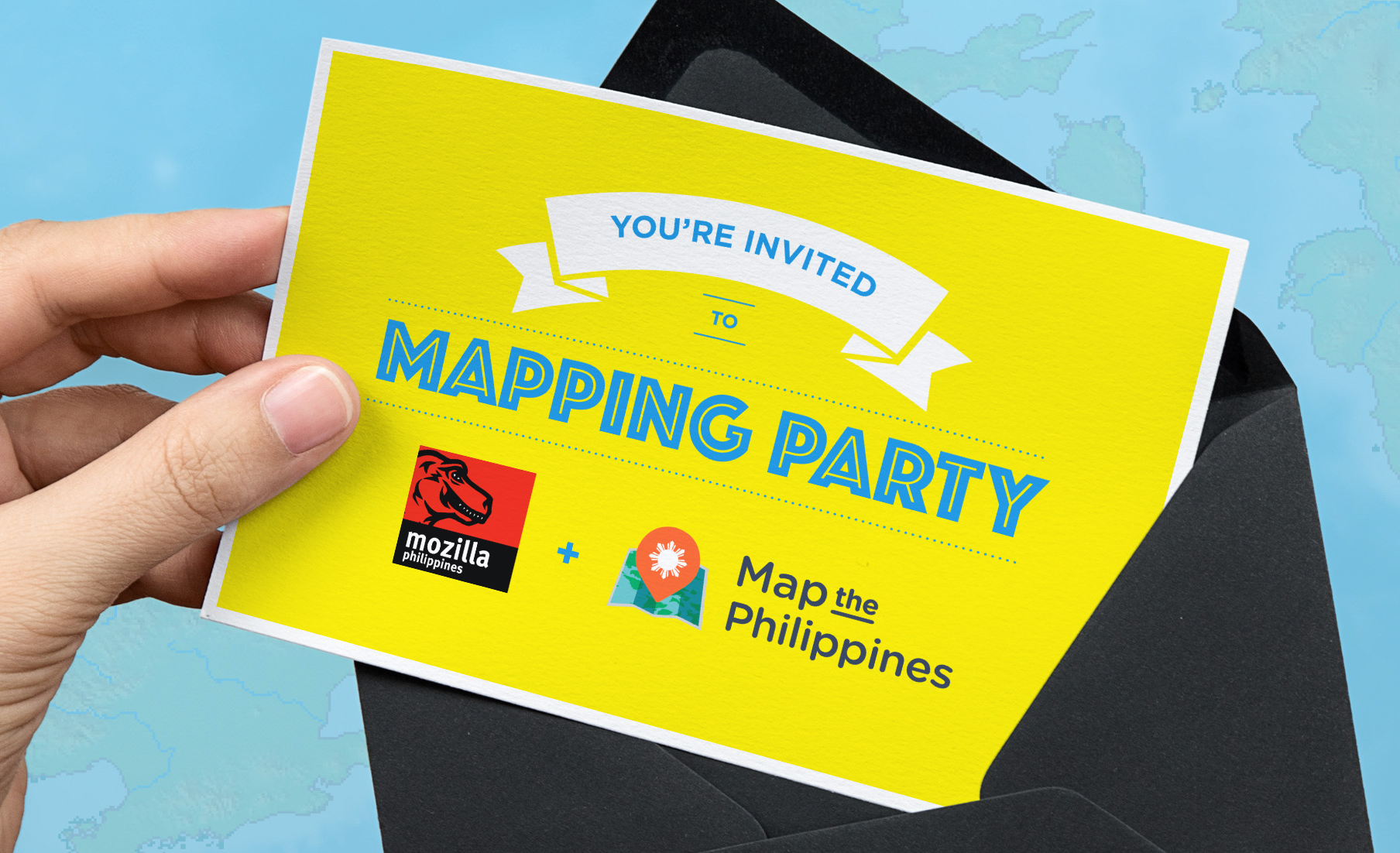
We believe maps and community driven mapping projects can help visualize the needs and opportunities in our neighbourhoods. Maps can serve as the connecting point to coordinate and track efforts across government, business, NGOs and community groups. Which is why we support OpenStreetMap, a free and open source mapping platform supported by a community of over 2.3 million mappers that contribute data about roads, hospitals, restaurants, coffee shops and more from around the world. Learn more about becoming a mapping volunteer.
Learn about OpenStreetMap and how mapping helps visualize community needs and opportunities in disaster, livelihood, arts, heritage preservation and food security.
If you’d like to learn how to map, please bring your own laptop, tablet or GPS.
The event is free and everyone is welcome! Introductions will begin from 1:00-2:00pm.
1:00 to 6:00pm
Mozilla Community Space Manila (MozSpaceMNL)
Roof Deck, Molave Building,
2231 Chino Roces Avenue (Pasong Tamo)
Makati City, Philippines 1233
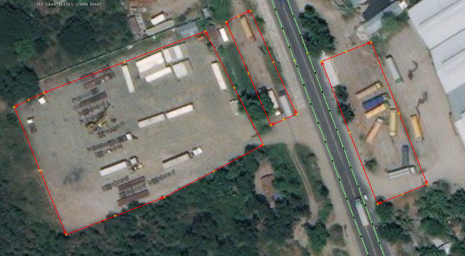
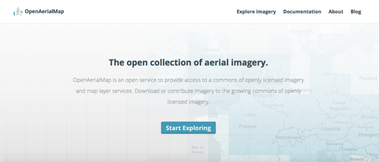
OpenAerialMap is an open service to provide access to a commons of openly licensed imagery and map layer services from around the world. Rather than spending time and resources on expensive imagery, you can search teh repository and download or contribute imagery to the growing commons of openly licensed, non-commercial imagery. This helps governments, NGOs, business and academe access expensive imagery and helps reduce duplicate efforts on high resolution map imagery.
Under the World Bank OpenRoads project, my company and partners were the first to share our Philippine imagery on OpenAerialMap.
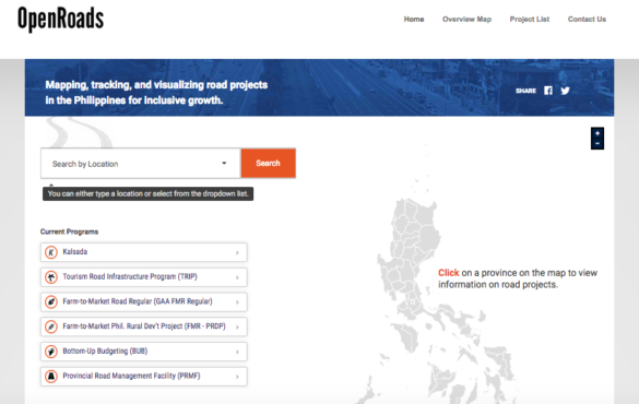
The World Bank’s Open Roads program requested my consulting company to lead mapping training with local government units, business, NGOs, academe and citizens in partnership with the Philippine Department of Budget and Management’s initiative to fast track much need road infrastructure in the country. By using OpenStreetMap’s free online mapping tools, this would enable the national government to more effectively plan and disburse funding for local, regional and national road networks. Road construction is one of the largest sources of corruption in the country, and by using participatory budgeting and open data, communities can request and track the status of roads in their communities.
I’ve had the pleasure of hosting five USAID AidData Fellows from June to August 2015 here in Manila to work on several of my Map the Philippines initiatives. This is the first time fellows have been hosted in the Philippines, and we hope to host more fellows in the future. The AidData program helps improve the planning, tracking and delivery of aid of by using maps to visualize where aid has been delivered to a nation. In many cases, aid reporting data tracks the announcement of aid being promised to a nation but doesn’t track the flow down to the region, province, municipality, barangay or village. The process of creating these maps starts with geocoding, where a program or service is assigned a geographic location so that it can be placed on a map. Plotting these locations helps create maps that visualize patterns in the delivery of aid against poverty, disaster risk, hunger and other measures that can help fine tune programming and identify whether there are gaps and overlaps in the flow of aid within and organization, and across sectors. Government, NGOs, Business and citizens provide many programs and services to help communities, but often work independently, and in silos, so mapping can provide opportunities for better coordination, collaboration and monitoring of aid.
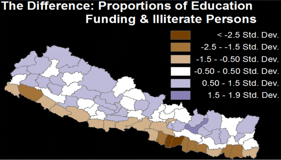
Literacy funding (purple areas) mapped against illiteracy levels – brown to dark brown indicating high illiteracy levels.
So far the Fellows have joined me on several community engagements across Manila and Leyte, meeting mayors, students and other community leaders, faced challenges with contacting multiple government agencies for access to data and traveled hours to remote areas with limited road infrastructure for first hand experience on the importance of mapping and open data policies for better planning and accountability across public and private sectors. They’ll compile a summary of their work here by August, stay tuned here for the final report.
The fellows are here until August 12th, and are available to provide a complimentary 1-3 hour presentation or half day geocoding workshop to your organization. Here’s more background on their presentation.
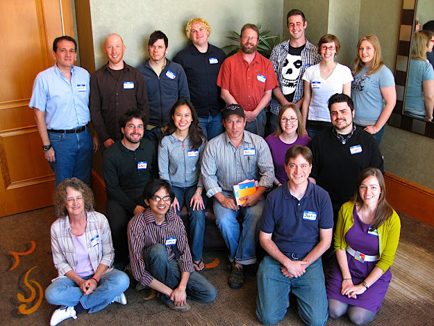
Netsquared City Organizers at the N2Y4 Mobile Challenge Conference in 2010.
Back in 2009, I co-organized Netsquared Toronto, the beginnings of a new life working in the tech for good sector and creating global programs and technology tools and events that enhance cross sector civic and community engagement. More than five years later and half way across the world, I’m back in Manila and excited to help launch Netsquared Manila.
Part of what brought me here was Typhoon Haiyan. Having grown up in Jakarta, Manila and Toronto, the need for networked community infrastructure around disasters inspired me to create a cross sector platform to help map the NGO, government, business and citizen group communities. Visualizing the work of organizations by location helps provide better transparency, accountability and collaboration during disasters, but more importantly helps build and strengthen these relationships year round. The platform includes workshops on how to map using OpenStreetMap, field mapping, drone mapping, sustainable livelihood programs and internet access tools to bring connectivity to at risk communities.
For NGOs, we’re mapping the needs of the sector, helping make community needs more visible to funders and to understand where there are gaps and overlaps in support.
In my role as co-organizer along with Jed Adao and Jake Fadallan, we’re getting to know the NGOs in Manila and creating events to help meet the tech needs of the community through our face to face Meetup group.
Coming soon…Netsquared Manila! We’re bringing all kinds of tech tool goodness to support the wonderful NGO community in Manila, and to connect us with over 80 Netsquared cities worldwide. Stay tuned for more updates! Netsquared is the face to face social purpose tech community meetup of Techsoup Global – a program providing free and discounted software and tools to NGOs around the world.
The UN has activated Micromappers to help tag tweets for Typhoon Ruby. In just one click, you can help classify tweets about typhoon damage, provided humanitarian aid, and requests for help. Micromappers helps the UN and other humanitarian aid groups assess typhoon damage and prioritize help more quickly.
OpenStreetMap is a collaborative project to create a free editable map of the world. It is supported and updated by 1.7 million registered users worldwide. During the Typhoon Yolanda response, as in other disasters, OpenStreetMap was widely used by the local and international aid community for its accuracy and accessibility with sharing and transferring data.
We want to help map the Philippines through free mapping workshops, citizen reporting and crowdsourced data. We’re creating mapping networks with local community leaders, colleges, government, business and NGOs to help empower Filipinos from across the sectors to collaborate together to map our communities. Our first step is to create a base layer map with roads, rivers and buildings, next we can then add additional layers such as needed infrastructure and social programming like disaster risk and preparedness, food security, health and education needs by location. We’re also bringing innovative and accessible internet access solutions and communications tools to the communities we partner with.
Learn about our exciting mapping projects and how you help become a citizen reporter with just a few clicks!
Please register so we can stay in touch with our mapping news and projects in the Philippines.
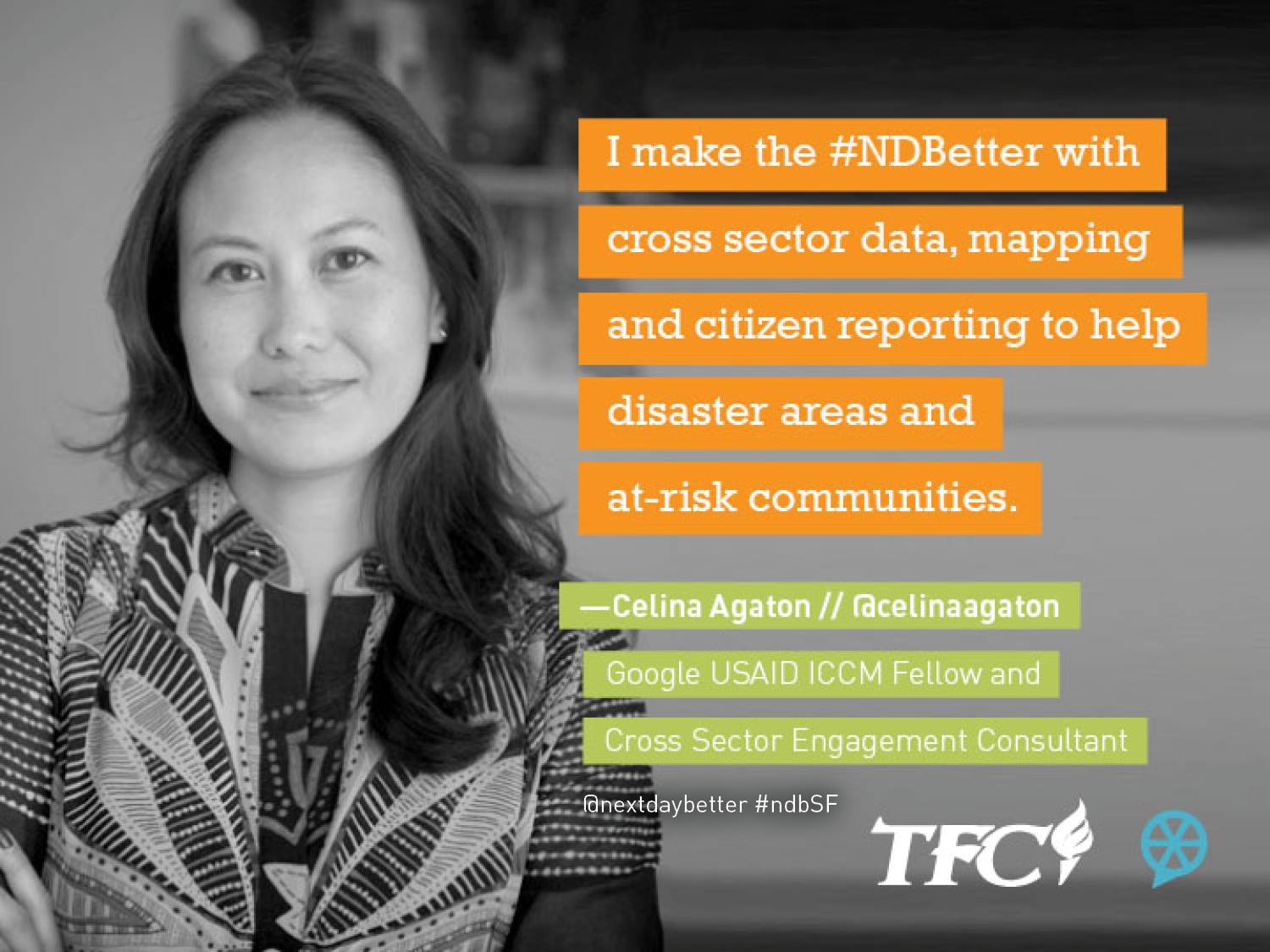
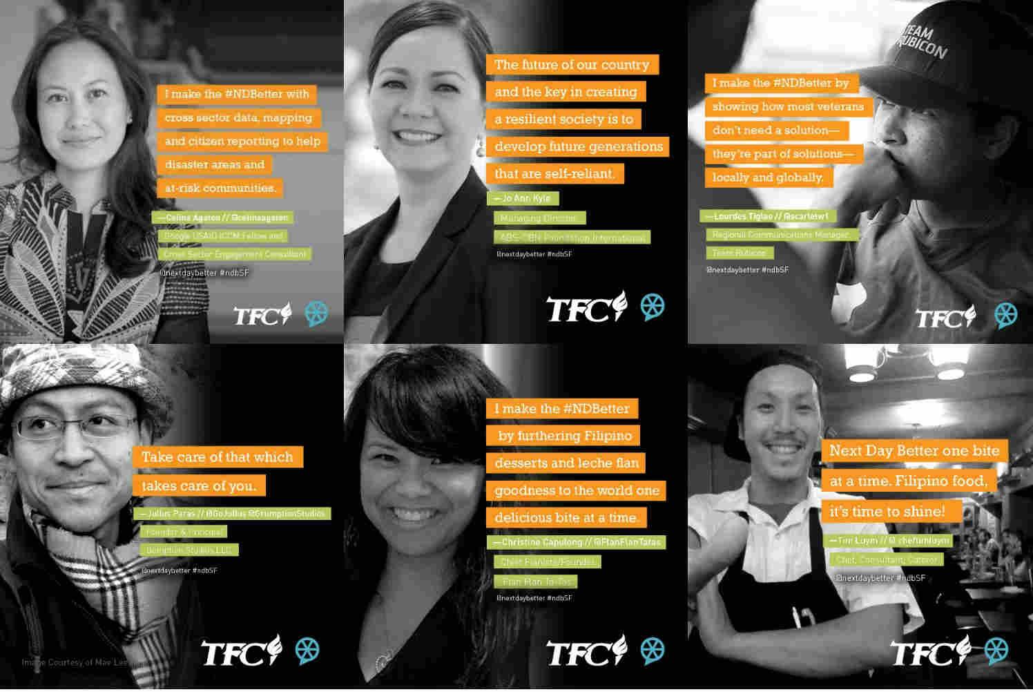
Curated by NextDayBetter, the TFC Speaker Salon took place at the San Francisco Children’s Creativity Museum and featured ideas and inspirations from the Philippines on how technology and creativity can solve today’s most pressing societal challenges.
Here’s a brief description of my talk:
From Crisis to Community: Innovations from the Typhoon Yolanda Disaster Response and Beyond
Google USAID ICCM Fellow Celina Agaton shares her community and technology driven approach to rebuilding communities post Typhoon Yolanda and to addressing community resiliency year round. Cross sector data mapping, drones to map and verify citizen reports, new sustainable farming practices and anti-poaching technologies are some of the innovations being developed in partnership with local community leaders, universities and other stakeholders. These tools help form a sustainable infrastructure to identify and prioritize local community needs and high risk
Here are the other speakers and their topics:
Courtesy NextDayBetter
NextDayBetter will be posting more photos and videos from the event, so I’ll be sharing them here, or check the NextDayBetter site, Facebook Page and Twitter.
Here’s an excerpt from my podcast for Slate’s Future Tense series. Listen to the podcast on Slate:
This week, Drone U features a podcast from Celina Agaton, the Google-USAID fellow for the International Conference on Crisis Mapping. Agaton looks at ways that drones can supplement traditional geographic information systems to help save lives in humanitarian crises.
After Typhoon Yolanda, Agaton has been creating a network of drone volunteers in the Philippines to quickly map areas for damage assessment and rehabilitation projects. She is also working on a first-of-its-kind system to use drones to verify aid reports.
Could emerging economies end up teaching countries like the United States how to best apply drone technology to solve real world challenges?
The Netquared team and city organizers from around the world.
I co-organized Netsquared Toronto, one of 80 Netsquared city chapters in cities around the world. I was also a global advisor to Netsquared headquarters which is based in San Francisco. Netsquared makes it easy, meaningful, and fun for people and organizations to get the information, visibility and support they need to maximize technology for social good.
It was during this time, during Netsquared’s N2Y4 Mobile Challenge where I learned about crisismapping through Ushahidi and citizen reporting through SeeClickFix.
Every month, the NetSquared Community comes together offline at Net Tuesday events around the world to mix, swap stories and ideas, build new relationships, and collaborate to help the local community. Our local organizers are volunteers dedicated to helping create local opportunities for learning, sharing and using technology to make a difference. In this Organizer Spotlight series we bring you interviews with organizers from around the world.
We’re happy to introduce: Celina Agaton!
Celina is a co-organizer of the Net Tuesday group in Toronto, ON, Canada. You can check out her profile and ways to connect on the Net Tuesday Organizer Team page. Are you in Toronto? Connect to the Net Tuesday group here!
Tell us who you are in less than 140 characters:
Celina Agaton was born and raised in Asia and studied studied psychology, equity studies and photography at the University of Toronto. In 2008, after nine years in marketing and advertising, she joined Volunteer Toronto, a government and United Way charity that helps people find great places to volunteer and supports 400 non-profits in Toronto. She speaks on social innovation and web 2.0 and has published articles in the Canadian Journal for Volunteer Resource Management. She developed a non-profit membership program that provides 21 benefits with community-friendly and sustainable organizations, and created Volunteer Toronto’s Free Movie Night, a community partnership program that screens free social change films.
How do you spend your time when you’re not organizing Net Tuesdays?
I’m working on some exciting projects with Don Tapscott and will be a panelist at the Social Tech Training for Net Change Week. I’m also excited to launch The Great Neighbourhood Food Drive, which is kind of like a food drive 2.0: part neighbourhood exploration, part food drive, part awareness campaign and part online media exhibit. All the tools will be free, replicable and scalable for other communities, so I can’t wait to share that.
What inspired you to organize local Net Tuesday events in your community?
Wanting to spread the word on the awesome social tech community in Toronto.
What’s the hardest part of the job?
We all seem to be launching several projects, so it’s been very busy. Social tech’s really taking off in Toronto, so it’s exciting to be part of the gravitational force.
We’re up to 10 drones now and are looking at getting live streaming capabilities. The drones are currently being using for disaster mapping but will soon also verify aid delay reports.
Current mapping plans include these areas. We’re looking for volunteer pilots and mappers. Please PM me if you’re interested.
Our current team will be in Panay Island next week December 11 to December 15 our targets are:
A.) Capiz
B.) Aklan River Headwater (Libacao and Banga)
If we finish early we may go to Northern Negros to map some areas there.
December 16 to December 20 we will be in Davao and Compostela Valley
December 21 to December 28 will be in Cagayan De Oro Area (and maybe Zamboanga).
On the Return to manila we will head towards Cebu First and do Northern Cebu Again if we can.
And then we hope to have 20 areas of coverage based on the disaster preparedness and response hubs we’ll be setting up and training in January. If you’re in Manila or available online over the next six months, we’ll need all the help we can get as we’ll be conducting a cross sector community resilience analysis identifying risk areas with logistics and political challenges in preparation for the upcoming monsoon season in June. I’ll set up a sign up sheet to organize contacts, availability, skills and locations soon.
Celina Agaton with the Art Gallery of Ontario’s Education Committee
A Heart to Art Chat was an unconference-style event I developed to co-create ideas for the Art Gallery of Ontario. 70 community leaders and participants from the arts, culture and events communities came together in the beautiful new 35,000 square foot Weston Family Learning Centre. Over a six month process, I led the strategic planning, digital and community strategy for the Art Gallery of Ontario (AGO) and currently sit as an advisor to the AGO’s Education Committee.
I am currently developing a plan to create a sustainable infrastructure for youth and the arts through museum, NGO, government, and business partnerships and crowdfunding.
I consult as a researcher and community engagement director for Don Tapscott’s think tank, Global Solution Networks.
Understanding the New Multi-Stakeholder Models for Global Cooperation, Problem Solving and Governance
The institutions and mechanisms responsible for global cooperation at the international level are having increasing difficulty solving global problems—problems like poverty, climate change, access to water and human rights. There is growing urgency to rethink our aging global institutions. Today’s challenges demand solutions that transcend the traditional boundaries of the nation-state—solutions that include authentic citizen voices and new initiatives in social innovation that extend beyond communities and nations to the global stage.
The Martin Prosperity Institute is pleased to announce a new, landmark study of the potential of global web-based networks for cooperation, problem solving and governance. Through a series of major research projects led by global experts, we will identify and explain key issues, strategies and approaches that can help these new multi-stakeholder platforms thrive, scale and become material on the global scene.
Join institutions, corporate partners and individuals from around the world in this program to create a series of publications, tools, video and ultimately a book authored by contributing members, to explore, explain and illustrate emerging models for policy choices and ultimate impact on the problems we collectively face.
The program officially launcheS on January 29, 2013 at the Martin Prosperity Institute and on June 4, 2013 at the Summit on New Models of Global Problem Solving, Cooperation and Governance hosted by the U.S. State Department.
For more information, or to subscribe to updates on this landmark program, please contact:
Joan Bigham, Managing Director at joan@tapscott.com +1 860.536.6693
There are a number of global social tech and community engagement awareness days throughout the year, so I thought I’d help shine a brighter light on the awesome social tech community. Based on the success of the Toronto screenings I organized, I thought it would be fun for social tech and social change makers to self-organize screenings of Us Now around the world to inspire new opportunities for collaboration across government, education, technology and volunteer communities.
Here are the cities that have hosted Us Now screenings:
Us Now is a UK documentary film project that discusses how Web 2.0 inspires people to participate in their communities in new ways. The film’s strength is its appeal to a broad audience; it speaks well to non-techies and boomers. It’s a great conversation starter for people to take back and discuss Web 2.0 opportunities in their communities. Film length: 59 minutes.
Featured speakers in the film: Don Tapscott, Clay Shirky, Alan Cox, Charles Leadbeater among others.
Individual screening dates are totally flexible and decided by the organizers. But, it would be fun to have a group of them around the same time or at the exact same time for organizers and audience members to connect across cities and capture this online and on film.
Audience:
The ideal audience includes a cross-section of community members (students, politicians, techies, non-profits, funders etc.) to inspire participation and cross-community collaboration. Ideally (but optional), you could invite community-friendly organizations to host display tables at the screening to directly connect attendees to local meetups, organizations and conferences to facilitate more learning and participation.
To Do List & Costs:
If you wish, organizers can charge a pay what you can fee for the screening to help raise funds for your group/meetup. Since the film is on a Creative Commons license, the Us Now producers, Banyak Films have agreed to receive 20% from the fees collected in lieu of negotiating film distribution rights since I have no funds to cover this. You can PayPal the fees tohugh@banyak.co.uk and mark as ‘US Now Services’. Us Now is free for the public to view online, so this is a way to help the producers cover their costs.
Us Now is available for free online viewing or organizers can purchase the DVD online for about US$20.
Theatre space: approach social innovation centres/universities to donate free space=$0
Keynote: Don Tapscott or Anthony Williams to Skype/video/keynote and/or answer audience Q&As. Celina to arrange with Don. Cost=$0.
Catering: In Toronto, we asked a green caterer to sell drinks and snacks, so catering cost=$0.
Event promo: Used Eventbrite, Eventful, Twitter, Facebook and bloggers to plan and promote the event, cost=$0.
The Us Now Blog, Don Tapscott, and Meetup sites will also post the event screening on their blogs=$0
Founded in 2005 by Oliver Madison and Craig & Marc Kielburger, Me to We Style is a social enterprise that provides domestically produced clothing using eco-friendly fabrics such as certified organic cotton, viscose from bamboo and recycled polyester.
Each year, Me to We Style donates half of their annual profits to their charity partner, Free the Children, while the other half is reinvested to grow the enterprise and its social mission. Through Free the Children, they plant a tree in the Maasai region in Kenya for every piece of apparel that is sold as part of a long term sustainability initiative.
Me to We Style is part of a family of youth organizations, including Free the Children, Me to We and We Day, that has a shared goal: to empower a generation to shift the world from ‘me’ to ‘we’—through how we act, how we give, the choices we make on what to buy and what to wear, the media we consume and the experiences with which we choose to engage.
In 2009, I established Me to We Style’s social media presence on Facebook and Twitter.
I launched the Pay it Forward campaign to help kids and families in priority neighbourhoods attend the 2013 Toronto Mini Maker Faire. Part science fair, part festival, and part something entirely new, Toronto Mini Maker Faireis a registered non-profit, all-ages gathering of tech enthusiasts, engineers, tinkerers, hobbyists, science clubs, hackers, artists, students, and commercial exhibitors. All of these “makers” come to Maker Faire to show what they have made and to share what they have learned while creating it. Toronto joins over 60 cities around the world that host a Maker Faires of their own.
Over 4000 people packed Wychwood Barns Sept 21 & 22 for Maker Faire Toronto 2013.
Open data is data that can be freely used, re-used and redistributed by anyone – subject only, at most, to the requirement to attribute and sharealike.
Lifted from the Open Data Handbook, the key benefits to open data include:
Availability and Access: the data must be available as a whole and at no more than a reasonable reproduction cost, preferably by downloading over the internet. The data must also be available in a convenient and modifiable form.
Re-use and Redistribution: the data must be provided under terms that permit re-use and redistribution including the intermixing with other datasets.
Universal Participation: everyone must be able to use, re-use and redistribute – there should be no discrimination against fields of endeavour or against persons or groups. For example, ‘non-commercial’ restrictions that would prevent ‘commercial’ use, or restrictions of use for certain purposes (e.g. only in education), are not allowed.
Open data formats enable the interoperability of datasets across various operating systems, and tax payer funded research should be saved in open data format to ensure its use and access by the public.