I presented my local data economy model at the University of Technology Sydney’s Institute for Sustainable Futures Revealing Resilience Series: Exploring synergies between community and individual measurement approaches to resilience.
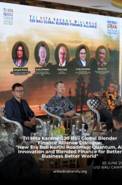
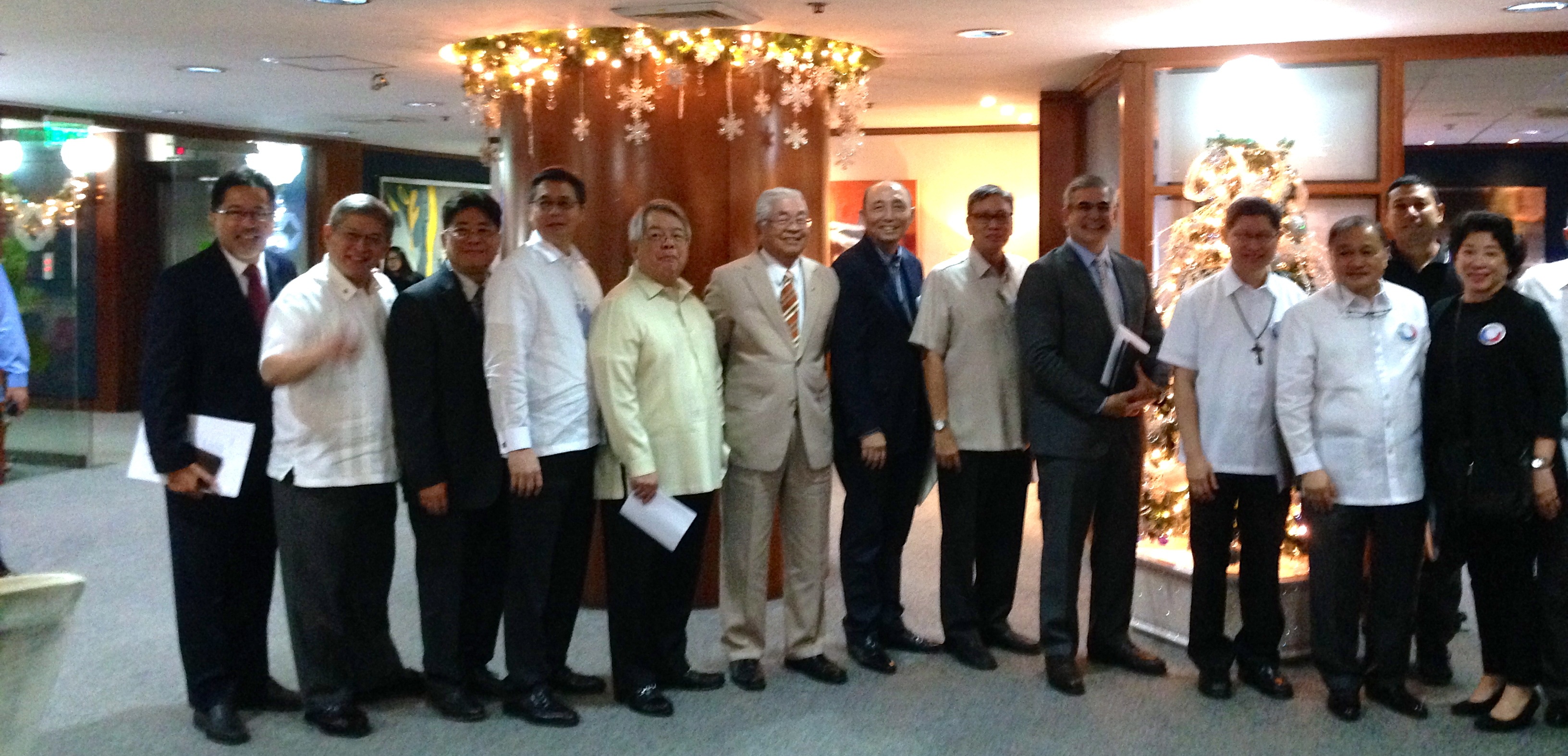
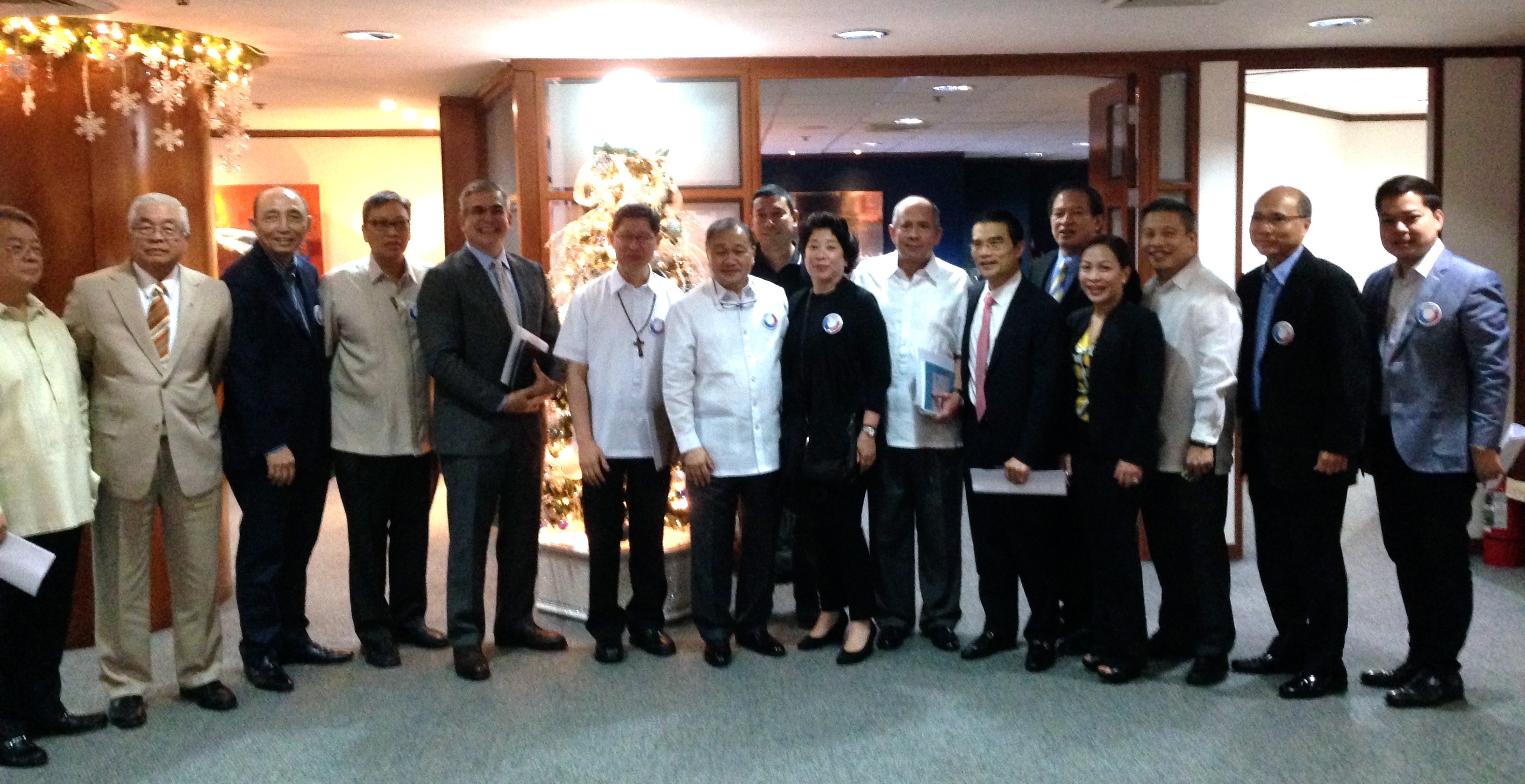
On June 20, I was invited to participate in the G20 Bali Global Blended Finance Alliance Dialogue. Local government and international leadership included Rockefeller Foundation, Pegasus Capital, GEAPP, OECD and Conservation International.
My session led the discussion on family office investments, where I shared my local data economy model to stabilise data, wages and revenues given that less than 10% of global Official Development Assistance dedicated for low and middle income countries reaches local community organizations. The recognition of local knowledge, combined with free and open source tools enables local communities to generate faster, more accurate, verifiable and representative data at scale at least 50% lower costs and environmental footprints. Not only does this hyper local recruitment and training method include everyone to participate in collecting and reporting data, but it enables an increase in up to US$100 hourly data wages, 2-5 times higher staff wages and high local revenues for the catchment areas. Data collection, research and business intelligence can be transformed into direct economic, social and environmental impacts for the program catchment areas.
In 2019, I led my largest implementation and field testing of my local data economy model. Research, investment, policy and program development studies are typically conducted in a siloed and uncoordinated fashion that requires a lot of time, effort and expense for local communities. The Philippines is ranked as the most at risk for disasters and climate change, averaging 22 typhoons (hurricanes or cyclones) a year. This places a tremendous burden on local communities who are typically required to travel long, difficult journeys to attend numerous events and workshops that are often located far away near airports or luxury hotels for the convenience of donors and funders.
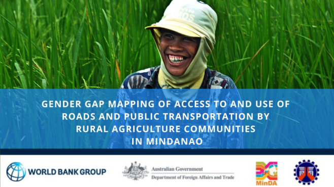
In 2019, with World Bank, IFC and Australian Department of Foreign Affairs and Trade funding, I was able to conduct five simultaneous studies, including World Bank’s first gender gap mapping study, across six provinces in the conflict region of Mindanao in the Philippines as Technical Assistance for the Mindanao Transport Connectivity Improvement Project:
600 Gender Gap Mapping Household Surveys
7000 Agriculture Commodity Flow and Origin-Destination Surveys
Six Province AI Studies on Industrial Logistics Congestion and Challenges
3 Regional Open Workshops for 180 Cross-Sector Participants (including micro enterprise through to conglomerates)
Road, Agriculture, Micro to Medium Enterprise (MSME) to Industrial, Indigenous, Tourism and Creative Industries and Disaster Infrastructure Field and Remote Mapping
These studies required 200 field staff, all of whom were Filipino, and 180 were located in close proximity to the survey sites. For the community-based mapping workshops, I undertook a careful validation process of ensuring the community was represented by progressive cross-sector leaders across government, business, non-profit, schools and university staff and students, and local community leaders. Rather than requiring a technical background, an interest to learn and teach others was the primary criteria, because the best knowledge often comes from people with strong community ties and diverse experiences. Our simplified mapping techniques ensure that anyone can learn to map, and we’ve trained people from age 6-60+ years.
Through our exclusive use of free and open source software and frugal sciencem methods, and hiring local staff and data collectors and processors, we not only strengthen local community engagement, but we are able to increase and improve the standard of data and outputs, at a much lower costs and environmental footprint. This enabled on average, and increase of 2-5 times higher staff and data wages. With every expense designed to directly benefit the local community sites, we create opportunities for research, investment, policy and program development studies, across public and private sectors to be transformed into accelerated impact models.
We were fortunate to compelete the program and report approvals in March 2020. This project enabled and challenged me to further develop inclusive innovations, frugal science, and safer methods that achieve representative data samples at scale, while supporting our highest wages to date, which is US$100 per hour for fully remote recruitment and data collection during the pandemic.
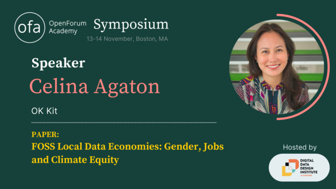
OpenForum Europe (OFE) recently invited me Boston to present my local data economy in partnership with Harvard’s new Digital Data Design Institute. OFE is a European open source software think tank that advises European policymakers and legislators on the merits of openness in computing and provides technical analysis and explanation. OFE promotes open source software, as well as openness more generally, as part of a vision to facilitate open, competitive choice for technology users.
FOSS local data economies are self-sustaining and more equitable economic, social and environmental models that meet the pace and urgency of accelerating global risks. Faster, more accurate, verifiable and representative data enable better public and private sector prioritization, coordination and monitoring across the Sustainable Development Goals (SDGs). The SDGs largely lack geospatial indicators that capture mobility, safety, proximity, infrastructure and service assessments, which accurately reflect the intersecting risks and opportunities communities experience in real-life. 78% of the 231 SDG indicators lack gender data, and despite women’s majority contributions to household and economic tasks, they have the least access to essential household and business infrastructure.
OECD reports that less than 10% of funding is received by local organizations, with 80% of climate research awarded to Western organizations over the last 30 years. Of the $137 billion invested a decade after Super Typhoon Haiyan and the Sendai Framework, only 4 percent was invested in mitigation in Asia Pacific, and the lack of coordination and tangle of overlapping multilateral efforts continues to create further chaos to already traumatized communities.
Rather than a siloed and political approach reliant on glacial grant and funding processes, local governments and cross-sector communities co-develop their own continuous and interoperable SDG map with geospatial indicators to better fast track public and private sector investments and interventions, receive the majority of budgets, and address long neglected infrastructure and the unique needs of marginalized communities.
With the exclusive use of free and open source mapping tools including unique digital twin techniques for infrastructure and disaster modelling, non-technical and technical local communities produce faster, more accurate, representative and verifiable data, at 50% lower cost and environmental footprints, while increasing local daily wages 100-900 percent, starting at 3 months. The highest wage to date is remotely trained World Bank road safety surveys at $100 per hour of work.
This an immediately viable transition to a local data economy, where local communities continuously lead data and knowledge on their community, industry and geography, to depoliticize investments, with greater governance and accountability, especially in technology, engineering and construction, which are among the most corrupt industries.
This bridges the gaps between effective policy, program development, local capacity, data and research gaps.
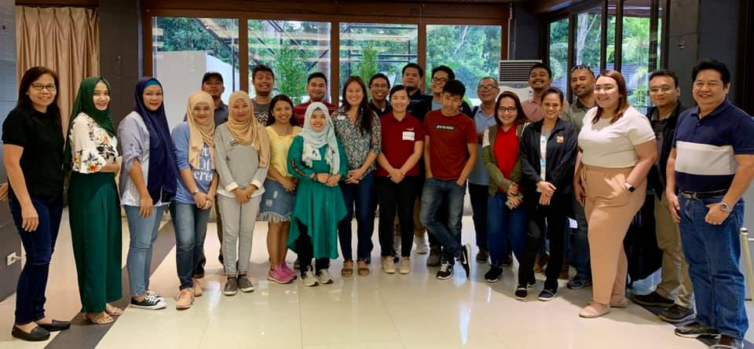
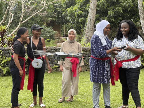
In September 2022, CGIAR funded our Open Knowledge Kit accelerated humanitarian and MSME regeneration program in Bali, Indonesia. We brought together selected technical and non-technical women and Indigenous youth to learn our accelerated program of SDG data collection, mapping, analytics and monitoring, drone operations, and Tourism and Creative Industries micro, small and medium enterprise support and market access.
Our model delivers faster, more accurate verifiable representative data using free and open source tools and low-cost equipment. Training local communities means expensive consultant, equipment, software and travel costs and carbon footprints are greatly reduced, and enable continuous and consistent monitoring while increasing local daily wages by 100 to 1700 percent.
CGIAR is a global research partnership for a food-secure future dedicated to transforming food, land, and water systems in a climate crisis. The Open Knowledge Kit program is supported under their gender and digital divide Digital Innovation Initiative.
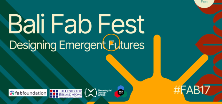
Bali Fab Fest is organized by the Fab Foundation, the Center for Bits and Atoms at MIT, the Fab City Foundation, and the Meaningful Design Group. It brings together two major annual events, the 17th edition of the Fab Lab Conference and 7th Fab City Summit 2022. Bali Fab Fest is a learning experience for both international participants and local stakeholders who invest their efforts into inventing and realizing the world that is coming next, responding to global challenges such as climate change and social exclusion through small scale interventions in situated communities. The event aims to promote and enable meaningful collaborations between innovators, makers, entrepreneurs, organizations, and the public sector.
In 2022 I was one of six people awarded with a fellowship at Subak Australia. Subak’s Fellowship funds innovative climate data specialists. This funding partially supported outputs for my G20 presentations, to show that my OK Kit local data economy and MSME program can provide better data, local revenues and social impacts at significantly lower costs and climate footprints, in just 3 months.
With the loss of funding to many vulnerable communities, multinational organizations will continue to shape humanitarian and development funding. How can we shift to more local and regional models of cross-sector leadership?
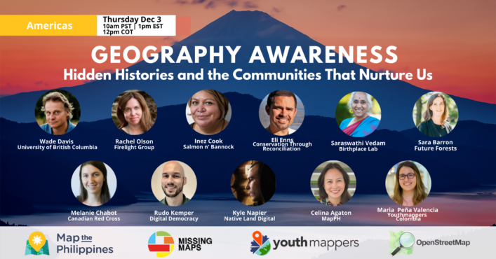
On Thursday, December 3rd 10am PST | 12pm COT | 1pm EST, we celebrate the Americas Geography Awareness Event with an opening keynote by Wade Davis. Wade holds degrees in anthropology and biology and received his Ph.D. in ethnobotany, all from Harvard University. He is an Explorer-in-Residence at the National Geographic Society and is currently Professor of Anthropology and the BC Leadership Chair in Cultures and Ecosystems at Risk at the University of British Columbia. He has authored 22 books, including One River, The Wayfinders and Into the Silence, winner of the 2012 Samuel Johnson prize, the top nonfiction prize in the English language. His work has taken him to East Africa, Borneo, Nepal, Peru, Polynesia, Tibet, Mali, Benin, Togo, New Guinea, Australia, Colombia, Vanuatu, Mongolia and the high Arctic of Nunuvut and Greenland.
Hear the stories of nice people doing good work. Connect with friendly local and regional communities, learn about free training, resources and funding opportunities.This event is free. Talks are 10 minutes each with a Q&A on the Facebook Live stream.
View the Facebook event page https://fb.me/e/1MwlEyx0b December 3rd 10am-1:15pm PST 12pm-3:15pm COT 1pm-4:15pm EST
Meet our speakers! 10:10am PST Celina Agaton
10:25am PST Wade Davis National Geographic Society Explorer-in-Residence | BC Leadership Chair in Cultures and Ecosystems at Risk at the University of British Columbia
10:45am PST Rachel Olson Indigenous Maternal Health & Gender Firelight Group
11am PST Inez Cook Co-Founder and Owner Salmon n’ Bannock
11:15am PST Saraswathi Vedam Birthplace Lab
11:30am PST Sara Barron Future Forests
11:45am PST Melanie Chabot Canadian Red Cross
12:00pm PST Rudo Kemper Digital Democracy
12:15pm PST Kyle Napier Native Land Digital
12:30pm PST Maria Peña Valencia Youthmappers Colombia
1:00pm Eli Enns Indigenous Conservation Conservation Through Reconciliation See Less
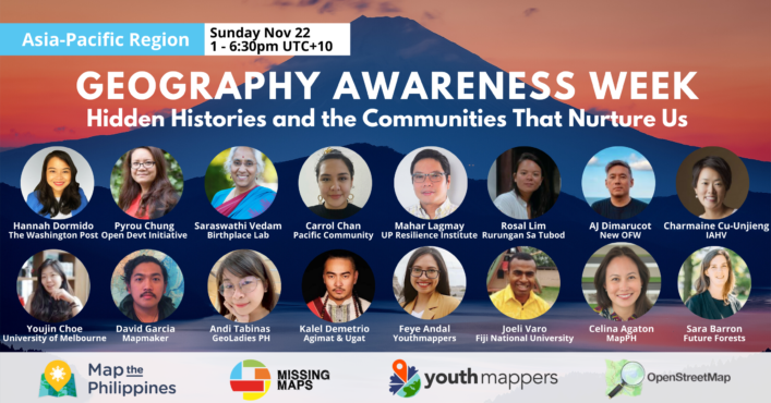
With the loss of funding to many vulnerable communities, multinational organizations will continue to shape humanitarian and development funding. How can we shift to more local and regional models of cross-sector leadership? Join our Asia-Pacific discussions for Geography Awareness Week
This year’s Geography Awareness Week helps bring together regional communities to discuss shared histories in food, work and now, Covid. Hear the stories of nice people doing good work. Connect with friendly local and regional communities, learn about free training, resources and funding opportunities. This event is free. Talks are 10 minutes each, followed by a 10 minute Q&A
Please meet our Asia-Pacific Region speakers!
Celina Agaton Regenerating Supply Chains
MapPHFeye Andal University Mapping Communities and Humanitarian Mapping Youthmappers
Sara Barron Local Voices in Urban Forest Planning Future Forests
Carrol Chan Disaster and Climate Change GIS and Remote Sensing Officer Pacific Community (SPC)
Youjin Choe Interpersonal Conflict in the OpenStreetMap community University of Melbourne
Pyrou Chung Indigenous Data Sovereignty Open Development Initiative, East-West Management Institute, Inc.
Charmaine Cu-Unjieng Free Stress and Trauma Management Programs International Association for Human Values
Kalel Demetrio Culinary History and Innovation Agimat & Alamat Foraging Bar and Restaurant
AJ Dimarucot Sustainable Careers for Remote Work in Creative Industries New OFW (Overseas Foreign Worker)
Hannah Dormido Graphics Reporter and Cartographer The Washington Post
David Garcia Indigenous and Conflict Mapping Mapmaker
Mahar Lagmay Disaster, Climate Change and Covid Mapping Executive Director University of the Philippines Resilience Institute
Adelaida Lim & Maribel Ongpin Rural and Indigenous Artisan Markets Philippine Textile Council
Rosal Lim Women Weavers and Artisan Markets Rurungan Sa Tubod Palawan
Leigh Lunas Drone Mapping GeoLadies PH
Andi Tabinas Mental Health Mapping Mental Health aWHEREness GeoLadies PHilippines
Mikko Tamura LGBTQ Mapping Mapbeks
Joeli Varo Pacific Mapping and Navigation Techniques Fiji National University
Saraswathi Vedam Global Quality Maternal and Newborn Care Hub and Covid-19 Birthplace Lab University of British Columbia
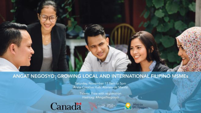
I recently curated Angat Negosyo: Growing Local and International Filipino MSMEs, a workshop to help micro-, small-, and medium-sized enterprises navigate the local and export market journey. In partnership with the Asia Pacific Foundation of Canada, this event was funded by Global Affairs Canada in collaboration with the APEC Secretariat. The APEC-Canada Growing Business Partnership works to build the potential of micro-, small-, and medium-sized enterprises (MSMEs) in APEC developing economies to foster sustainable growth and poverty reduction in the region – with a focus on Vietnam, Indonesia, the Philippines and Peru.
Participants had the opportunity to hear speakers share their journey and work hands-on with local and Canadian leaders in design, production, taxation, logistics and finance.
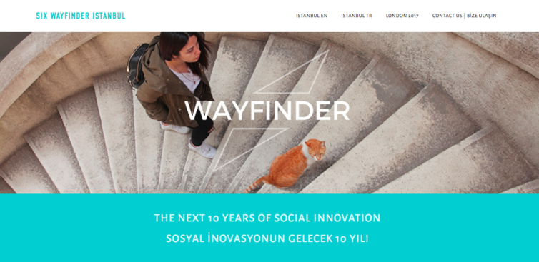
I’ve been invited again to join the 2018 Wayfinder meeting in Istanbul this year. The Wayfinder is organized by Social Innovation Exchange (SIX), the world’s primary network focusing on social innovation. I will join a select group of 150 innovators, experts, and entrepreneurs from around the world and across Turkey, who have played, and will continue to play, a critical role in building the social innovation field. I’m excited to share our work on cross sector mapping within the framework of the Sustainable Development Goals, and our resilient supply chains and livelihood programs.
The first Wayfinder in 2017 was hosted in London and brought together 150 social innovation leaders from across the world to celebrate 10 years of social innovation practice, and to explore our visions for the future of social innovation.
I’m excited to visit Turkey for the first time, and hopefully get to know more about my Turkish roots.
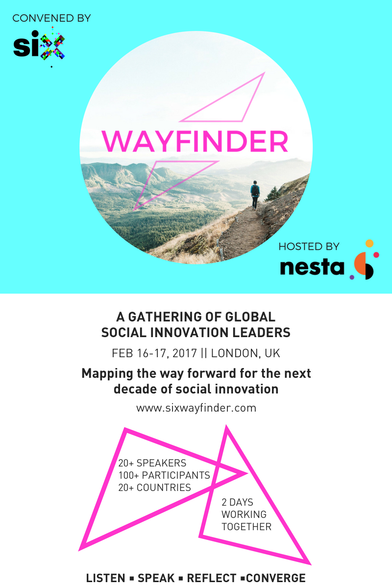
London calling! Thrilled to be heading to SIX – Social Innovation Exchange Wayfinder: Mapping the Way Forward For The Next Decade of Social Innovation. I’ll be sharing our Map the Philippines story and delivering a talk on the future of development session with 160 leaders from 34 countries.
Last year I was grateful to be invited to the First White House Mapathon and was able to thank the U.S. State Department for sharing satellite imagery and mapping support for Super Typhoon Haiyan. I’m thrilled to have been invited back to the White House for their Second White House Mapathon under the Obama Administration on July 7, 2016. #WHMapathon
The Philippines is the third most disaster prone country in the world, and the number one most at risk from climate change. With Map the Philippines readying for launch in the coming weeks, we aim to map the Philippines’ 81 provinces by December 2017 for better transparency, prioritization, coordination and monitoring of public and private infrastructure needs and projects. Beyond disaster management, our mapping, training and programs focus on building community resilience to help achieve the United Nations 17 Sustainable Goals.
The Office of Science and Technology Policy invites you to the Second White House Mapathon to celebrate and actively do Open Mapping on Thursday, July 7, 2016 from 1:00 PM to 4:00 PM.
Open Mapping, or collaborative mapping, is where participants use a wiki-like approach to contribute to maps of the world. Open, accessible data -— including geospatial data — has been a key component of the Administration’s Open Data initiatives. During this event, we will highlight exciting initiatives that collect, create and use open geospatial data and participate in mapping projects to further those initiatives.
Increasingly, tools like citizen science and crowdsourcing are opening up the ability for the public to contribute to government datasets, and for government to support the creation of open data. Agencies including the Department of State, the Department of Interior, the U.S. Agency for International Development, the Peace Corps, the U.S. Geological Survey, and the General Services Administration are working on crowdsourced mapping projects.
Crowdsourced mapping projects and participants are part of a growing innovation movement, transforming the relationship between the government and the public, and supported by United States commitments in the Second and Third Open Government National Action Plans. The White House Mapathon will highlight the successes and invite participants to contribute to the rising efforts in Open Mapping.
1. Create a network of food community members from farming, education, government, business NGO and community groups.
2. Outline community needs such as farm to market roads, marketplaces, training programs, funding and other funding needs to support our local food economy.
3. Visualize the network and needs on a map to identify funding opportunities and areas for collaboration across government, business and NGO sectors.
Light snacks will be served, please feel free to bring a platter and showcase your local food products at our community table.
Our goal is to help create more sustainable infrastructure and to provide a space for better cross sector collaboration, transparency and accountability for our communities. Our free online platform launches in early 2016 and provides opportunities for citizens and organizations to share their programs, services, and best practices, and to identify funding needs and connect with other stakeholders.
I’m partnered with Making All Voices Count on this Philippines #Tech4Resilience Challenge. Anyone can apply! Finalists will be presenting their pitches at my Map the Philippines event June 24, please save the date.
The deadline is on June 17. Good luck!
Making All Voices Count is calling for innovative projects and creative tech solutions that can be implemented in the Philippines under the themes below. The ideas should aim at addressing Making All Voices Count’s overarching goal; transparency, accountability and better governance. Any entity from the Philippines is welcome to apply: companies, government actors, non-profits, for-profits, education establishments, NGOs or individuals.
Themes
New projects that seek to incorporate both ‘offline’ efforts with use of ‘online’/ICT tools are strongly encouraged. The two themes for which you can submit your project idea are listed below. Ideas should seek to address two or more of the guiding points under each theme:
1. Within the theme ‘Strengthening community resiliency and response to disasters’ we seek projects that:
– Use of technology and innovation to strengthen disaster preparedness and response;
– Improve governance at local level for resilience and/or responses to natural disasters;
– Uses technology and innovation to support local communities with strengthening disaster resilience and response;
– Inclusive infrastructure and social program planning and development at community level;
– Make effective use of technology to ‘make all voices count’ through active engagement of women and marginalized groups or communities.
2. Within the theme ‘Improved planning and budgeting for disaster resiliency and response’ we seek projects that:
– Utilizes open-data to facilitate dialogue for change between actors;
– Better integration of planning and/or budgeting across 3 levels of government using technology and innovation;
– Follow the money on resilience/response efforts;
– Improve government coordination that mitigates against humanitarian crisis using technology and innovation;
– Make effective use of technology to ‘make all voices count’ through active engagement of women and marginalized groups or communities in disaster planning and budgeting.
Process and Awards
– Up to 10 finalists will be selected to attend Map the Philippines Unconference – 23-24 June 2015, where they will pitch their idea to a panel of judges;
– 1 – 3 winners of the competition will get incubation support for their ideas from Making All Voices Count, with mentoring. Incubation will include preparation for potential innovation grants of up to GBP 40,000 down the line, depending on (i) the development of a proposal strong enough to warrant a grant and (ii) demonstration of their capacity to successfully implement;
– Winners will have access to mentoring support, international networking and related tools and resources through Making All Voices Count’s South to South Lab.
Key Dates
– Applications open on 25 May and close on 17 June 201523:59 GMT; – Finalists announced on 19 June 2015; – Pitching session and announcement of winners on 24 June 2015
I’m thrilled to have been invited to the first White House Mapathon under the Obama administration on June 21, 2015 where they featured mapping projects like the Nepal earthquake and included my resiliency mapping project in the Philippines. The Philippines mention below links to my 2014 International Conference of Crisis Mapping talk.
The White House Office of Digital Strategy and the Office of Science and Technology Policy are pleased to invite you to the first White House Mapathon to celebrate and actively participate in Open Mapping on Thursday, May 21, 2015 from 1:00 PM to 4:00 PM.
Open Mapping, or crowdmapping, is where participants use a wiki-like approach to contribute to maps of the world. Geospatial data has been a key component of the Administration’s Open Data initiatives.
Increasingly, tools like citizen science and crowdsourcing are permitting the public to contribute to government datasets. In some cases, the public is collaborating to create data that never existed before their involvement, such as the OpenStreetMap response to the West Africa Ebola outbreak. Agencies including the Department of State, the Department of Interior, the U.S. Agency for International Development, the Peace Corps, and the General Services Administration are working on crowdmapping projects.
Crowdmapping projects and participants are part of a growing innovation movement, transforming the relationship between the government and the public, and supported by United States commitments in the Second Open Government National Action Plan. The White House Mapathon will highlight these successes and engage participants in contributing to the rising efforts in Open Mapping.
The Mapathon will start with remarks and lightning talks highlighting the impact of open and crowd-sourced mapping projects. Then we will ask you to choose one of the five mapping projects outlined below and get to work mapping!
Mapathon Projects:MapGive: A public diplomacy program that supports the use ofOpenStreetMap in humanitarian response and development. Participants will contribute to three sub-projects, targeting the Nepalearthquake response, public health initiatives in Botswana, and disaster preparedness and development in the Philippines. Power Service Area Mapping: Participants will contribute to a geospatial database under development by the Department of Energy, by researching public outage information so that disaster-impacted residents, tourists, first responders and relief volunteers can easily get to the information they need on scope and estimated restore times for power outages.Every Kid in a Park: The Every Kid in a Park initiative is a multi-agency effort to open our Nation’s lands and waters to all 4th graders for the 2015-2016 school year. This project will coordinate trail and facility mapping activities, further improving facility information within public lands and waters that have educational activities for kids.
Coming soon…Netsquared Manila! We’re bringing all kinds of tech tool goodness to support the wonderful NGO community in Manila, and to connect us with over 80 Netsquared cities worldwide. Stay tuned for more updates! Netsquared is the face to face social purpose tech community meetup of Techsoup Global – a program providing free and discounted software and tools to NGOs around the world.
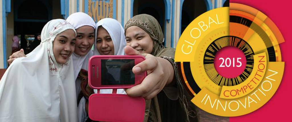
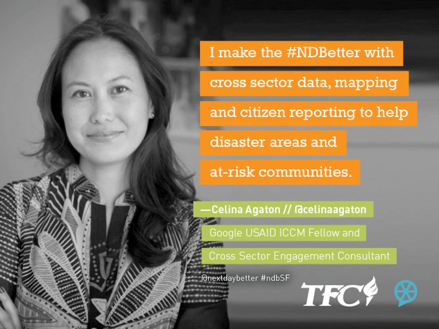
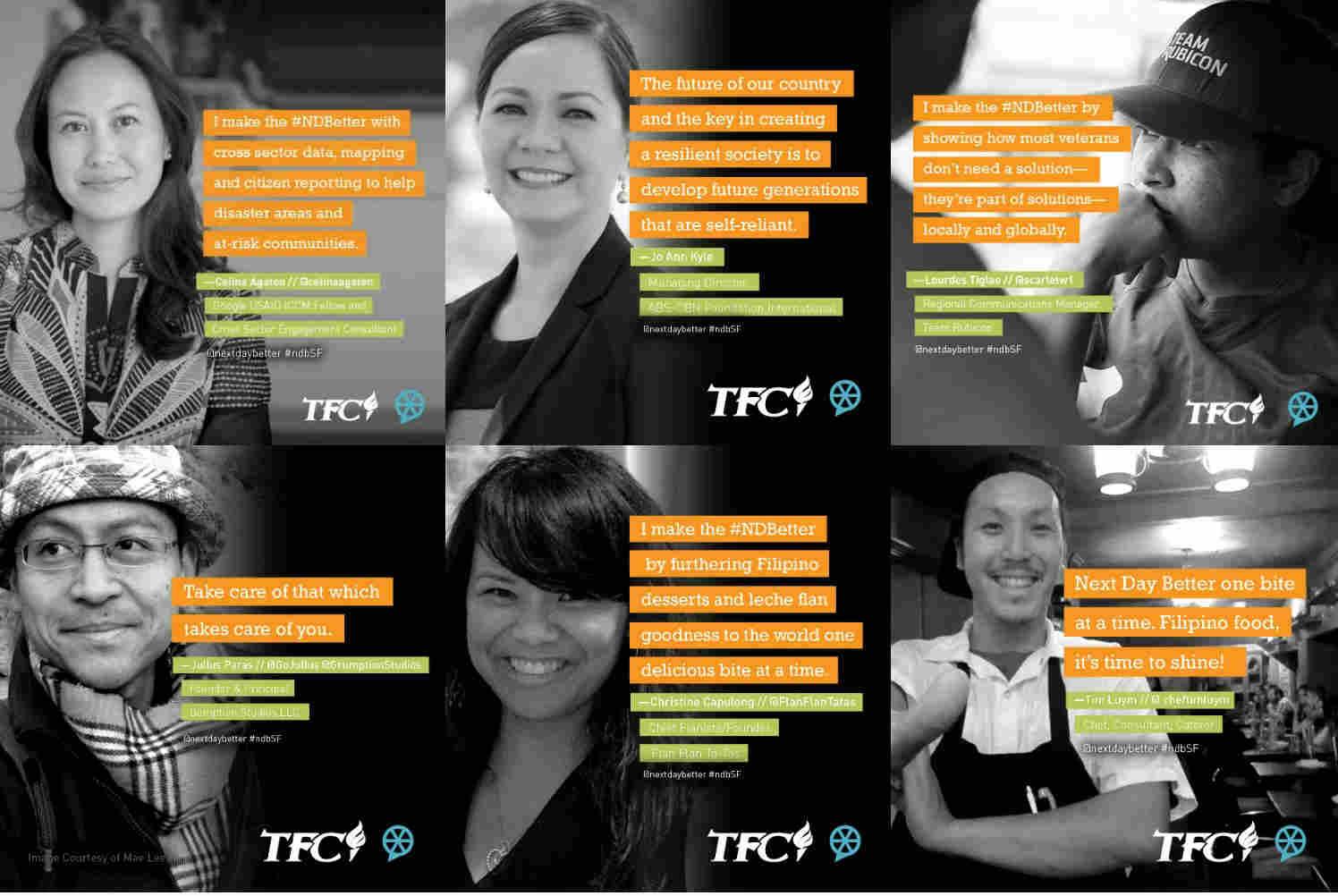
Curated by NextDayBetter, the TFC Speaker Salon took place at the San Francisco Children’s Creativity Museum and featured ideas and inspirations from the Philippines on how technology and creativity can solve today’s most pressing societal challenges.
Here’s a brief description of my talk:
From Crisis to Community: Innovations from the Typhoon Yolanda Disaster Response and Beyond
Google USAID ICCM Fellow Celina Agaton shares her community and technology driven approach to rebuilding communities post Typhoon Yolanda and to addressing community resiliency year round. Cross sector data mapping, drones to map and verify citizen reports, new sustainable farming practices and anti-poaching technologies are some of the innovations being developed in partnership with local community leaders, universities and other stakeholders. These tools help form a sustainable infrastructure to identify and prioritize local community needs and high risk
Here are the other speakers and their topics:
Courtesy NextDayBetter
NextDayBetter will be posting more photos and videos from the event, so I’ll be sharing them here, or check the NextDayBetter site, Facebook Page and Twitter.
Here’s an excerpt from my podcast for Slate’s Future Tense series. Listen to the podcast on Slate:
This week, Drone U features a podcast from Celina Agaton, the Google-USAID fellow for the International Conference on Crisis Mapping. Agaton looks at ways that drones can supplement traditional geographic information systems to help save lives in humanitarian crises.
After Typhoon Yolanda, Agaton has been creating a network of drone volunteers in the Philippines to quickly map areas for damage assessment and rehabilitation projects. She is also working on a first-of-its-kind system to use drones to verify aid reports.
Could emerging economies end up teaching countries like the United States how to best apply drone technology to solve real world challenges?
We’re up to 10 drones now and are looking at getting live streaming capabilities. The drones are currently being using for disaster mapping but will soon also verify aid delay reports.
Current mapping plans include these areas. We’re looking for volunteer pilots and mappers. Please PM me if you’re interested.
Our current team will be in Panay Island next week December 11 to December 15 our targets are:
A.) Capiz
B.) Aklan River Headwater (Libacao and Banga)
If we finish early we may go to Northern Negros to map some areas there.
December 16 to December 20 we will be in Davao and Compostela Valley
December 21 to December 28 will be in Cagayan De Oro Area (and maybe Zamboanga).
On the Return to manila we will head towards Cebu First and do Northern Cebu Again if we can.
And then we hope to have 20 areas of coverage based on the disaster preparedness and response hubs we’ll be setting up and training in January. If you’re in Manila or available online over the next six months, we’ll need all the help we can get as we’ll be conducting a cross sector community resilience analysis identifying risk areas with logistics and political challenges in preparation for the upcoming monsoon season in June. I’ll set up a sign up sheet to organize contacts, availability, skills and locations soon.
This morning, I joined the Philippine Disaster Recovery Foundation to help announce a new initiative for the private sector and NGO sectors to collaborate together to share relief data, map initiatives and outline capabilities for Typhoon Yolanda, and to lay the groundwork for a national disaster preparedness plan. The PDRF is co-chaired by PLDT and Metro Pacific Investments Corporation Chairman Manuel V. Pangilinan, Ayala Corporation Chairman and CEO Jaime Augusto Zobel de Ayala, and Manila Archbishop Luis Antonio Tagle.
The PDRF will act as a connecting point for the business community with the government, international aid agencies and the NGO community. For the Typhoon Yolanda disaster response, the foundation has identified six sectors for early recovery efforts: Shelter, Livelihood, Education, Environment, Infrastructure, and Water, Sanitation and Health (WASH), which will be focused in the following priority areas:
I’ll be leading the cross sector mapping platform, where we map aid efforts and capabilities across NGOs, government and the private sector along the United Nations Office for the Coordination of Humanitarian Aid (UN OCHA)’s current international humanitarian coordination system of 14 clusters. Two important new channels will be added to the map: citizen groups and citizen reports. There are clusters of large scale, self-organized, citizen groups with access to planes and helicopters and a network of volunteers who quickly mobilize to deploy aid. These groups have been critical in filling the gaps that inevitably emerge in disaster response.
Once the platform is ready, we will be opening a citizen reporting channel via SMS short code where we can begin to more immediately respond to needs by analyzing clusters of verified citizen reports. I’m excited to engage and empower the public to not only help aid groups prioritize aid, but to help add accountability and transparency by tracking and reporting on the status efforts for throughout the relief, recovery and rebuild phase. On the back end, we’re mapping our stakeholder network to receive alerts on verified report clusters, and enabling an SMS and online tasking system to respond to reports.
Right now I’m working on the categorization of aid items with UN OCHA to be able to help standardize the way aid inventories are reported. And then we start the process of asking sectors to share their spreadsheets of delivered and planned aid, capabilities and catchment areas.
2013 Google ICT4Peace Fellows with ICCM sponsors, the U.S. Agency for International Development (USAID)
I’m grateful to be one of ten fellows selected to attend the 5th International Conference of Crisis Mappers (ICCM) in Nairobi, Kenya from November 18-22. The ICCM brings together the most engaged practitioners, scholars, software developers and policymakers at the cutting edge of crisis mapping and humanitarian technology.
I’ve been volunteering as a crisis mapper since the Haiti earthquake, and have helped with the Japan earthquake, Typhoon Pablo and the recent Typhoon Yolanda in the Philippines. Having grown up in Jakarta and Manila, the cycle of devastation, international aid and corruption has been all too familiar. With the power of social media and the tools of crisis mapping, I believe we can develop a platform to track aid not only when it’s pledged in a press release, but through to when it is delivered at the village level. If citizens can participate in sending social media reports of aid delivery delays, then we can identify and track issues and the NGO, government and private sectors can collaborate more quickly and effectively to help communities.
A large part of the Philippines’ emergency response efforts are organized by a robust network of private citizens and their network of fixers who are able to act quickly through email, text and social media, and part of what I’m trying to do is help get their reports included in relief tracking initiatives. Through this network we have been able to update the disaster maps for under mapped and underserved areas. I’ve also connected with the Ateneo de Manila University who are currently using drones to map these areas, and am looking into the use of drones to verify data on aid delivery delays.
We’re also looking to fund the set up of a radio and SMS network in partnership with news networks to help communicate with remote communities.
I’m currently in Manila to help develop and launch this citizen reporting platform, and with anything else I can for the next little while. If you’re interested in donating to help Typhoon Yolanda victims, Gawad Kalinga and Tao Philippines are doing excellent work.
Celina Agaton with the Art Gallery of Ontario’s Education Committee
A Heart to Art Chat was an unconference-style event I developed to co-create ideas for the Art Gallery of Ontario. 70 community leaders and participants from the arts, culture and events communities came together in the beautiful new 35,000 square foot Weston Family Learning Centre. Over a six month process, I led the strategic planning, digital and community strategy for the Art Gallery of Ontario (AGO) and currently sit as an advisor to the AGO’s Education Committee.
I am currently developing a plan to create a sustainable infrastructure for youth and the arts through museum, NGO, government, and business partnerships and crowdfunding.
I consult as a researcher and community engagement director for Don Tapscott’s think tank, Global Solution Networks.
Understanding the New Multi-Stakeholder Models for Global Cooperation, Problem Solving and Governance
The institutions and mechanisms responsible for global cooperation at the international level are having increasing difficulty solving global problems—problems like poverty, climate change, access to water and human rights. There is growing urgency to rethink our aging global institutions. Today’s challenges demand solutions that transcend the traditional boundaries of the nation-state—solutions that include authentic citizen voices and new initiatives in social innovation that extend beyond communities and nations to the global stage.
The Martin Prosperity Institute is pleased to announce a new, landmark study of the potential of global web-based networks for cooperation, problem solving and governance. Through a series of major research projects led by global experts, we will identify and explain key issues, strategies and approaches that can help these new multi-stakeholder platforms thrive, scale and become material on the global scene.
Join institutions, corporate partners and individuals from around the world in this program to create a series of publications, tools, video and ultimately a book authored by contributing members, to explore, explain and illustrate emerging models for policy choices and ultimate impact on the problems we collectively face.
The program officially launcheS on January 29, 2013 at the Martin Prosperity Institute and on June 4, 2013 at the Summit on New Models of Global Problem Solving, Cooperation and Governance hosted by the U.S. State Department.
For more information, or to subscribe to updates on this landmark program, please contact:
Joan Bigham, Managing Director at joan@tapscott.com +1 860.536.6693
During my two years as Communications Director at Volunteer Toronto, I led and developed a training curriculum on social media, cross sector collaboration and volunteer engagement for non-profit organizations. I created an online process to enhance the matching of non-profit needs with corporate volunteer interests and established a program to provide low cost and free technology tools and discounted program resources to support Volunteer Toronto’s community of 500 non-profit organizations. I created Volunteer Toronto’s ChariTee campaign which was sponsored by the Ontario Ministry of Citizenship and Immigration, George Brown School of Design students, and youth social enterprise, Me to We Style.
I conceptualized and launched Volunteer Toronto’s Free Movie Night, a social change film series to bring together funders, non-profits, business, government and volunteers, and to connect them to social innovation events and collaboration opportunities. These free movie nights brought together audiences of 300 people at each screening.
I collaborated with volunteers to create Volunteer Connect, a Facebook application for volunteer opportunities, which was endorsed by the Ontario Ministry of Citizenship and Immigration.
I hosted Volunteer Toronto’s annual event, Toronto TimeRaiser, an event to connect people in their 20s and 30s to volunteer opportunities.
I also created and managed successful e-newsletters, social media content and campaigns. Highlights include using social media to recruit 200 volunteers in two weeks to attend an 8am volunteer program at Toronto Zoo.
I was a contributor to Don Tapscott’s follow up to international bestseller, Wikinomics. Macrowikinomics: New Solutions for a Connected Planet was published in the October 2010. I also developed the creative concept for the paperback edition and launched the website, Macrowikinomics.com. Macrowikinomics is available in 10 languages.
In 2007, Wikinomics: How Mass Collaboration Changes Everything was the best-selling breakthrough introduction to the new economics transforming business and competition with the emergence of web 2.0. Wikinomics showed how mass collaboration was changing the way businesses communicate, compete, and succeed in the new global marketplace. But much has changed in three years, and wikinomics’ principles of openness, peering, sharing, and acting globally are now more powerful than ever and present not only in business, but across all our community sectors. This is macrowikinomics at work.
In this new age of networked intelligence, businesses and communities are bypassing crumbling institutions. We are altering the way our financial institutions and governments operate; how we educate our children; and how the healthcare, newspaper, and energy industries serve their customers. In every corner of the globe, businesses, organizations, and individuals alike are using mass collaboration to revolutionize not only the way we work, but how we live, learn, create, and care for each other.
Drawing on an entirely new set of original research conducted with countless collaborators in fields such as healthcare, science, education, energy, government and the media, we tell the stories of some of the world’s most dynamic innovators, from a global citizen’s movement working to reverse the tide of disruptive climate change to for-profit startups that are turning industries ranging from music to transportation on their head.
We argue that collaborative innovation is not only transforming our economy but all of society and its many institutions. Now the onus is now on each of us to lead the transformation in our households, communities and workplaces. After all, the potential for new models of collaboration does not end with the production of software, media, entertainment and culture. Why not open source government, education, science, the production of energy, and even health care?
As this book shows, these are not idle fantasies, but real opportunities that the new world of wikinomics makes possible.