UN World Data Forum Blog

by Celina Agaton

My work in the Philippines was recently referenced in the United Nations World Data Forum Blog by Afeefah Khazi-Syed at the World Bank Global Practice Group for Sustainable Development:
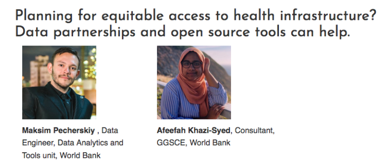
Resource-poor regions around the world have been suffering from inequitable health infrastructure for decades. As we look forward to the 2020 Virtual UN World Data Forum (October 19-21, 2020), hospital accessibility planning falls squarely within Thematic Area 2: “Leaving No One Behind.”

The World Bank’s Development Data Partnership brings international organizations together with private sector companies to facilitate the use of third-party data in research and international development. Using this platform and guidance of experts in the field, our team worked with several open and private data sources to address the challenge of measuring accessibility to health facilities in select regions. Here, we discuss our workflow and demonstrate findings in Indonesia and the Philippines as a proof of concept.
Read the full article.


Celebrating Geography Week

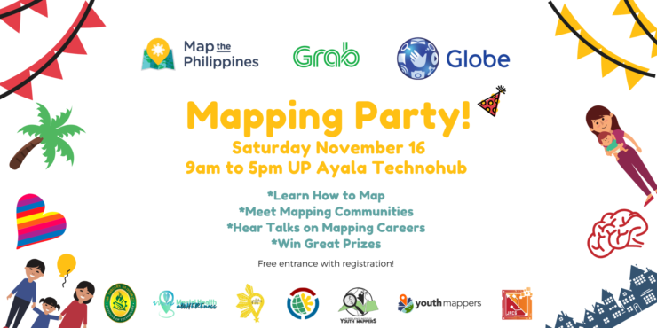
Para sa pagmamahal sa bayan! For the love of country! We’re celebrating Geography Week around the world with a free mapping party on Saturday, November 16 from 9am to 5pm at UP Ayala Technohub. Everyone is welcome, families with children aged 10 years old and up!

Tickets are free with registration, Grab discount coupons are available while they last at https://mapphnov16.eventbrite.com

* Learn to map

* Meet amazing mapping communities

* Hear talks on why mapping is a great career

* Win great prizes! Shop in our palengke to help local farmers and artisans

Join our mapping sessions :

  • Learn the basics of how to map using OpenStreetMap
  • Join GeoLadies PH and Mental Health aWHEREness to help map breastfeeding, LGBTQ, health and mental health services
  • Learn how to use drones
  • Map tourism sites, restaurants and learn Wikipedia
  • Validate Facebook Artificial Intelligence roads
  • Join or start a Youthmappers community


Mapping Party for Mindanao

This slideshow requires JavaScript.

Para sa pagmamahal sa bayan! Alang sa paghigugma sa atong nasud! Thanks to your amazing efforts, in two days we were able to complete 120,500 map changes! Keep up the good work, we can do this!

Many thanks to Youthmappers in Bangladesh, Washington and France for joining us remotely!

This Valentine’s weekend, 40 participants joined our mapping party on Saturday, February 16 to help map Mindanao to support rural farming, gender gap, healthcare and artisan communities. MapPH and Youthmappers Philippines chapters at Far Eastern Universtiy Technology Junior Philippine Computer Society and UP Resilience Institute welcomed attendees to

* Learn how to map with OpenStreetMap, the Wikipedia model of maps
* Meet mappers from the public and private sector
* Join the international humanitarian mapping community
* Won prizes of free mobile data for a month and enjoyed free pizza

Learn about OpenStreetMap at https://youtu.be/suk8uRpIBQw and learn more at https://learnosm.org/

Learn how to use iD Editor to edit maps https://learnosm.org/en/beginner/id-editor/

Learn how to be a humanitarian mapping volunteer with Humanitarian OpenStreetMap https://youtu.be/8wdzGKmZu-k

Learn how to help with humanitarian mapping tasks https://learnosm.org/en/coordination/tasking-manager3/

Learn about the World Bank DRIVER Road Safety Platform https://www.roadsafety.gov.ph

#MapPHMindanao #SDGs #GenderGap #EM2030Index #OpenStreetMap #hotosm


OpenStreetMap’s 10th Anniversary

Screen Shot 2014-12-01 at 1.01.13 AM

Come Join Our Celebrations for OpenStreetMap’s 10th Anniversary!

* Learn about mapping * Enjoy our drone showcase * Eat cupcakes! *

Everyone is welcome! Twitter, Instagram and Facebook Hashtag #mapPHL

Mind Museum Outdoor Canopy
J. Y. Campos Park, 3rd Ave, Taguig
Thursday December 4th 11am to 2pm
Enjoy snacks and drinks
FREE

Learn more >>

Help Spread the Word! Download the Flyer

OpenStreetMap is a collaborative project to create a free editable map of the world. It is supported and updated by 1.7 million registered users worldwide. During the Typhoon Yolanda response, as in other disasters, OpenStreetMap was widely used by the local and international aid community for its accuracy and accessibility with sharing and transferring data.

We want to help map the Philippines through free mapping workshops, citizen reporting and crowdsourced data. We’re creating mapping networks with local community leaders, colleges, government, business and NGOs to help empower Filipinos from across the sectors to collaborate together to map our communities. Our first step is to create a base layer map with roads, rivers and buildings, next we can then add additional layers such as needed infrastructure and social programming like disaster risk and preparedness, food security, health and education needs by location. We’re also bringing innovative and accessible internet access solutions and communications tools to the communities we partner with.

Learn about our exciting mapping projects and how you help become a citizen reporter with just a few clicks!

Please register so we can stay in touch with our mapping news and projects in the Philippines.

We thank our generous supporters:

World Food Program     BGC         SkyEye


Healthcare Advertising

by Celina Agaton

Working Image Health

I spent 6 years leading national launches for pharmaceutical companies in Canada and enjoyed working across government, healthcare, business and creative sectors. I managed two historical launches for the Canadian pharmaceutical industry: AstraZeneca’s Crestor launch, the largest advertising account at $25 million, and Janssen Ortho’s Pariet launch, the fastest product launch over 2 months. Other notable clients include GSK’s vaccine portfolio including Twinrix vaccine, Solvay Men’s Health and AstraZeneca’s Symbicort respiratory therapy.