CGIAR Indonesia-Africa SDG Workshop

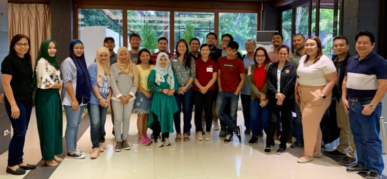
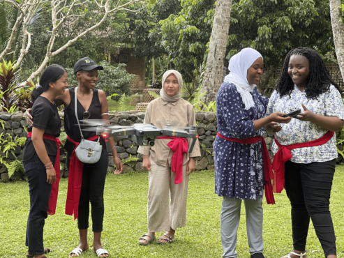
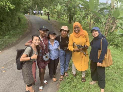
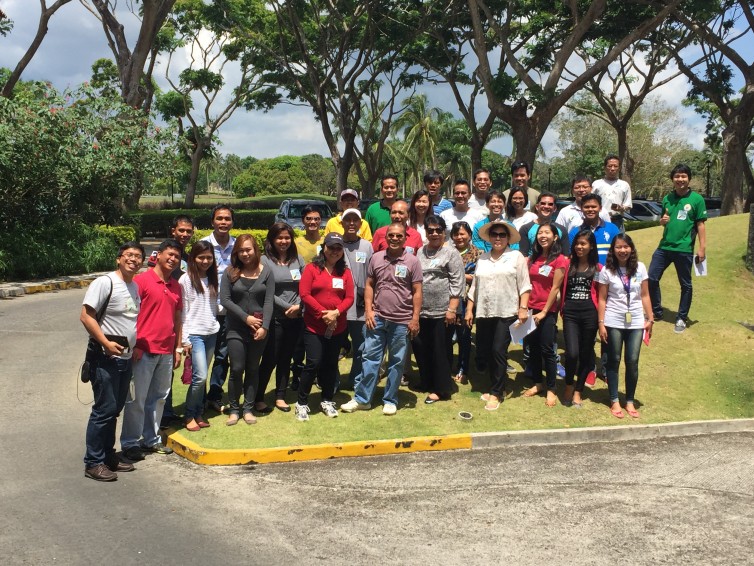
In September 2022, CGIAR funded our Open Knowledge Kit accelerated humanitarian and MSME regeneration program in Bali, Indonesia. We brought together selected technical and non-technical women and Indigenous youth to learn our accelerated program of SDG data collection, mapping, analytics and monitoring, drone operations, and Tourism and Creative Industries micro, small and medium enterprise support and market access.

Our model delivers faster, more accurate verifiable representative data using free and open source tools and low-cost equipment. Training local communities means expensive consultant, equipment, software and travel costs and carbon footprints are greatly reduced, and enable continuous and consistent monitoring while increasing local daily wages by 100 to 1700 percent.

CGIAR is a global research partnership for a food-secure future dedicated to transforming food, land, and water systems in a climate crisis. The Open Knowledge Kit program is supported under their gender and digital divide Digital Innovation Initiative.

Read CGIAR’s blog post.


Open Knowledge Kit: 2023 Launch

2022 CGIAR Indonesia-Africa Training Program

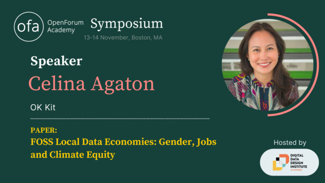
Open Knowledge Kit is a global program that addresses long-standing barriers to addressing gender, jobs and climate security gaps. Non-technical and technical cross-sector local communities led by women are rapidly trained across 15 free and open source tools to create local data employment opportunities at 2-17 times higher daily wages, while agriculture, tourism and creative industries are connected to premium and ethical clients.

We’re committed to the long-term well-being of local communities by coordinating donors across multi-year investments and enabling them to make more informed decisions with better data, prioritization and monitoring methods across the Sustainable Development Goals.

Stay tuned for our official launch soon!


Pacific Forum Women Peace and Security Fellow

This November, I became a Women, Peace and Security Fellow for the Pacific Forum. The Pacific Forum enables academics and professionals to conduct research and support WPS programming in fields such as inclusive health security, cybersecurity, climate security, humanitarian assistance and disaster relief, preventing and countering violent extremism, and maritime security, with a focus on the promotion of women’s participation in peace and security policy at international levels in dialogues, policies, and peace processes. Founded in 1975, the Pacific Forum is a non-profit, foreign policy research institute based in Honolulu, Hawaii. The Forum’s programs encompass current and emerging political, security, economic and business issues and works to help stimulate cooperative policies in the Indo-Pacific region through analysis and dialogue undertaken with the region’s leaders in the academic, government, and corporate areas.

I’m currently designing a gender and climate security study using geospatial indicators and 3D reconstruction across eight countries, including comparisons on conflict and infrastructure.


World Bank G20 Youth Event

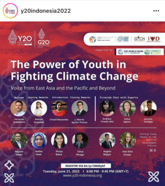
On June 21, I’ll be sharing how our Open Knowledge Kit regeneration program helps non-Youthmappers and non-technical youth learn mapping skills that create local data employment to earn 2-17 times higher daily wages through mostly remote training. These skills combine with climate change modeling and early warning flood systems at 70-1000 percent lower costs to remove barriers to addressing climate change.

The World Bank Group (WBG) Youth Summit Committee (YS) and the Youth-to-Youth Community team (Y2Y) are organizing a joint event in the context of the Youth G20 (Y20) Pre-Summit event in Indonesia. The goal of this joint event is to highlight the role of the youth in addressing the impacts of climate change, foster environmental inclusion, and to discuss the importance of having a youth-led green, resilient and inclusive development approach for people and the planet.  

The World Bank Group (WBG) Youth Summit Committee (YS) and the Youth-to-Youth Community team
(Y2Y) are organizing a joint event in the context of the Youth G20 (Y20) Pre-Summit event in Indonesia.


AVPN G20 Social Impact Event

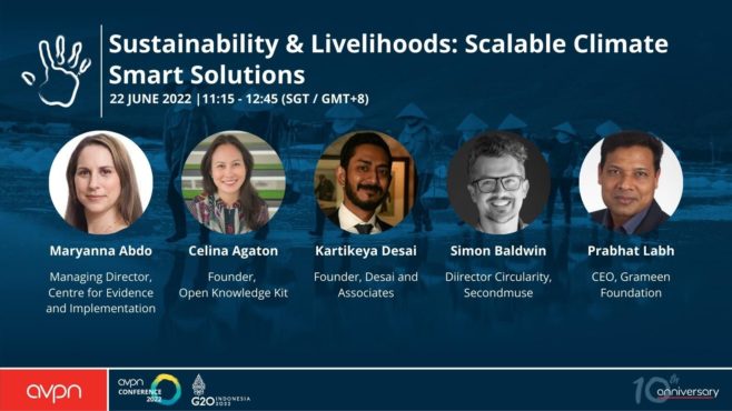
Thanks to the generous support of Julie Ann Wrigley Global Futures Laboratory, Arizona State University Global Institute of Sustainability and Innovation, I’m able to present our Open Knowledge Kit program at special session at the Asian Venture Partner Network’s Global Conference, the Official Social Impact Event for the G20 on June 21-24, 2022.

Here’s our session description:

Early warning weather alerts, real-time traffic maps, ride-hailing services. Technology has quietly become part of our daily lives.

SEAsia is home to the world’s fastest growing e-commerce market. As a result, there is a pressing need to ensure that communities are not left behind in an increasingly digital world.

In this session we will talk about climate smart solutions that contribute to achieving the Sustainable Development Goals (SDGs) of reducing hunger, closing the gender gap and improving environmental management.

Access to technology can level the playing field for struggling rural farmers, new low-cost data collection models result in 17 times higher wages for local communities and an app for informal waste workers can contribute to a clean ocean.

What needs to happen to fully utilize the potential of green tech for our planet and our societies? What can funders do to empower local communities to develop their own solutions? How can bold innovations be fostered?

Key Takeaways:

  • How green tech can open a path towards sustainable growth across the spectrum of climate, gender and livelihoods
  • Beyond free and open source technologies, placing cross-sector communities at the centre of knowledge stewardship and employment models provides the stability critical to bridge successful policy and program implementation, while dramatically reducing costs and carbon footprints
  • Initiatives to improve recovery rates of plastics in the ocean need to take into account the social and economic impacts on informal waste worker


Subak Australia Climate Impact Fellowship

In 2022 I was one of six people awarded with a fellowship at Subak Australia. Subak’s Fellowship funds innovative climate data specialists. This funding partially supported outputs for my G20 presentations, to show that my OK Kit local data economy and MSME program can provide better data, local revenues and social impacts at significantly lower costs and climate footprints, in just 3 months.


FOSS4G 2021 Buenos Aires

I’ll be speaking at FOSS4G 2021, the world’s largest geospatial conference on free and open source software.

Pandemic and Climate Recovery through FOSS4G Local Knowledge Stewardship and Employment Models

September 30, 14:30–15:00, Puerto Madryn

The Open Knowledge Kit Regeneration Program addresses key challenges in the pandemic and climate crisis: How to collect near real-time data, how to create research, policy and programs that reflect the central role of women in the economic and social prosperity of their communities, how to address the political and funding barriers in hazard and climate change modeling, and how to develop fully local research teams to address revolving door outsider and expat models in vulnerable communities.


IUCN World Conservation Congress

by Celina Agaton
IUCN World Conservation Congress, 7-15 January 2021, Marseilles, France -  GGCP

This Saturday September 4th, I”ll be joining the International Union for Conservation of Nature (IUCN Wolrd Congress’ Supporting Indigenous peoples in Defending Nature and Traditions with Geospatial Technologies panel to discuss how our Open Knowledge Kit Regeneration Program provides life saving employment, strengthens local knowledge stewardship and provides better quality real-time data, and industry-leading mapping analytics, disaster and climate change modeling with free and open source tools.

Saturday September 4th at 13:30 – 15:30 GMT+2 | 5:30am PST| 8:30pm PHT

Session Description 

Evidence from across the globe shows that Indigenous peoples and local communities (IPLCs) are effective stewards of nature, yet they are constantly faced with threats from outside interests and their voices are often marginalized in decision-making processes. IPLCs frequently lack consistent and timely access to the data, technologies, and resources necessary to effectively gain official recognition of and uphold their land rights and monitor new threats to nature and their livelihoods. In this campus session, speakers will share their experiences from applying and designing innovative geospatial technologies and learn about the current suite of geospatial tools designed to increase access and use by diverse conservation actors. One key outcome of this session will be an action plan to improve knowledge exchange of ideas, capacity-building resources, and accessible geospatial technologies appropriate for Indigenous-led mapping and monitoring.

Speakers:

Keynote Speaker: Melanie Goodchild, the founder of the Turtle Island Institute

Session host: James Rattling Leaf Sr., GEO Indigenous Alliance

Presenter #1: Giovanni Soliman Bete Reyes, Philippine Indigenous Peoples Community Conserved Territories and Areas Consortium

Presenter #2: Celina Agaton, Fil-Canadian founder, MapPH

The International Union for Conservation of Nature (IUCN) World Conservation Congress takes place on Septembe 3-11, 2021. The IUCN World Conservation Congress is where the world comes together to set priorities and drive conservation and sustainable development action. IUCN’s 1400+ government, civil society and indigenous peoples’ Member organisations vote on major issues, action which guides humanity’s relationship with our planet for the decades ahead. IUCN’s unique and inclusive membership gives the Congress a powerful mandate as it is not solely government or non-government, but both together.

IUCN was created in 1948, and has evolved into the world’s largest and most diverse environmental network. It harnesses the experience, resources and reach of its more than 1,400 Member organisations and the input of some 13,000 experts. IUCN is the global authority on the status of the natural world and the measures needed to safeguard it. Our experts are organised into six commissions dedicated to species survival, environmental law, protected areas, social and economic policy, ecosystem management, and education and communication.

The Congress is also the largest marketplace for conservation and sustainable development science, practice and policy. Scientists, policy experts, business leaders and professionals from around the globe: share their experience, innovation and latest research.

  • 8 days
  • 1000+ participants
  • 1300+ interactive sessions
  • 160+ countries represented
  • 100+ motions decided
  • 4 high-level dialogues
  • 8 days
  • 1000+ participants
  • 1300+ interactive sessions
  • 160+ countries represented
  • 100+ motions decided
  • 4 high-level dialogues


Advancing Women, Peace & Security in the Indo-Pacific

by Celina Agaton
Advancing WPS in the Indo-Pacific

At the Pacific Forum’s Advancing Women, Peace & Security in the Indo-Pacific conference on September 1st, I’ll be speaking about how our Open Knowledge Regeneration Program creates local women-led employment, improves local knowledge stewardship and creates better data and climate change modeling, all using free and open-source tools.

Thursday, September 2, 2021 10:30 AM – 12:00 PM (HST) Session 7 |
Gender and Climate Security in the Indo-Pacific

This session explores different aspects of gender and climate security in the Indo-Pacific. What are examples of established and emerging evidence on the difference that women’s participation and leadership make on climate change responses? What are ongoing challenges posed by climate inaction to addressing gender equality, and vice versa? How and why are gender justice and climate justice interlinked? 

Speakers:

Joan Carling, Indigenous Peoples Major Group for Sustainable Development (IPMG); Indigenous Peoples Rights International (IPRI)

Dr. Laura Hosman, Arizona State University

Celina Agaton, Map the Philippines (MapPH) 

Maria Tanyag, Pacific Forum Women, Peace and Security Fellow

Moderator:

Sharon Bhagwan-Rolls, Shifting the Power Coalition / GPPAC Pacific

The Pacific Forum is a non-profit, foreign policy research institute based in Honolulu, Hawaii. The Forum’s programs encompass current and emerging political, security, economic and business issues and works to help stimulate cooperative policies in the Indo-Pacific region through analysis and dialogue undertaken with the region’s leaders in the academic, government, and corporate areas.

The Forum collaborates with a network of more than 30 research institutes around the Pacific Rim, drawing on Asian perspectives and disseminating its projects’ findings and recommendations to opinion leaders, governments, and publics throughout the region. We regularly cosponsor conferences with institutes throughout Asia to facilitate nongovernmental institution building as well as to foster cross-fertilization of ideas.

Pacific Forum was listed among the “2020 Best New Think Tanks” in the 2020 Global Go To Think Tank Index Report; having recently returned to it’s former fully-independent status. This is an annual ranking produced by the Lauder Institute at the University of Pennsylvania. The index looks at over 11,000 think tanks around the world.

In addition to ranking in the “2020 Best New Think Tanks” global category, Pacific Forum was listed in the top 100  “2020 Top Think Tanks in the United States.” Even more competitively, the organization was recognized as one of only 17 US think tanks listed in the top 73 “2020 Think Tanks With the Most Significant Impact on Public Policy” in the world.


Mindanao: Agriculture, Gender Gap and Logistics Mapping

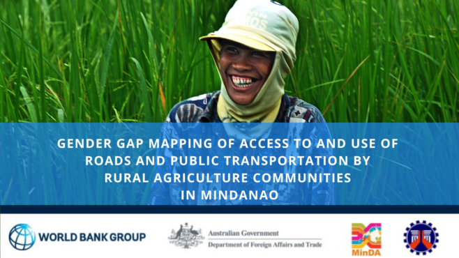
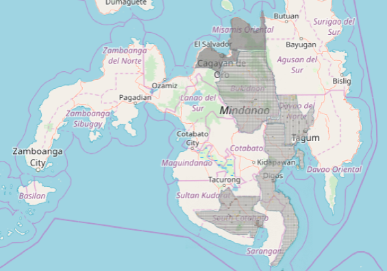
My Canadian consulting company is currently mapping the Mindanao region to support rural farming, gender, healthcare and artisan communities. The Mindanao region grows almost half the country’s food, yet remains the poorest population, with many communities at 30-70% poverty incidence. War and conflict have increased in the region in recent years, with security and safety concerns for girls and women. Our goal is to help map rural agriculture, logistics and the gender gap to plan improved infrastructure with long-term impacts on health, well-being and livelihood for girls, women, Indigenous Peoples and farm families.

This is a coordinated effort across international agencies, government, business, non-profits, academe and community leaders. Our study results will lead the prioritization and coordinated planning between international funding agencies and private investment in the second phase of this initiative.

We’ll be working with communities to teach them to map and using geospatial technologies to rapidly analyze infrastructure gaps for validation with local communities.

Local YouthMappers chapters at Far Eastern University and University of the Philippines Resilience Institute, Map the Philippines, George Washington University Humanitarian Mapping Society, and USAID GeoCenter are generously supporting the validation of these tasks.


After Typhoon Haiyan: Disaster and Community Resiliency

Participatory Mapping with the Municipality of Malvar, Batangas

Participatory Mapping with the Municipality of Malvar, Batangas

It’s been a while since I’ve done an update to the crisismappers network since my talk post Typhoon Yolanda/Haiyan at the International Conference on Crisis Mapping, but there are lots of good things happening here in the Philippines. The White House Office of Digital Strategy and the Office of Science and Technology Policy invited me to attend the first White House Mapathon on May 21, so I’ll be in DC until May 23 if folks want to meetup.

We’ve begun my cross sector initiative to provide a comprehensive map of the Philippines on OpenStreetMap. I’ve won a grant from Making All Voices Count to develop an open source, open data platform to provide layers of data from hazards and population, to infrastructure, disaster, community and economic reslilience needs. Some of our data partners include UNOCHA, Department of Interior and Local Government, League of Municipalities, WWF and corporate, NGO and citizen networks. One of the core functions of the platform is to identify gaps and overlaps in community needs versus publicly and privately funded programs. We aim to complete the first modules of the platform over the coming weeks to prepare for the upcoming monsoon season and 7.2 earthquake in Manila. We’re targeting high risk poverty, disaster and illegal fishing and poaching areas for disaster resilient farming projects and will be mapping this data on to the platform. This is a critical time in the Philippines with an upcoming national election in May 2016, meaning a government slow down by October 2015. We want to future proof the platform to ensure our partners are networked and running regardless of the future administration and in preparation for disasters.

The U.S. State Department’s MapGive program is generously providing satellite imagery help us map base layers on OpenStreetMap. I’ve requested Bing imagery to be refreshed countrywide to support our preparations. We would also love to be included on Missing Maps soon to help fast track our mapping.

With the World Bank and Department of Budget and Management, we are working on training local government units, colleges, cross sector partners and citizens on OpenStreetMap and a suite of other mapping tools for a more participatory planning and budgeting process on infrastructure planning.

We’re also providing free OpenStreetMap workshops across the country, including 5-day mapping training series pilots with colleges to learn OSM, JOSM and other free and opensource tools. We have a local drone partner who provide 5cm/pixel imagery for infrastructure, disaster preparedness and monitoring and evaluation and helps visualize infrastructure needs for budget proposals. We’re working with USAID AidData Fellows to work on several of our programs as well.

We’ll be piloting a Map the Philippines initiative to connect local and international mappers to local tourist and at risk area mapping activities. This is in preparation for the International Conference on Crisis Mapping which I am co-organizing in late 2016 and hosting in our new 26,000 square foot arts, tech and disaster resiliency centre. After the conference we are inviting mappers to join mapping events across the country.

Week of June 15th we’ll be organizing a free OSM training in Manila to help provide support for climate change and disaster risk mapping for the Philippines to join global Climathons with ClimateKIC on June 18 for COP21. On June 24 we’ll be hosting a Map the Philippines mapping event with OpenStreetMap Philippines and OSM Founder Steve Coast. This is in partnership with Making All Voices Count and includes a pitching competition on disaster resiliency tech with prize amounts of up to GBP20,000 or US$31K following incubation. We’ll be organizing mapathons for Disaster Resilience Reduction Day on October 13 and World Food Day on October 16.

I’ll have other updates on food security and disaster resilient agriculture soon.

Thank you for all your support so far. We’ll need help with feedback and support during these critical months and hope you can join us online and in country. We’ll have more details online soon.


OpenStreetMap Philippines Workshop in Batangas

OpenStreetMap in Batangas

Under the OpenRoads initiative, the World Bank is supporting the government of the Philippines in advancing a set of policies and tools to improve strategic local road infrastructure for inclusive growth. The starting point for financing and implementation of better local road networks is a strategic map.

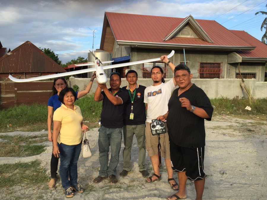
OpenStreetMap Philippines conducted a 2-day OpenStreetMap workshop, with SkyEye drone mapping, community consultations and the Local Government Units of Tanauan and Malvar, Batangas. A follow up visit and additional mapping events and tools are planned soon.

Update: our drone imagery is available on CC-BY license on the OpenAerial platform.

View the photo gallery on Facebook >>

Learn more:

OpenRoads
http://openroads.ph/

OpenStreetMap Philippines
http://www.openstreetmap.org/

Map the Philippines
http://celinaagaton.com/openstreetmaps-10th-anniversary-party/


OpenStreetMap’s 10th Anniversary

Screen Shot 2014-12-01 at 1.01.13 AM

Come Join Our Celebrations for OpenStreetMap’s 10th Anniversary!

* Learn about mapping * Enjoy our drone showcase * Eat cupcakes! *

Everyone is welcome! Twitter, Instagram and Facebook Hashtag #mapPHL

Mind Museum Outdoor Canopy
J. Y. Campos Park, 3rd Ave, Taguig
Thursday December 4th 11am to 2pm
Enjoy snacks and drinks
FREE

Learn more >>

Help Spread the Word! Download the Flyer

OpenStreetMap is a collaborative project to create a free editable map of the world. It is supported and updated by 1.7 million registered users worldwide. During the Typhoon Yolanda response, as in other disasters, OpenStreetMap was widely used by the local and international aid community for its accuracy and accessibility with sharing and transferring data.

We want to help map the Philippines through free mapping workshops, citizen reporting and crowdsourced data. We’re creating mapping networks with local community leaders, colleges, government, business and NGOs to help empower Filipinos from across the sectors to collaborate together to map our communities. Our first step is to create a base layer map with roads, rivers and buildings, next we can then add additional layers such as needed infrastructure and social programming like disaster risk and preparedness, food security, health and education needs by location. We’re also bringing innovative and accessible internet access solutions and communications tools to the communities we partner with.

Learn about our exciting mapping projects and how you help become a citizen reporter with just a few clicks!

Please register so we can stay in touch with our mapping news and projects in the Philippines.

We thank our generous supporters:

World Food Program     BGC         SkyEye


Map the Philippines

OpenStreetMap PhilippinesWe’re partnering with local community leaders, colleges, government, business and NGOs to host OpenStreetMap workshops to help empower Filipinos from across the sectors to work together to help map the Philippines.

OpenStreetMap is a collaborative project to create a free editable map of the world and is supported and updated by 1.7 million registered users worldwide. During the Typhoon Yolanda response, as in other disasters, OpenStreetMap was widely used by the local and international aid community for its accuracy and accessibility with sharing and transferring data. The Humanitarian OpenStreetMap community was critical in providing much needed imagery for unmapped areas devastated by Typhoon Yolanda.

Even businesses like Foursquare, Munch Punch, Craigslist and Mapquest also use OpenStreetMap. OpenStreetMap is a free, open data and open source platform, mapped by the community, for the community.

Our first step is to create a base layer map with roads, rivers and buildings mapped out, then we can then add additional layers like needed infrastructure and social programming like disaster risk and preparedness, health and education needs by location. We’re planning on deploying mapping kits with laptops, GPS and other tools needed for communities to continue updating their maps after our training workshop.

Our Goals:
1. To complete the mapping of the Philippines for its many diverse communities.
2. To have accurate mapping data ready and available for ongoing and future disaster, infrastructure and community needs.
3. To grow the current Philippine OpenStreetMap community to help update our maps.

We’ll be making some exciting announcements at our OpenStreetMap 10th Anniversary Party at the Mind Museum on December 4th from 11am to 2pm. I hope you can join us for our drone showcase, mapping demos and cupcakes!


World Food Day 2014

by Celina Agaton

World Food Day Siargao

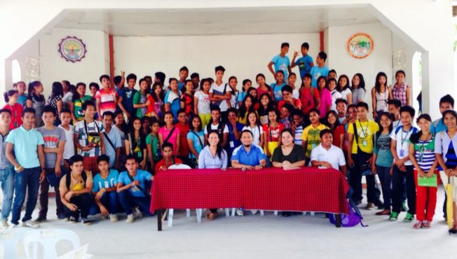
Happy World Food Day from the Surigao State College of Technology’s agriculture and fisheries program! Spent the day with Mayor Coro touring sustainable food programs and drafting up mapping and livelihood projects. Fortuitous timing for this trip to happen on this day.


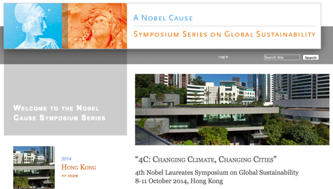
4th Nobel Laureates Symposium on Global Sustainability

by Celina Agaton

Screen Shot 2014-10-13 at 10.20.50 AM

Update: Event postponed due to the current situation in Hong Kong.

Thankful to have been invited to the 4th Nobel Laureates Symposium on Global Sustainability next week in Hong Kong. I’ll be joining Nobel Laureates, scientists, policy makers, global and business leaders and sharing our exciting mapping, climate and community resiliency projects here in the Philippines.

I’ll also be conducting a few interviews and writing an article as a member of the Global Solution Networks, a landmark study of the potential of global web-based networks for cooperation, problem solving and governance.


Canadian Non-Profits: Enjoy Up to 80% Off School and Office Supplies With Lyreco

Lyreco

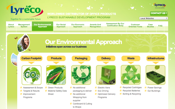
I’ve enjoyed a long partnership with Lyreco Canada and admire their commitment to the environment. During my time at Volunteer Toronto, I wanted to help Toronto non-profits access more affordable school, art and office supplies with a company committed to the environment. So in 2008 I announced a 70% discount with Lyreco for Volunteer Toronto’s non-profit community, the same discount rate provided to the Ontario government as their official vendor. At the time, they offered 600 green products, and today Lyreco offers over over 1600 green products and has expanded their commitments to sustainable development from environmental packaging to green delivery and green infrastructure.

I’m so pleased to announce that in 2014, we’ve expanded our partnership, and all registered Canadian non-profit organizations can enjoy up to 80% off school and office supplies. Membership is free, comes with online ordering and free delivery.

To sign up, contact:

Wayne McKenna
Strategic Account Manager
Central Canada

Lyreco
Phone: 1 416 707 8951
7303 Warden Avenue, Markham, Ontario, L3R 5Y6, CANADA
wayne.mckenna@lyreco.com
http://www.lyreco.com

 No disclosures here, I am not compensated in any way by Lyreco.


World Food Day Toronto

by Celina Agaton

More than half of Toronto residents live in “Food Deserts,” neighbourhoods that do not have access to good quality and affordable food.

On World Food Day, October 16, 2012, Toronto’s community leaders are coming together at the newly opened Daniels Spectrum to celebrate a cross sector approach to achieving a sustainable local food system with good food for all.

My social change film series, Films that Move and Food Forward have partnered with the Centre for Social Innovation to raise awareness and action on the challenges with hunger and the way we grow, buy and learn about the food we eat.

“Many people think of hunger as a problem exclusive to other countries, but as we know, it’s everywhere. Right here in Toronto, last year alone, there were a million visits to food banks,” says UN World Food Programme National Ambassador Against Hunger George Stroumboulopoulos. “World Food Day helps us recognize the great work currently being done in schools, businesses and communities. It also reminds us that we have a long way to go, and need an integrated approach both locally and globally to address this widespread challenge.”

World Food Day Toronto is a free event open to the public.

World Food Day
Tuesday, October 16, 2012 5:30-9pm. Doors open at 5:15
Daniels Spectrum, A Cultural Hub in Regent Park
585 Dundas Street East at Parliament. Map and Directions.
Twitter Hashtag #WFD2012 #FoodTO

5:15pm Doors Open

5:30pm Reception: Featuring food from Chef Michael Stadtlander, Paintbox and
Regent Park Community Health Centre Kitchen

6:00pm Welcome and Introductions
Opening remarks by Chef Michael Stadtlander

6:30pm Speakers
Yung Chang, The Fruit Hunters Documentary
Mark Cutrara, Cowbell
Suresh Doss, Food Truck Eats
Bryan Gilvesy, Y U Ranch/Sustain Ontario
Seana Irvine, Evergreen
Tzazna Miranda Leal, Justicia for Migrant Workers
Laura Reinsborough, Not Far From the Tree
David Reycraft, Regent Park Food Partnership/Dixon Hall
Nick Saul, The Stop
Erin Shapero, Local Food Plus

7:20pm Break

7:45pm 30-minute workshops
Topics: Community Food Projects, Food Business,
Food Centres, Street Food and Labour Rights

8:45pm Announcements and Close