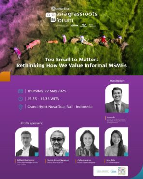
The informal MSMEs are often left behind with little attention given to them from the government or society sides in general. The informal MSMEs are nevertheless the largest source of jobs, especially for women, youth and marginalized groups, and they support domestic demand by providing affordable goods and services tailored to local communities. How should we therefore reconsider the way we think about the informal MSMEs in developing Asia?
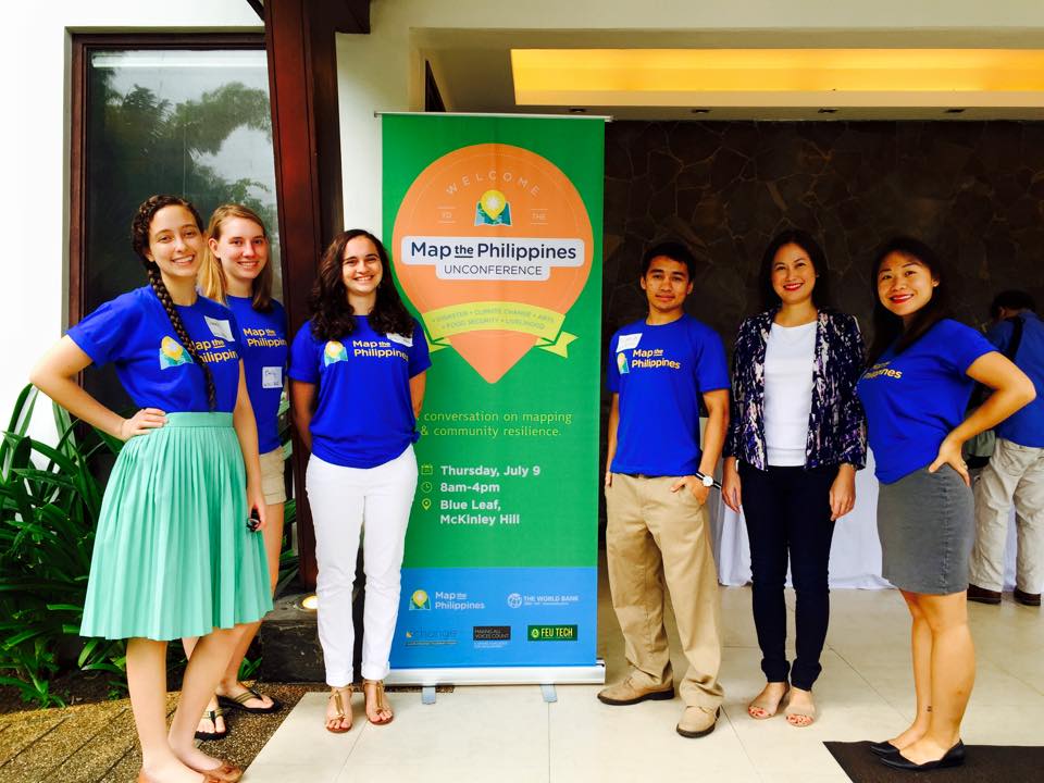
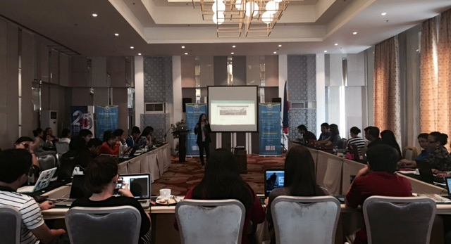
In 2019, I led my largest implementation and field testing of my local data economy model. Research, investment, policy and program development studies are typically conducted in a siloed and uncoordinated fashion that requires a lot of time, effort and expense for local communities. The Philippines is ranked as the most at risk for disasters and climate change, averaging 22 typhoons (hurricanes or cyclones) a year. This places a tremendous burden on local communities who are typically required to travel long, difficult journeys to attend numerous events and workshops that are often located far away near airports or luxury hotels for the convenience of donors and funders.
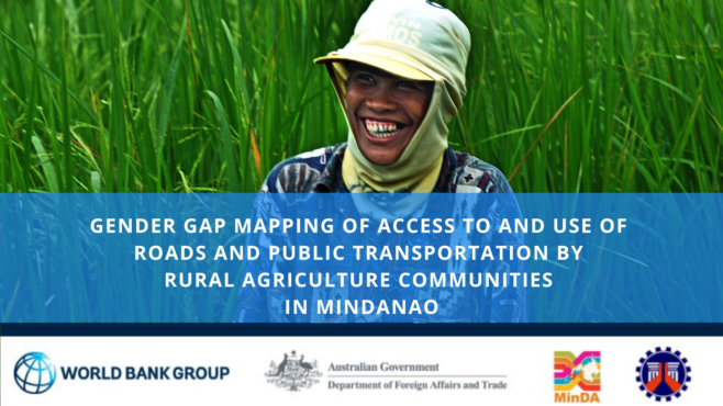
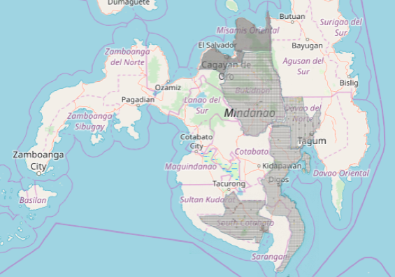
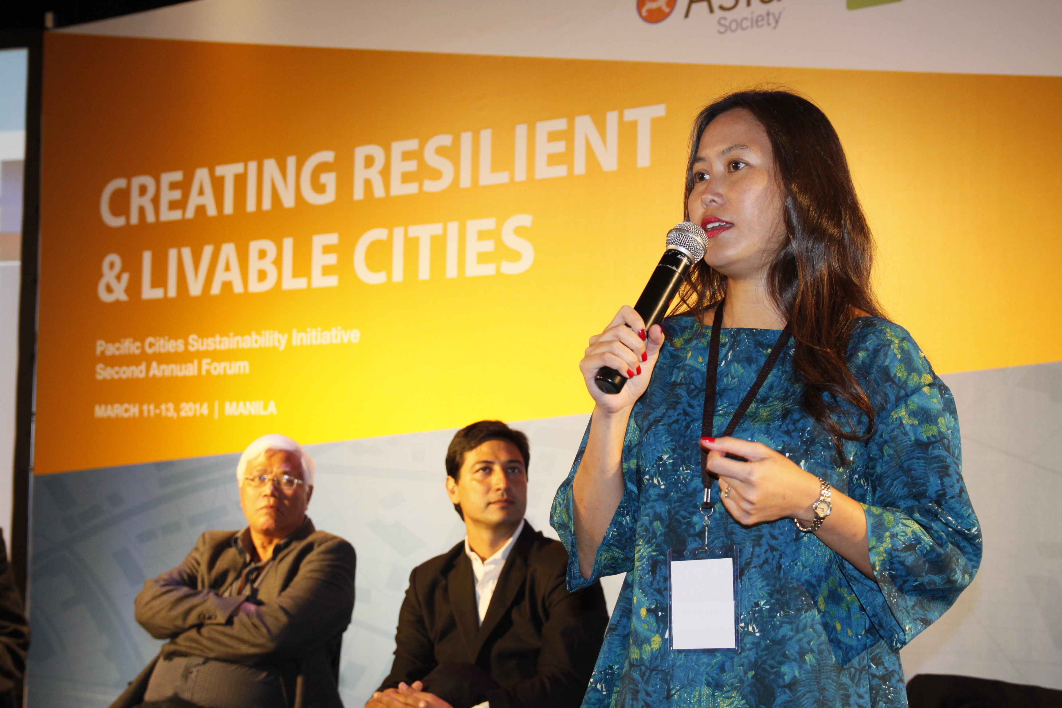
In 2019, with World Bank, IFC and Australian Department of Foreign Affairs and Trade funding, I was able to conduct five simultaneous studies, including World Bank’s first gender gap mapping study, across six provinces in the conflict region of Mindanao in the Philippines as Technical Assistance for the Mindanao Transport Connectivity Improvement Project:
600 Gender Gap Mapping Household Surveys
7000 Agriculture Commodity Flow and Origin-Destination Surveys
Six Province AI Studies on Industrial Logistics Congestion and Challenges
3 Regional Open Workshops for 180 Cross-Sector Participants (including micro enterprise through to conglomerates)
Road, Agriculture, Micro to Medium Enterprise (MSME) to Industrial, Indigenous, Tourism and Creative Industries and Disaster Infrastructure Field and Remote Mapping
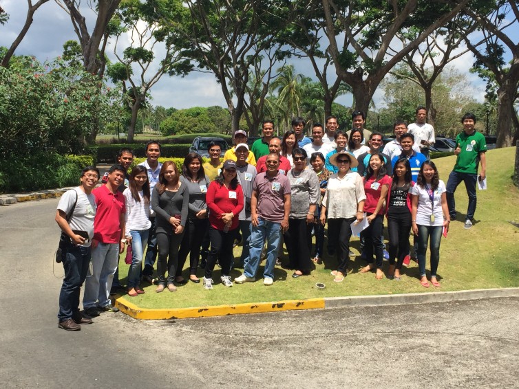
These studies required 200 field staff, all of whom were Filipino, and 180 were located in close proximity to the survey sites. For the community-based mapping workshops, I undertook a careful validation process of ensuring the community was represented by progressive cross-sector leaders across government, business, non-profit, schools and university staff and students, and local community leaders. Rather than requiring a technical background, an interest to learn and teach others was the primary criteria, because the best knowledge often comes from people with strong community ties and diverse experiences. Our simplified mapping techniques ensure that anyone can learn to map, and we’ve trained people from age 6-60+ years.
Through our exclusive use of free and open source software and frugal sciencem methods, and hiring local staff and data collectors and processors, we not only strengthen local community engagement, but we are able to increase and improve the standard of data and outputs, at a much lower costs and environmental footprint. This enabled on average, and increase of 2-5 times higher staff and data wages. With every expense designed to directly benefit the local community sites, we create opportunities for research, investment, policy and program development studies, across public and private sectors to be transformed into accelerated impact models.
We were fortunate to compelete the program and report approvals in March 2020. This project enabled and challenged me to further develop inclusive innovations, frugal science, and safer methods that achieve representative data samples at scale, while supporting our highest wages to date, which is US$100 per hour for fully remote recruitment and data collection during the pandemic.
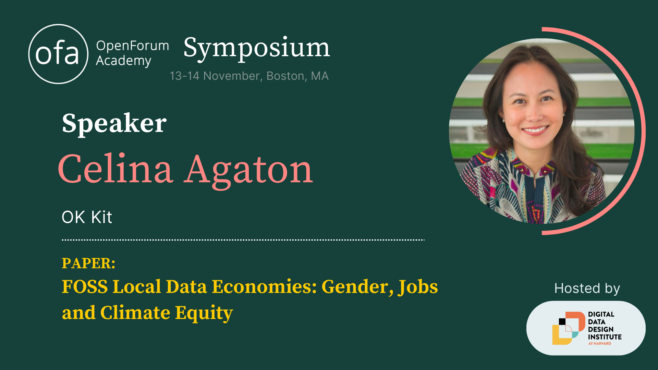
OpenForum Europe (OFE) recently invited me Boston to present my local data economy in partnership with Harvard’s new Digital Data Design Institute. OFE is a European open source software think tank that advises European policymakers and legislators on the merits of openness in computing and provides technical analysis and explanation. OFE promotes open source software, as well as openness more generally, as part of a vision to facilitate open, competitive choice for technology users.
FOSS local data economies are self-sustaining and more equitable economic, social and environmental models that meet the pace and urgency of accelerating global risks. Faster, more accurate, verifiable and representative data enable better public and private sector prioritization, coordination and monitoring across the Sustainable Development Goals (SDGs). The SDGs largely lack geospatial indicators that capture mobility, safety, proximity, infrastructure and service assessments, which accurately reflect the intersecting risks and opportunities communities experience in real-life. 78% of the 231 SDG indicators lack gender data, and despite women’s majority contributions to household and economic tasks, they have the least access to essential household and business infrastructure.
OECD reports that less than 10% of funding is received by local organizations, with 80% of climate research awarded to Western organizations over the last 30 years. Of the $137 billion invested a decade after Super Typhoon Haiyan and the Sendai Framework, only 4 percent was invested in mitigation in Asia Pacific, and the lack of coordination and tangle of overlapping multilateral efforts continues to create further chaos to already traumatized communities.
Rather than a siloed and political approach reliant on glacial grant and funding processes, local governments and cross-sector communities co-develop their own continuous and interoperable SDG map with geospatial indicators to better fast track public and private sector investments and interventions, receive the majority of budgets, and address long neglected infrastructure and the unique needs of marginalized communities.
With the exclusive use of free and open source mapping tools including unique digital twin techniques for infrastructure and disaster modelling, non-technical and technical local communities produce faster, more accurate, representative and verifiable data, at 50% lower cost and environmental footprints, while increasing local daily wages 100-900 percent, starting at 3 months. The highest wage to date is remotely trained World Bank road safety surveys at $100 per hour of work.
This an immediately viable transition to a local data economy, where local communities continuously lead data and knowledge on their community, industry and geography, to depoliticize investments, with greater governance and accountability, especially in technology, engineering and construction, which are among the most corrupt industries.
This bridges the gaps between effective policy, program development, local capacity, data and research gaps.
Thrilled to be invited by the Youthmapper family to write a chapter on my gender, jobs and climate program for Springer’s Sustainable Development Goal Series. Open Mapping towards Sustainable Development Goals
Offers the voices of students or recent graduates in countries where YouthMappers is active
Covers topics ranging from water, agriculture, food, to waste, education, gender, and disasters
Addresses topics at various scales of perspective, from individual/local city level to national and global scopes
This book is open access, which means that you have free and unlimited access
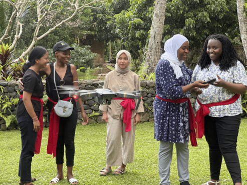
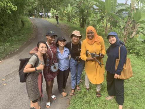
In September 2022, CGIAR funded our Open Knowledge Kit accelerated humanitarian and MSME regeneration program in Bali, Indonesia. We brought together selected technical and non-technical women and Indigenous youth to learn our accelerated program of SDG data collection, mapping, analytics and monitoring, drone operations, and Tourism and Creative Industries micro, small and medium enterprise support and market access.
Our model delivers faster, more accurate verifiable representative data using free and open source tools and low-cost equipment. Training local communities means expensive consultant, equipment, software and travel costs and carbon footprints are greatly reduced, and enable continuous and consistent monitoring while increasing local daily wages by 100 to 1700 percent.
CGIAR is a global research partnership for a food-secure future dedicated to transforming food, land, and water systems in a climate crisis. The Open Knowledge Kit program is supported under their gender and digital divide Digital Innovation Initiative.
Open Knowledge Kit is a global program that addresses long-standing barriers to addressing gender, jobs and climate security gaps. Non-technical and technical cross-sector local communities led by women are rapidly trained across 15 free and open source tools to create local data employment opportunities at 2-17 times higher daily wages, while agriculture, tourism and creative industries are connected to premium and ethical clients.
We’re committed to the long-term well-being of local communities by coordinating donors across multi-year investments and enabling them to make more informed decisions with better data, prioritization and monitoring methods across the Sustainable Development Goals.
This November, I became a Women, Peace and Security Fellow for the Pacific Forum. The Pacific Forum enables academics and professionals to conduct research and support WPS programming in fields such as inclusive health security, cybersecurity, climate security, humanitarian assistance and disaster relief, preventing and countering violent extremism, and maritime security, with a focus on the promotion of women’s participation in peace and security policy at international levels in dialogues, policies, and peace processes. Founded in 1975, the Pacific Forum is a non-profit, foreign policy research institute based in Honolulu, Hawaii. The Forum’s programs encompass current and emerging political, security, economic and business issues and works to help stimulate cooperative policies in the Indo-Pacific region through analysis and dialogue undertaken with the region’s leaders in the academic, government, and corporate areas.
I’m currently designing a gender and climate security study using geospatial indicators and 3D reconstruction across eight countries, including comparisons on conflict and infrastructure.
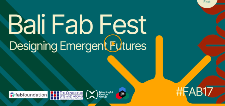
Bali Fab Fest is organized by the Fab Foundation, the Center for Bits and Atoms at MIT, the Fab City Foundation, and the Meaningful Design Group. It brings together two major annual events, the 17th edition of the Fab Lab Conference and 7th Fab City Summit 2022. Bali Fab Fest is a learning experience for both international participants and local stakeholders who invest their efforts into inventing and realizing the world that is coming next, responding to global challenges such as climate change and social exclusion through small scale interventions in situated communities. The event aims to promote and enable meaningful collaborations between innovators, makers, entrepreneurs, organizations, and the public sector.
On June 21, I’ll be sharing how our Open Knowledge Kit regeneration program helps non-Youthmappers and non-technical youth learn mapping skills that create local data employment to earn 2-17 times higher daily wages through mostly remote training. These skills combine with climate change modeling and early warning flood systems at 70-1000 percent lower costs to remove barriers to addressing climate change.
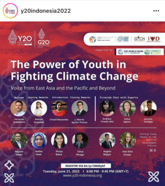
The World Bank Group (WBG) Youth Summit Committee (YS) and the Youth-to-Youth Community team (Y2Y) are organizing a joint event in the context of the Youth G20 (Y20) Pre-Summit event in Indonesia. The goal of this joint event is to highlight the role of the youth in addressing the impacts of climate change, foster environmental inclusion, and to discuss the importance of having a youth-led green, resilient and inclusive development approach for people and the planet.
The World Bank Group (WBG) Youth Summit Committee (YS) and the Youth-to-Youth Community team (Y2Y) are organizing a joint event in the context of the Youth G20 (Y20) Pre-Summit event in Indonesia.
Early warning weather alerts, real-time traffic maps, ride-hailing services. Technology has quietly become part of our daily lives.
SEAsia is home to the world’s fastest growing e-commerce market. As a result, there is a pressing need to ensure that communities are not left behind in an increasingly digital world.
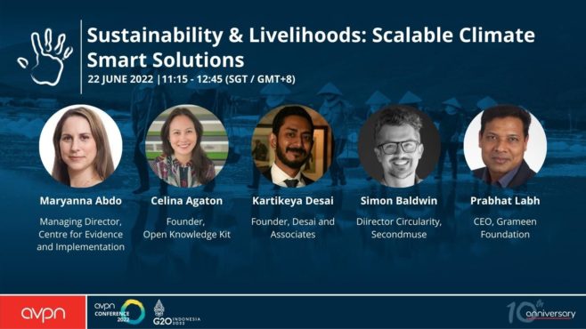
In this session we will talk about climate smart solutions that contribute to achieving the Sustainable Development Goals (SDGs) of reducing hunger, closing the gender gap and improving environmental management.
Access to technology can level the playing field for struggling rural farmers, new low-cost data collection models result in 17 times higher wages for local communities and an app for informal waste workers can contribute to a clean ocean.
What needs to happen to fully utilize the potential of green tech for our planet and our societies? What can funders do to empower local communities to develop their own solutions? How can bold innovations be fostered?
Key Takeaways:
How green tech can open a path towards sustainable growth across the spectrum of climate, gender and livelihoods
Beyond free and open source technologies, placing cross-sector communities at the centre of knowledge stewardship and employment models provides the stability critical to bridge successful policy and program implementation, while dramatically reducing costs and carbon footprints
Initiatives to improve recovery rates of plastics in the ocean need to take into account the social and economic impacts on informal waste worker
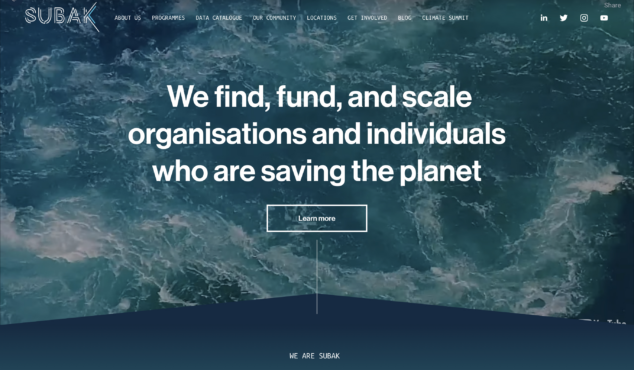
In 2022 I was one of six people awarded with a fellowship at Subak Australia. Subak’s Fellowship funds innovative climate data specialists. This funding partially supported outputs for my G20 presentations, to show that my OK Kit local data economy and MSME program can provide better data, local revenues and social impacts at significantly lower costs and climate footprints, in just 3 months.
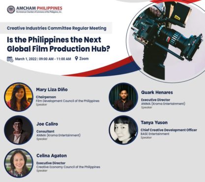
On March 1st I joined the American Chamber of Commerce’s Creative Industries Committee panel on supporting the Philippine film industry. Per usual, I spoke about the practical aspects of developing the film and creative industry: lack of accurate data and prioritization in a largely informal sector. I shared our local Open Knowledge Kit methodology that provides faster, cheaper, more accurate and verifiable data while creating local data employment opportunities well above the minimum wage. I also shared footage from one of the creative industry production hubs we are developing in the Philippines, with another location set in Indonesia to support the ASEAN region.
Media use is seen as a very important part of Filipino life as exposure to media mirrors the desire to be part of both society and the environment. Among the Filipino people, films are considered to be one of the popular forms of entertainment as it directly employs around 260,000 Filipinos and generate generating around ₱2 billion incomes per annum. Within the Southeast Asian region, Philippine cinema remains the most vibrant and diverse as the majority of films made in the region came from the Philippines along with the film industries of Thailand and Indonesia.
However, on a global scale, the downfall of Philippine cinema is traced to Filipinos’ exposure to foreign films rather than mainstream cinema. The competition from foreign films with better editing techniques, cinematography, story concept, and far bigger production made it difficult for Filipino films to compete. Also, high taxation for film producers affects the number of films available. Hence, with the advent of new technologies and new media platforms, the industry is faced with new challenges.
The technical quality of foreign films made it difficult for the local industry to compete since moviegoers mostly watched films for entertainment and a sort of enjoyment and diversion. Furthermore, the Philippine film industry has faced incredible drawbacks since the onset of the COVID-19 pandemic – from the continued closure of cinemas that affected the production of local films, to the challenges plaguing the safe conduct of production activities and onsite events.
Media use is seen as a very important part of Filipino life as exposure to media mirrors the desire to be part of both society and the environment. Among the Filipino people, films are considered to be one of the popular forms of entertainment as it directly employs around 260,000 Filipinos and generate generating around ₱2 billion incomes per annum. Within the Southeast Asian region, Philippine cinema remains the most vibrant and diverse as the majority of films made in the region came from the Philippines along with the film industries of Thailand and Indonesia.
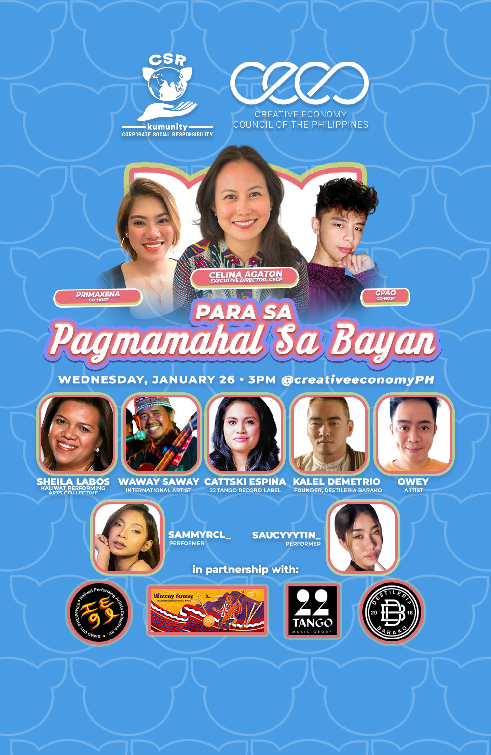
At the Creative Economy Council of the Philippines – CECP, we’ve partnered with Kumu, the Pinoy livestreaming app, to explore new ways for creatives to make a living. Kumu currently has 10 million users in 55 countries, with some regulars making P20,000 or $360 per week! Download the app and join our Kumu livestream @CreativeEconomyPH tomorrow at 3pm Wednesday, January 26 to meet and support the artists we’re working with:
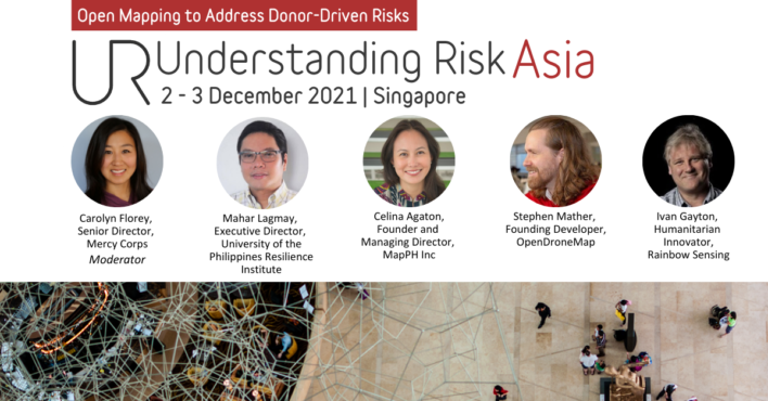
We were invited to present at two sessions at the 2021 Understanding Risk Asia conference hosted by World Bank and National University of Singapore.
I led a solo session talking about our Open Knowledge Kit program and four career tracks and also curated the panel presenting the developers behind our technology and implementing partners.
Open Knowledge Kit (OK Kit) is a free and open-source tool kit to empower local communities with digital employment through geospatial data collection, analytics and monitoring toward the stewardship of their economic, climate, and social prosperity. Surveys, disaster and climate change modeling and 3D reconstruction are now possible at much lower costs, training local and non-technical communities.
OK Kit Addresses the key barriers to achieving the SDGs:
1. Short-term and uncoordinated donor projects led by community outsiders 2. Expensive, proprietary and closed technology systems 3. The gender gap 4. Decent Work
This past November I represented the Philippines at the ASEAN Creative Economy Business Forum and shared progress on the Creative Industries Bill and Tax-Free program to support micro to medium enterprise. I also shared our Open Knowledge Kit program that provides local employment through remote and in-person training using free and open source data collection, mapping, and analytics tools to help inform and provide better cross-sector prioritization, coordination and monitoring of initiatives.
The Open Knowledge Kit Regeneration Program addresses key challenges in the pandemic and climate crisis: How to collect near real-time data, how to create research, policy and programs that reflect the central role of women in the economic and social prosperity of their communities, how to address the political and funding barriers in hazard and climate change modeling, and how to develop fully local research teams to address revolving door outsider and expat models in vulnerable communities.
This Saturday September 4th, I”ll be joining the International Union for Conservation of Nature (IUCN Wolrd Congress’ Supporting Indigenous peoples in Defending Nature and Traditions with Geospatial Technologies panel to discuss how our Open Knowledge Kit Regeneration Program provides life saving employment, strengthens local knowledge stewardship and provides better quality real-time data, and industry-leading mapping analytics, disaster and climate change modeling with free and open source tools.
Saturday September 4th at 13:30 – 15:30 GMT+2 | 5:30am PST| 8:30pm PHT
Session Description
Evidence from across the globe shows that Indigenous peoples and local communities (IPLCs) are effective stewards of nature, yet they are constantly faced with threats from outside interests and their voices are often marginalized in decision-making processes. IPLCs frequently lack consistent and timely access to the data, technologies, and resources necessary to effectively gain official recognition of and uphold their land rights and monitor new threats to nature and their livelihoods. In this campus session, speakers will share their experiences from applying and designing innovative geospatial technologies and learn about the current suite of geospatial tools designed to increase access and use by diverse conservation actors. One key outcome of this session will be an action plan to improve knowledge exchange of ideas, capacity-building resources, and accessible geospatial technologies appropriate for Indigenous-led mapping and monitoring.
The International Union for Conservation of Nature (IUCN) World Conservation Congress takes place on Septembe 3-11, 2021. The IUCN World Conservation Congress is where the world comes together to set priorities and drive conservation and sustainable development action. IUCN’s 1400+ government, civil society and indigenous peoples’ Member organisations vote on major issues, action which guides humanity’s relationship with our planet for the decades ahead. IUCN’s unique and inclusive membership gives the Congress a powerful mandate as it is not solely government or non-government, but both together.
IUCN was created in 1948, and has evolved into the world’s largest and most diverse environmental network. It harnesses the experience, resources and reach of its more than 1,400 Member organisations and the input of some 13,000 experts. IUCN is the global authority on the status of the natural world and the measures needed to safeguard it. Our experts are organised into six commissions dedicated to species survival, environmental law, protected areas, social and economic policy, ecosystem management, and education and communication.
The Congress is also the largest marketplace for conservation and sustainable development science, practice and policy. Scientists, policy experts, business leaders and professionals from around the globe: share their experience, innovation and latest research.
At the Pacific Forum’s Advancing Women, Peace & Security in the Indo-Pacific conference on September 1st, I’ll be speaking about how our Open Knowledge Regeneration Program creates local women-led employment, improves local knowledge stewardship and creates better data and climate change modeling, all using free and open-source tools.
Thursday, September 2, 2021 10:30 AM – 12:00 PM (HST) Session 7 | Gender and Climate Security in the Indo-Pacific
This session explores different aspects of gender and climate security in the Indo-Pacific. What are examples of established and emerging evidence on the difference that women’s participation and leadership make on climate change responses? What are ongoing challenges posed by climate inaction to addressing gender equality, and vice versa? How and why are gender justice and climate justice interlinked?
Speakers:
Joan Carling, Indigenous Peoples Major Group for Sustainable Development (IPMG); Indigenous Peoples Rights International (IPRI)
Dr. Laura Hosman, Arizona State University
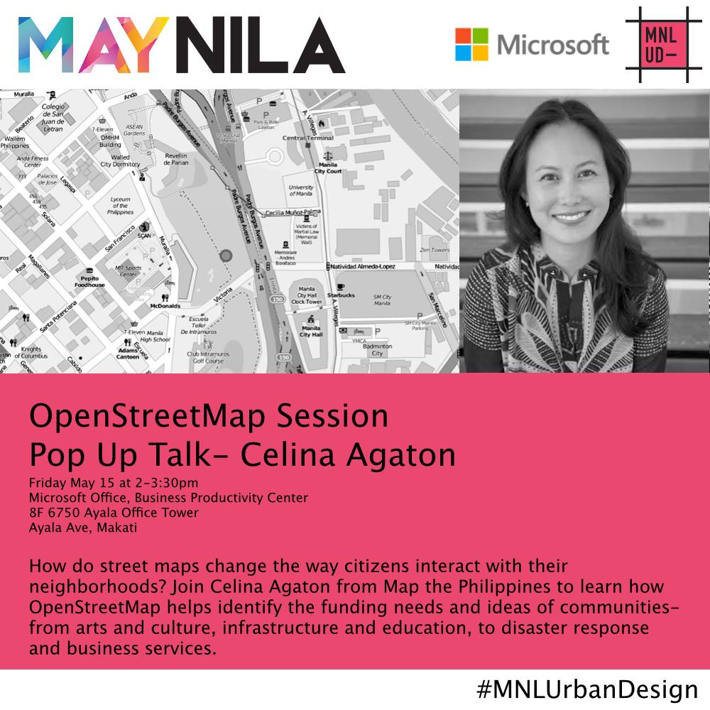
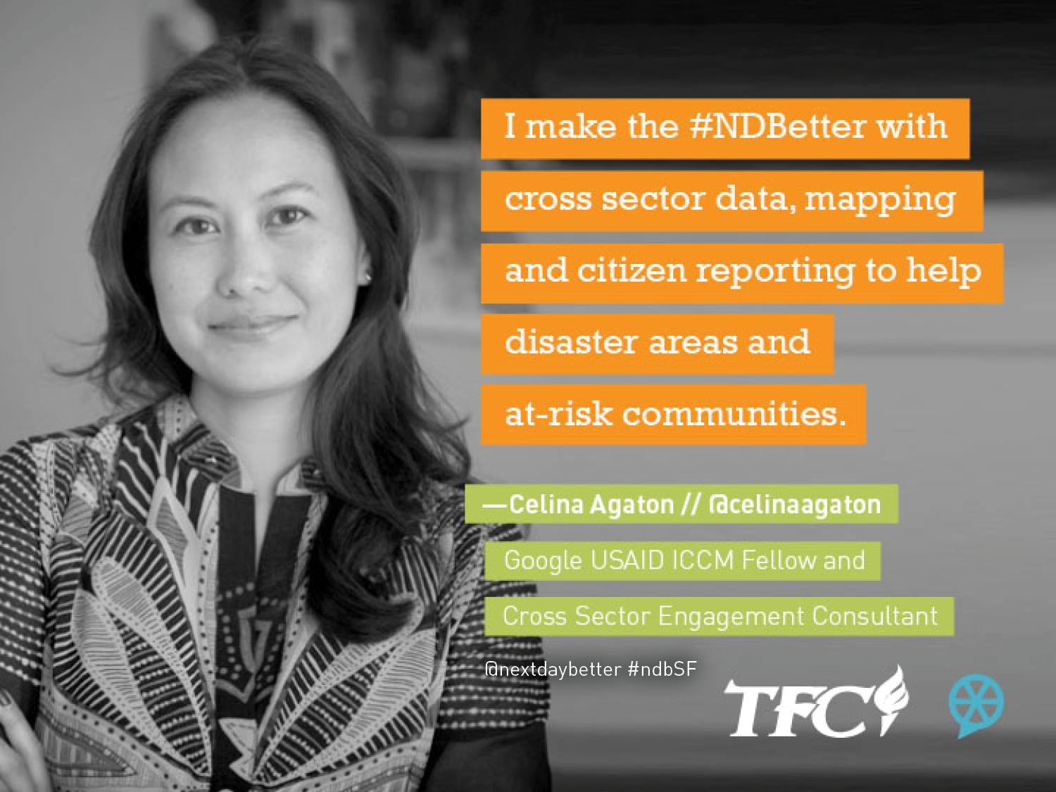
Celina Agaton, Map the Philippines (MapPH)
Maria Tanyag, Pacific Forum Women, Peace and Security Fellow
Moderator:
Sharon Bhagwan-Rolls, Shifting the Power Coalition / GPPAC Pacific
The Pacific Forum is a non-profit, foreign policy research institute based in Honolulu, Hawaii. The Forum’s programs encompass current and emerging political, security, economic and business issues and works to help stimulate cooperative policies in the Indo-Pacific region through analysis and dialogue undertaken with the region’s leaders in the academic, government, and corporate areas.
The Forum collaborates with a network of more than 30 research institutes around the Pacific Rim, drawing on Asian perspectives and disseminating its projects’ findings and recommendations to opinion leaders, governments, and publics throughout the region. We regularly cosponsor conferences with institutes throughout Asia to facilitate nongovernmental institution building as well as to foster cross-fertilization of ideas.
Pacific Forum was listed among the “2020 Best New Think Tanks” in the 2020 Global Go To Think Tank Index Report; having recently returned to it’s former fully-independent status. This is an annual ranking produced by the Lauder Institute at the University of Pennsylvania. The index looks at over 11,000 think tanks around the world.
In addition to ranking in the “2020 Best New Think Tanks” global category, Pacific Forum was listed in the top 100 “2020 Top Think Tanks in the United States.” Even more competitively, the organization was recognized as one of only 17 US think tanks listed in the top 73 “2020 Think Tanks With the Most Significant Impact on Public Policy” in the world.
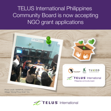
For registered non-profits in the Philippines, we need more grant applicants! The next Telus grant application deadline is June 11. A single organization can receive as much as P500,000 within 1-2 months. Telus funds youth, LGBTQ, Indigenous, health, agriculture, culture, sports, education, environment and technology projects.
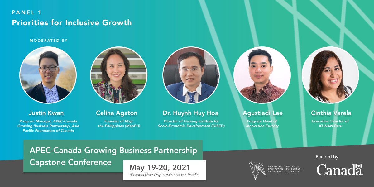
On May 19 I’ll be sharing our women-led mapping and infrastructure work to support micro, small and medium-sized enterprises (MSMEs) in the Philippines and Indonesia at the APEC – Asia-Pacific Economic Cooperation-Canada Growing Business Partnership. With majority of MSMEs led by women, economic and social investments should start and end with women. Join the Facebook Livestream at https://fb.me/e/L0c56n2v or register at https://bit.ly/3o1K015
Watch the Facebook Livestream : https://fb.watch/5FGmQgfLyE/
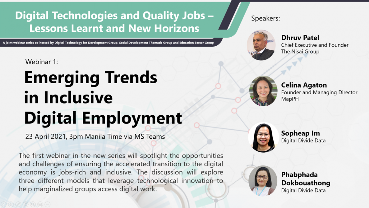
On Friday, April 23, 3pm Manila time, I will discuss our women-led open knowledge stewardship program using free and open source data collection, mapping and analytics tools and pioneering technologies. Effective humanitarian and development action should be led by the women who are at the center of the social and economic prosperity of their communities. Mapping and data science jobs also provide meaningful and productive work with fair wages, while working safely from home.
This the first Asian Development Bank webinar in a new series that will spotlight the opportunities and challenges of ensuring the accelerated transition to the digital economy is jobs-rich and inclusive. The discussion will explore three different models that leverage technological innovation to help marginalized groups access digital work.
Objectives
The webinar will:
Share findings from the experience of leading innovative digital skills and employment organizations in the region
Highlight opportunities and challenges to scale what works to support inclusive and sustainable recovery from the COVID-19 pandemic
Identify how governments and the private sector can work together, including opportunities for ADB engagement
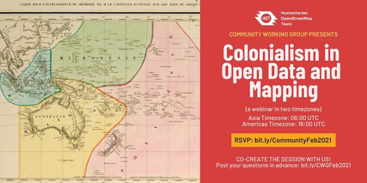
There is 06:00 UTC session and a 16:00 UTC session. Select the ticket for the session you want to attend. Both are 1:30 long.
About this Event
“And while maps may be missing from digital platforms and social networks, we are still here.” – David Garcia, 2020
Maps and digital data have played crucial roles in humanitarian aid eg. disaster response. Although it is of best interest to help local communities through generating data and features on the map, humanitarian actors and mappers should take note that we are not only mapping features (houses, roads, waterways, etc), but also mapping the land, oceans, and communities who live and are stewards of that space. With this webinar, we want to examine and discuss this balance (community digital information), decolonizing open data and open mapping, and representation and power in humanitarian mapping, among others.
There are two sessions so that people in every time zone can attend. You are welcome to attend either or both of them. You must register to attend. You will receive an email a couple of days before the event with a Zoom link to attend.
With the loss of funding to many vulnerable communities, multinational organizations will continue to shape humanitarian and development funding. How can we shift to more local and regional models of cross-sector leadership?
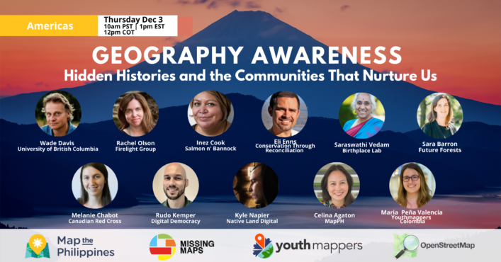
On Thursday, December 3rd 10am PST | 12pm COT | 1pm EST, we celebrate the Americas Geography Awareness Event with an opening keynote by Wade Davis. Wade holds degrees in anthropology and biology and received his Ph.D. in ethnobotany, all from Harvard University. He is an Explorer-in-Residence at the National Geographic Society and is currently Professor of Anthropology and the BC Leadership Chair in Cultures and Ecosystems at Risk at the University of British Columbia. He has authored 22 books, including One River, The Wayfinders and Into the Silence, winner of the 2012 Samuel Johnson prize, the top nonfiction prize in the English language. His work has taken him to East Africa, Borneo, Nepal, Peru, Polynesia, Tibet, Mali, Benin, Togo, New Guinea, Australia, Colombia, Vanuatu, Mongolia and the high Arctic of Nunuvut and Greenland.
Hear the stories of nice people doing good work. Connect with friendly local and regional communities, learn about free training, resources and funding opportunities.This event is free. Talks are 10 minutes each with a Q&A on the Facebook Live stream.
View the Facebook event page https://fb.me/e/1MwlEyx0b December 3rd 10am-1:15pm PST 12pm-3:15pm COT 1pm-4:15pm EST
Meet our speakers! 10:10am PST Celina Agaton
10:25am PST Wade Davis National Geographic Society Explorer-in-Residence | BC Leadership Chair in Cultures and Ecosystems at Risk at the University of British Columbia
10:45am PST Rachel Olson Indigenous Maternal Health & Gender Firelight Group
11am PST Inez Cook Co-Founder and Owner Salmon n’ Bannock
11:15am PST Saraswathi Vedam Birthplace Lab
11:30am PST Sara Barron Future Forests
11:45am PST Melanie Chabot Canadian Red Cross
12:00pm PST Rudo Kemper Digital Democracy
12:15pm PST Kyle Napier Native Land Digital
12:30pm PST Maria Peña Valencia Youthmappers Colombia
1:00pm Eli Enns Indigenous Conservation Conservation Through Reconciliation See Less
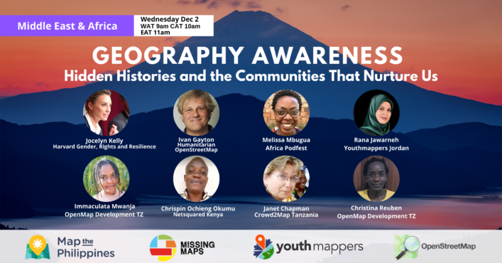
On Wednesday, December 2 Jocelyn Kelly, Director of the Gender, Rights and Resilience Program at Harvard Humanitarian Initiative opens our Middle East & Africa Geography Awareness Event. She designs and implements projects to examine issues relating to gender, peace, and security in fragile states. Her international work has focused on understanding the health needs of vulnerable populations in Eastern and Central Africa and has included working with Uganda Human Rights commission to launch the first office in Africa promoting the Right to Health.
View the Facebook event page at https://bit.ly/2HKoNIi Wednesday, December 2nd 9am-11:15am WAT 10am-12:15pm CAT 11am-1:15pm EAT
Each talk is 15 minutes including a Q&A on Facebook Live. Hear the stories of nice people doing good work, connect with local and regional communities, and learn about free tools, discounts and funding opportunities.
Meet our speakers!
11:10am EAT Celina Agaton MapPH
11:25am EAT Jocelyn Kelly Harvard Humanitarian Initiative Gender, Rights and Resilience
11:40am EAT Ivan Gayton Humanitarian OpenStreetMap
11:55am EAT Melissa Mbugua Africa Podfest | NBO Film Fest
12:15pm EAT Rana Jawarneh Youthmappers Jordan
12:30pm EAT Immaculata Mwanja & Christina Reuben OpenMap Development Tanzania
12:45pm EAT Chrispin Ochieng Okumu Netsquared Kenya | Home Grown Foods and Permaculture
1:00pm EAT Janet Chapman FGM and Development Mapping Crowd2Map Tanzania
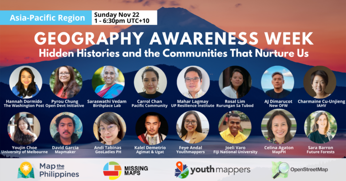
With the loss of funding to many vulnerable communities, multinational organizations will continue to shape humanitarian and development funding. How can we shift to more local and regional models of cross-sector leadership? Join our Asia-Pacific discussions for Geography Awareness Week
This year’s Geography Awareness Week helps bring together regional communities to discuss shared histories in food, work and now, Covid. Hear the stories of nice people doing good work. Connect with friendly local and regional communities, learn about free training, resources and funding opportunities. This event is free. Talks are 10 minutes each, followed by a 10 minute Q&A
Please meet our Asia-Pacific Region speakers!
Celina Agaton Regenerating Supply Chains
MapPHFeye Andal University Mapping Communities and Humanitarian Mapping Youthmappers
Sara Barron Local Voices in Urban Forest Planning Future Forests
Carrol Chan Disaster and Climate Change GIS and Remote Sensing Officer Pacific Community (SPC)
Youjin Choe Interpersonal Conflict in the OpenStreetMap community University of Melbourne
Pyrou Chung Indigenous Data Sovereignty Open Development Initiative, East-West Management Institute, Inc.
Charmaine Cu-Unjieng Free Stress and Trauma Management Programs International Association for Human Values
Kalel Demetrio Culinary History and Innovation Agimat & Alamat Foraging Bar and Restaurant
AJ Dimarucot Sustainable Careers for Remote Work in Creative Industries New OFW (Overseas Foreign Worker)
Hannah Dormido Graphics Reporter and Cartographer The Washington Post
David Garcia Indigenous and Conflict Mapping Mapmaker
Mahar Lagmay Disaster, Climate Change and Covid Mapping Executive Director University of the Philippines Resilience Institute
Adelaida Lim & Maribel Ongpin Rural and Indigenous Artisan Markets Philippine Textile Council
Rosal Lim Women Weavers and Artisan Markets Rurungan Sa Tubod Palawan
Leigh Lunas Drone Mapping GeoLadies PH
Andi Tabinas Mental Health Mapping Mental Health aWHEREness GeoLadies PHilippines
Mikko Tamura LGBTQ Mapping Mapbeks
Joeli Varo Pacific Mapping and Navigation Techniques Fiji National University
Saraswathi Vedam Global Quality Maternal and Newborn Care Hub and Covid-19 Birthplace Lab University of British Columbia
This year’s Geography Awareness Week helps bring together regional communities to discuss shared histories in food, work and now, Covid. Hear the stories of nice people doing good work. Connect with friendly local and regional communities, learn about free training, resources and funding opportunities. Short talks and discussions will run throughout the day across regional time zones. Everyone is welcome. More details to come soon!
Stay updated on events on Facebook https://fb.me/e/1NBreSiPv
This year, two amazing global festivals, Ubud Food Festival and Ubud Writers & Readers Festival come together for Kembali 2020 from October 29 to November 8 to help rebuild Bali’s creative industry and artisan communities. Join me on November 4 as we screen The Fruit Hunters, a story of nature, obsession, commerce and adventure by director Yung Chang. The movie was inspired by The New York Times’ Editor’s choice book by Adam Gollner. Many of you may know Adam’s writing from Vanity Fair, Vice and Lucky Peach. Join Adam and me as we discuss his travels to remote areas to research the rarest fruit, and the state of food and heirloom farming today. Most sessions are online at https://www.ubudwritersfestival.com/kembali-2020-a-rebuild-bali-festival-set-to-reflower-indonesias-creative-industry-and-communities/
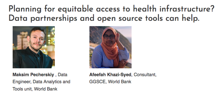
My work in the Philippines was recently referenced in the United Nations World Data Forum Blog by Afeefah Khazi-Syed at the World Bank Global Practice Group for Sustainable Development:
The World Bank’s Development Data Partnership brings international organizations together with private sector companies to facilitate the use of third-party data in research and international development. Using this platform and guidance of experts in the field, our team worked with several open and private data sources to address the challenge of measuring accessibility to health facilities in select regions. Here, we discuss our workflow and demonstrate findings in Indonesia and the Philippines as a proof of concept.
Join the first Asia Pacific series on resilient Geographic Information Systems education on Monday Aug 17th 2am UTC.
Asia – Pacific Panel 1: Pedagogies for Resilient GIScience Education.
Monday August 17, 2020, from 2:00 – 3:30 pm New Zealand / 12 – 1:30 pm Sydney / 10 – 11:30 am Beijing
Click here to watch a recording of this panel discussion and here to read a transcript of the chat discussion.
Panelists:
Yinghui (Cathy) Cao is a Lecturer in Geography at Qingdao University, China. She earned her PhD from the University of Western Australia, and M.A. from Temple University (US). With an experience of teaching and learning GIS related subjects from three countries, she is able to reflect on the distinctions in university culture and programs and their influence on GIS pedagogy. Cathy’s research focuses on the use of geographic information and geovisual techniques for improving public education and communication concerning climate change and disaster risk.
David Garcia (social media: @mapmakerdavid), originally from the Philippines, is a Geospatial Science PhD student at the University of Canterbury, New Zealand. He is a prolific mapmaker with a background as a geographer and urban planner in cities and communities hit by disaster or war. His PhD project is an ethnography of crowdsourcing and GIS by working with the OpenStreetMap community. He is a member of the Ministry of Mapping (social media: @mappingministry), a geospatial collective that cares about equity, diversity, and regeneration in Asia and the Pacific.
Celina Agaton (Twitter: @CelinaAgaton) helps revitalize local economies around the world through heritage preservation, food security, gender, sustainable tourism, open data and free and open source geospatial technologies. Her programs coordinate efforts across community sectors and funders. She loves creating vibrant, accessible and sustainable creative spaces that connect people to the things they care about in their communities. Her projects take her around the world, working with CEOs, farmers, government leaders, doctors, artists and students. She consulted as the community engagement director and strategist for innovation thought leader, Don Tapscott’s initiatives including Open Cities and Global Solution Networks at the Martin Prosperity Institute, and was a contributor to social innovation bestseller, Macrowikinomics: New Solutions for a Connected Planet.
Martin Tomko (Twitter: @dinomirMT) is a spatial information scientist specialising in computational approaches to spatial communication problems (i.e., the communication in and about our spatial environment with a primary focus on cities. Beyond that, he has a keen interest in spatial databases, and in cultural heritage documentation. He is currently Senior Lecturer at the Department of Infrastructure Engineering and part of the Geomatics Discipline team at The University of Melbourne, Australia. Martin is also a founding member and member of the board of directors of OSGeo Oceania.
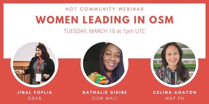
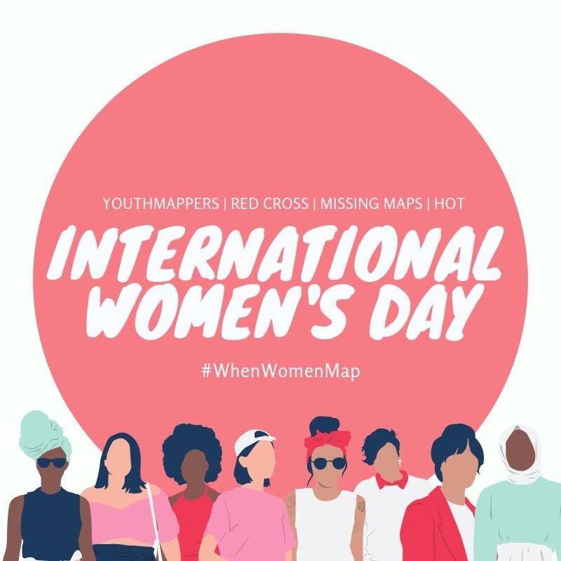
OpenStreetMap’s free mapping tools and open data are critical for development that reflects the central role of women in achieving community prosperity. Learn more at our free International Women’s Day webinar on March 10 (1pm UTC, 9pm PHT, 8am EST) Register at http://bit.ly/IWDHOSM#IWD2020
This year, Humanitarian OpenStreetMap invited me and my colleagues, Nathalie Sidibe of OpenStreetMap Mali and Jinal Foflia of Grab Asia to discuss the importance of mapping and open data to women during a webinar for International Women’s Day.
I’m excited to connect with more female leaders and mapping groups and to learn about exciting projects to strengthen our communities. Follow female mapping news with the #WhenWomenMap hashtag.
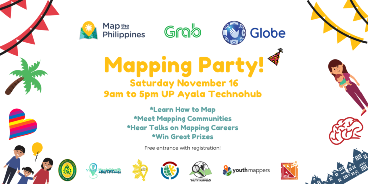
Para sa pagmamahal sa bayan! For the love of country! We’re celebrating Geography Week around the world with a free mapping party on Saturday, November 16 from 9am to 5pm at UP Ayala Technohub. Everyone is welcome, families with children aged 10 years old and up!
My Canadian consulting company is currently mapping the Mindanao region to support rural farming, gender, healthcare and artisan communities. The Mindanao region grows almost half the country’s food, yet remains the poorest population, with many communities at 30-70% poverty incidence. War and conflict have increased in the region in recent years, with security and safety concerns for girls and women. Our goal is to help map rural agriculture, logistics and the gender gap to plan improved infrastructure with long-term impacts on health, well-being and livelihood for girls, women, Indigenous Peoples and farm families.
This is a coordinated effort across international agencies, government, business, non-profits, academe and community leaders. Our study results will lead the prioritization and coordinated planning between international funding agencies and private investment in the second phase of this initiative.
We’ll be working with communities to teach them to map and using geospatial technologies to rapidly analyze infrastructure gaps for validation with local communities.
Para sa pagmamahal sa bayan! Alang sa paghigugma sa atong nasud! Thanks to your amazing efforts, in two days we were able to complete 120,500 map changes! Keep up the good work, we can do this!
Many thanks to Youthmappers in Bangladesh, Washington and France for joining us remotely!
* Learn how to map with OpenStreetMap, the Wikipedia model of maps * Meet mappers from the public and private sector
* Join the international humanitarian mapping community
* Won prizes of free mobile data for a month and enjoyed free pizza
Learn about OpenStreetMap at https://youtu.be/suk8uRpIBQw and learn more at https://learnosm.org/
Learn how to use iD Editor to edit maps https://learnosm.org/en/beginner/id-editor/
Learn how to be a humanitarian mapping volunteer with Humanitarian OpenStreetMap https://youtu.be/8wdzGKmZu-k
Learn how to help with humanitarian mapping tasks https://learnosm.org/en/coordination/tasking-manager3/
Learn about the World Bank DRIVER Road Safety Platform https://www.roadsafety.gov.ph
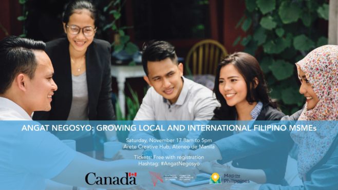
I recently curated Angat Negosyo: Growing Local and International Filipino MSMEs, a workshop to help micro-, small-, and medium-sized enterprises navigate the local and export market journey. In partnership with the Asia Pacific Foundation of Canada, this event was funded by Global Affairs Canada in collaboration with the APEC Secretariat. The APEC-Canada Growing Business Partnership works to build the potential of micro-, small-, and medium-sized enterprises (MSMEs) in APEC developing economies to foster sustainable growth and poverty reduction in the region – with a focus on Vietnam, Indonesia, the Philippines and Peru.
Participants had the opportunity to hear speakers share their journey and work hands-on with local and Canadian leaders in design, production, taxation, logistics and finance.
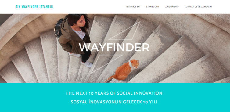
I’ve been invited again to join the 2018 Wayfinder meeting in Istanbul this year. The Wayfinder is organized by Social Innovation Exchange (SIX), the world’s primary network focusing on social innovation. I will join a select group of 150 innovators, experts, and entrepreneurs from around the world and across Turkey, who have played, and will continue to play, a critical role in building the social innovation field. I’m excited to share our work on cross sector mapping within the framework of the Sustainable Development Goals, and our resilient supply chains and livelihood programs.
The first Wayfinder in 2017 was hosted in London and brought together 150 social innovation leaders from across the world to celebrate 10 years of social innovation practice, and to explore our visions for the future of social innovation.
I’m excited to visit Turkey for the first time, and hopefully get to know more about my Turkish roots.
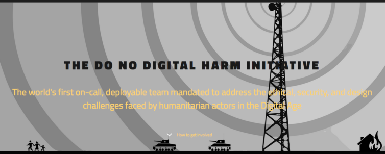
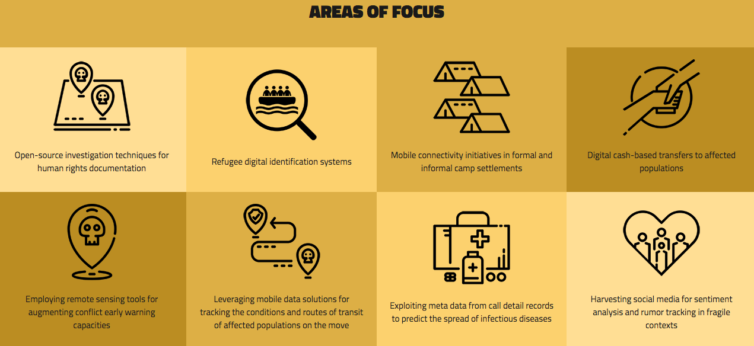
I’ve just joined the board for the Do No Digital Harm Initiative, the world’s first on-call, deployable team mandated to address the ethical, security, and design challenges faced by humanitarian actors supporting highly vulnerable civil society groups, crisis-affected populations and the humanitarian practitioners who serve them. Our mandate is to reduce harm resulting from information activities and digital services deployed in natural disaster and protracted conflict environments.
Today is United Nations World Food Day and Indigenous Peoples Month. In the Philippines, most of our communities do not have access to safe, affordable and nearby nutrition, making food security our number one priority. This year’s theme is Change the Future of Migration: Invest in Food Security and Rural Development.
This week, from Friday, October 20 to Sunday, October 22 the 7th Likhang Habi Market Fair takes place at Glorietta until 10pm. Please come and support food, fashion and household products made by artisan weaving communities from across the country. The road to resilient communities begins with liveable wages. Please help support our local economies. #habifair2017#MapPH
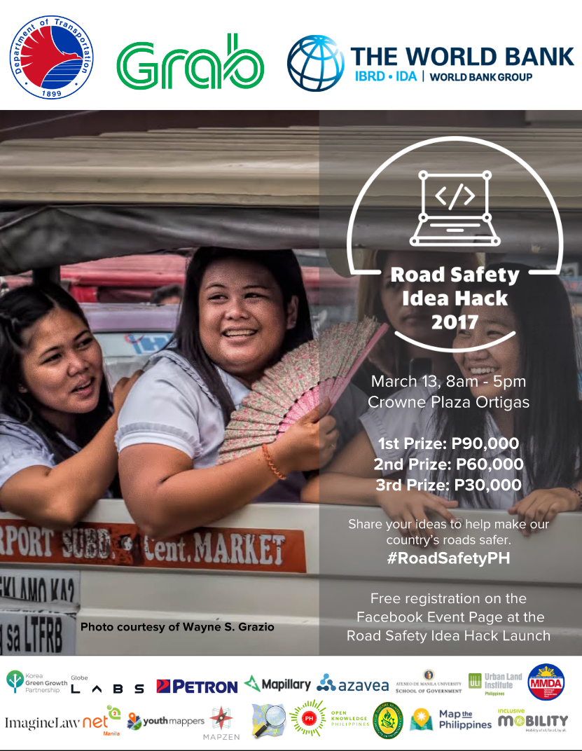
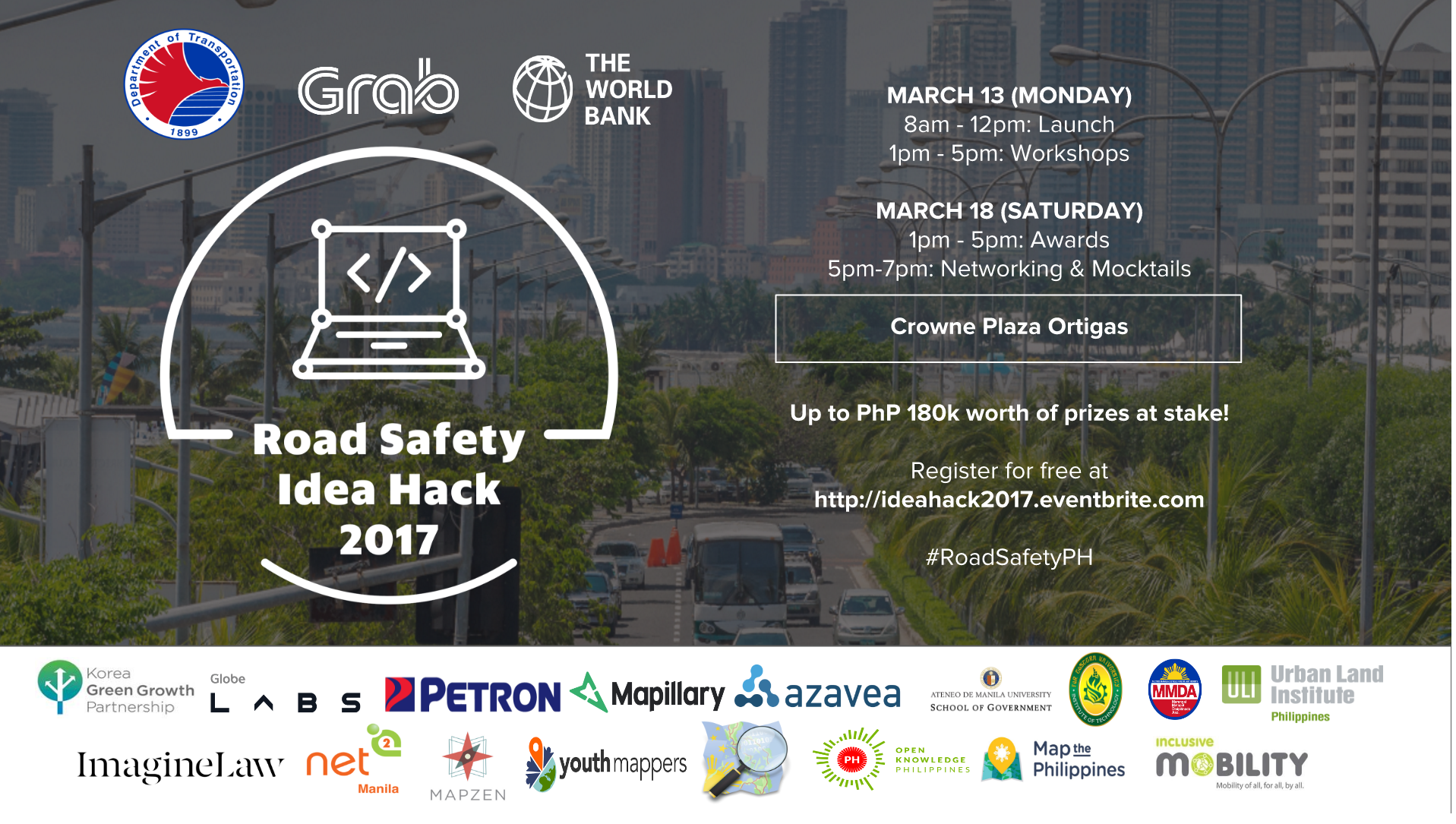
Let’s help each other to make our roads safer! Together with the Department of Transportation, World Bank and Grab, join the Road Safety Idea Hack 2017 Launch this Monday, March 13th from 8am to 5pm at Crowne Plaza Manila. Cash prizes: 1st Prize P90,000, 2nd Prize P60,000 and 3rd Prize P30,000. Come join us for the kick off talks and contest mechanics in the morning, lunch, then workshops in the afternoon where you’ll learn about how you, community groups, open data, mapping and government can work together to make our roads safer. Free registration at http://ideahack2017.eventbrite.com/#roadsafetyPH
*Update* The photos are up! Come see them on Facebook.
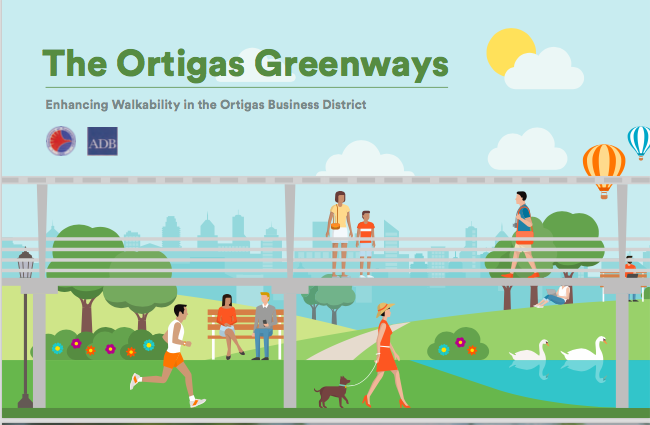
It’s time for another Jane’s Walk! On May 13 from 8:30 to noon we’ll explore the dynamic Ortigas neighborhood, learn about the exciting new Ortigas Greenways parks, bike hub and walkways, and finish off with homemade halo-halo at Purple Yam Estancia. Hear amazing stories from Paulo Alcazaren and Amy Besa. Children and leashed pets are welcome! #Janeswalk#mapPH
Highlights include learning about the upcoming Ortigas Greenways Project, where new elevated walkways, three parks and a bike hub connect from the Ortigas MRT to Robinsons Galleria and Meralco Avenue. The Ortigas Greenways is a partnership with the Department of Transportation and Asian Development Bank to enhance walkability and recreation in the Ortigas business district.
Meet at 8:30am at the main gates of Saint Pedro Poveda College on Poveda Street. Tour ends at noon at Purple Yam Estancia at Capitol Commons where homemade halo-halo will be available for P240. Stay and explore the Katipunan Weekend Market until 10pm.
Tour stops include:
Saint Pedro Poveda College
Asian Development Bank – ADB
Ortigas Greenways
Lopez Museum and Library
Purple Yam Estancia
This Jane’s Walk is led by
Architect and heritage advocate Paulo Alcazaren
Purple Yam restaurant co-owner and culinary heritage advocate Amy Besa
ADB Senior Transport Specialist Lloyd Wright MapPH.com founder Celina Agaton
Dress for summer walking and bring water, sunscreen, hats and umbrellas! Children and leashed pets are welcome.
What is a Jane’s Walk?
Jane Jacobs believed in walkable neighbourhoods and cities planned for and by people. Her principles continue to guide urban planning principles today. We started Jane’s Walk in 2006 to honour her life and ideas. More than 200 cities around the world host walks every year. Learn more at http://janeswalk.org/information/about/janes-walk/
I’ve been asked to work with World Bank’s Road Safety Hack in partnership with the Department of Transportation and Grab. The launch and orientation starts on March 13th at 8am, with participants learning about the role of open data, health, road safety and community groups in addressing the Philippines issues with road safety. Attendees are invited to participate in creating solutions to road safety with P180,000 in prizes.
For more details, visit http://ideahack2017.eventbrite.com
London calling! Thrilled to be heading to SIX – Social Innovation Exchange Wayfinder: Mapping the Way Forward For The Next Decade of Social Innovation. I’ll be sharing our Map the Philippines story and delivering a talk on the future of development session with 160 leaders from 34 countries.
To make the conference more accessible, tickets for Philippines’ based attendees are P2,500 including 3 days of conference + 2 field visits!
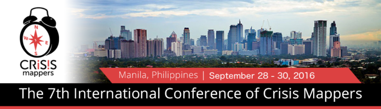
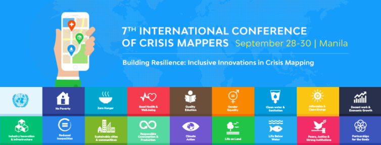
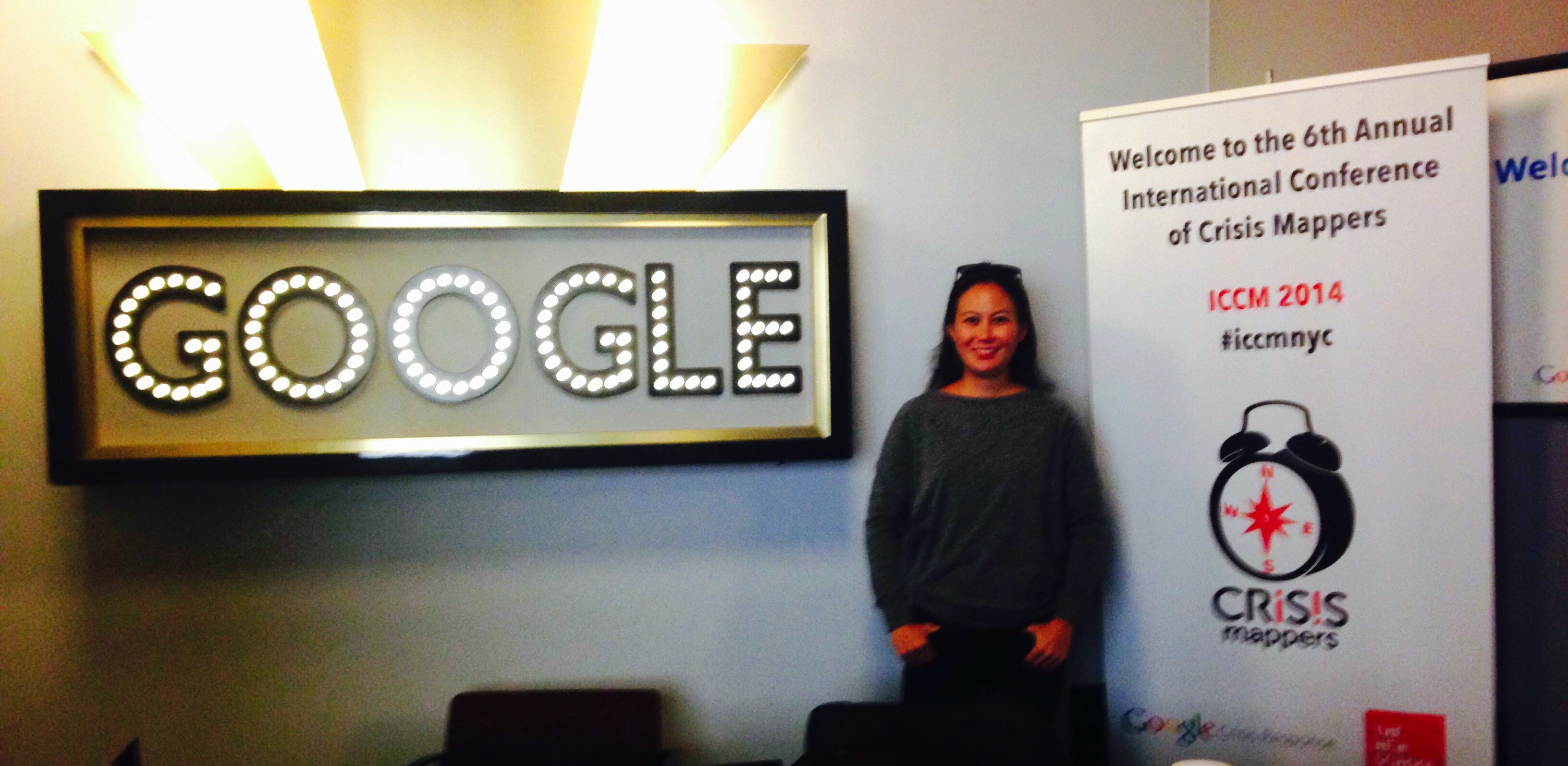
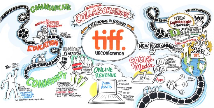
Organized by the International Network of Crisis Mappers, The International Conference of Crisis Mappers (ICCM) is the leading humanitarian technology event of the year, bringing together the most important humanitarian, human rights, development and media organizations with the world’s best technology companies, software developers and academics. Everyone from every sector is welcome to attend the conference.
2016 marks the first year ICCM is being held in the Southeast Asian region, so please help us showcase the Philippines and make the conference a success! This year’s theme, in partnership with Map the Philippines is Building Resilience: Inclusive Innovations in Crisis Mapping, is focused on the United Nations Sustainable Development Goals and will highlight how local citizens, business, NGOs, schools, government and technical communities can work better together with more accessible tools to strengthen the resilience of our communities.
Last year I was grateful to be invited to the First White House Mapathon and was able to thank the U.S. State Department for sharing satellite imagery and mapping support for Super Typhoon Haiyan. I’m thrilled to have been invited back to the White House for their Second White House Mapathon under the Obama Administration on July 7, 2016. #WHMapathon
The Philippines is the third most disaster prone country in the world, and the number one most at risk from climate change. With Map the Philippines readying for launch in the coming weeks, we aim to map the Philippines’ 81 provinces by December 2017 for better transparency, prioritization, coordination and monitoring of public and private infrastructure needs and projects. Beyond disaster management, our mapping, training and programs focus on building community resilience to help achieve the United Nations 17 Sustainable Goals.
The Office of Science and Technology Policy invites you to the Second White House Mapathon to celebrate and actively do Open Mapping on Thursday, July 7, 2016 from 1:00 PM to 4:00 PM.
Open Mapping, or collaborative mapping, is where participants use a wiki-like approach to contribute to maps of the world. Open, accessible data -— including geospatial data — has been a key component of the Administration’s Open Data initiatives. During this event, we will highlight exciting initiatives that collect, create and use open geospatial data and participate in mapping projects to further those initiatives.
Increasingly, tools like citizen science and crowdsourcing are opening up the ability for the public to contribute to government datasets, and for government to support the creation of open data. Agencies including the Department of State, the Department of Interior, the U.S. Agency for International Development, the Peace Corps, the U.S. Geological Survey, and the General Services Administration are working on crowdsourced mapping projects.
Crowdsourced mapping projects and participants are part of a growing innovation movement, transforming the relationship between the government and the public, and supported by United States commitments in the Second and Third Open Government National Action Plans. The White House Mapathon will highlight the successes and invite participants to contribute to the rising efforts in Open Mapping.
I’m thrilled to be co-organizing the 7th International Conference of Crisis Mappers in Manila on September 28-30, 2016. The week of October 1st sends our participants to field sites across the Philippines to connect with local communities and collaborate on mapping tasks.
This year’s theme is Building Resiliency: Inclusive Innovations in Crisis Mapping. The Philippines is the third most disaster prone country in the world and the most at risk from climate change. Its geography is spread over 7,000 islands, which are home to 12 ethnic groups and over 100 tribal groups. In contrast, it is also the fasted growing economy in Asia and our communities are one of the top users of social media in the world. In spite of our many challenges, Filipinos maintain a remarkably resilient and warm culture, even Anthony Bourdain dedicated a show episode to our resounding spirit.
Everyone is welcome to attend the conference, we hope to have a good representation of all the sectors providing their insights and feedback. We hope many Filipinos will participate, and we are offering a 3-day conference rate of P2500 to improve accessibility and will open scholarship opportunities as well.
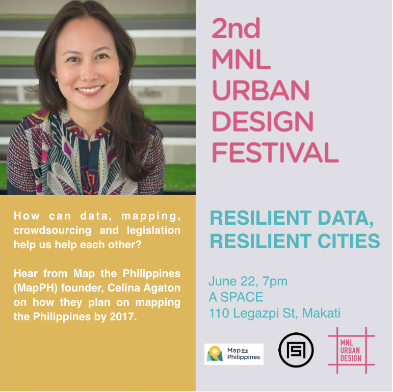
“A Resilient City is one that has developed capacities to help absorb future shocks and stresses to its social, economic, and technical systems and infrastructures so as to still be able to maintain essentially the same functions, structures, systems, and identity.” ResilientCity.org
To become a resilient city, coordinating the efforts of the public and private sectors is essential to the well-being of our communities, and to achieve Sustainable Development Goals. How can data, mapping, crowdsourcing and legislation help us help each other? Hear from Map the Philippines (MapPH) founder, Celina Agaton on how they plan on mapping the Philippines by 2017.
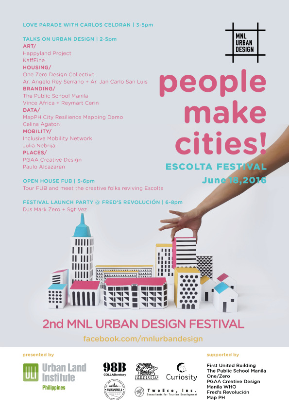
I’m speaking at MNL Urban Design Festival twice this year! The first event is on Saturday June 18th 3:30pm at the MNL Urban Design Festival x Escolta at HUB: Make Lab at First United Building, 413 Escolta Street, Manila. Next I’ll be speaking at A Space on Wednesday, June June 22, stay tuned for details!
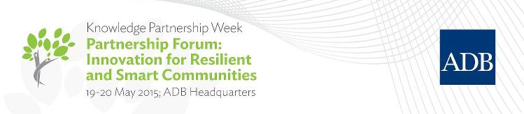
MapPH was invited to present our national OpenStreetMap resilience mapping program during the Improving Mobility, Improving Resilience at the Asian Development Bank’s Innovation for Resilient and Smart Communities event on May 20, 2015.
On May 7, Manila joined 200 cities in celebrating the 10th anniversary of Jane’s Walk and what would have been Jane Jacob’s 100th birthday. Jane’s Walks began in 2006 to commemorate the life of one of the most influential figures in urban planning. Jane Jacobs championed a community-based approach to designing cities, including the seminal concepts of pedestrian-friendly sidewalks, parks, and retail design in building vibrant local economies. She helped derail plans to convert core downtown neighbourhoods into highways in both Toronto and New York. May also marks National Heritage Month, providing opportunities to raise awareness of heritage buildings in need of preservation.
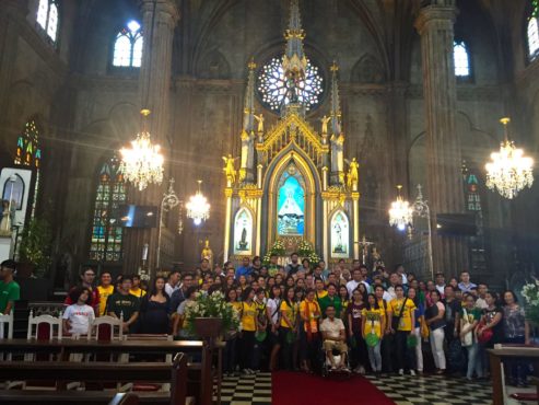
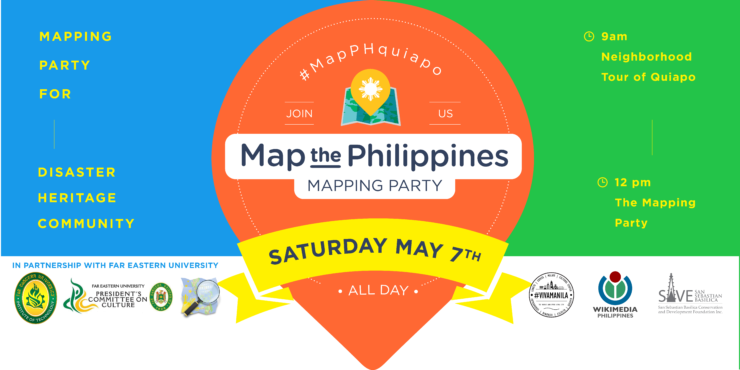
In partnership with Far Eastern University, Map the Philippines hosted a walking tour of historic Quiapo district attended by over a hundred participants. Labelled #mapPHquiapo, the tour included 125 year-old San Sebastian Basilica, led by Conservation Foundation Director, Tina Paterno who detailed the rich history of the country’s only all metal building and whose interior finishes are still original from 1891. The Basilica’s steel and cast iron were forged in Belgium and shipped to Manila in 9 steamships, and then curiously painted to look like stone. Its painters were the country’s leading art school which eventually evolved to become the University of the Philippines Fine Arts. Another original feature is its intricately painted German stained glass by Heinrich Oidtmann, whose work is part of major museum collections around the world.
From the church, Kapitbahayan sa Kalye Bautista’s Peter Rallos and Far Eastern University Guides Fatima Mae Luna and Francis Calderon led participants through historical Hidalgo street lined with 300 year-old homes and Bahay Nakpil-Bautista, home of composer Julio Nakpil and heroes of the 1896 revolution. The tour ended at Far Eastern University’s living art space, recognized by UNESCO for successful heritage preservation. Its five Art Deco buildings were designed by Pablo Antonio, Sr., National Artist for Architecture.
From the walking tour showcasing Quiapo’s past and present, the event transitioned to a mapping party for Quiapo’s future at the modern Far Eastern University Institute of Technology 17th floor hall overlooking the city of Manila. Participants learned the basics of neighborhood mapping on OpenStreetMap, how to report heritage protection needs, and how to share photos on free mapping app, Mapillary. Wikimedia Philippines taught participants how to create and edit Wikipedia pages. Local residents and the local fire hall inspector shared concerns regarding fire safety and the lack of adequate sprinkler and hydrants to protect heritage sites and affected communities, which initiated a separate project to map to identify fire risks in Quiapo.
On May 1, 2016 I was invited by DZMM Radio and Project NOAH Executive Director Prof. Mahar Lagmay’s radio show, Red Alert. Dr. Lagmay was recently names one of Asia’s Top 100 Scientists by Asian Scientist Magazine and received the 2015 Plinius Medal by the European Geosciences Union for his work on hazard research and natural disaster engagement in the Philippines.
In partnership with Far Eastern University, you’re invited to Map the Philippines at our Quiapo Walking Tour and Mapping Party on May 7th! #mapPHquiapo #mapPH
Join one or both events, everyone is welcome and the event is free!
9:00 – 12:00 Quiapo Neighbourhood Walking Tour. Meet at San Sebastian Church steps.
12:00 – 5:00 Mapping Party at the Rooftop of FEU’s Institute of Technology Click on the green Register button above to secure your spot! You’ll receive more details and tips after registration.
During the Walking Tour you’ll hear stories behind the color and character of the Quiapo district, the former downtown of Manila. The Walking Tour is part of the 10th Anniversary of Jane’s Walks taking place in over 150 cities around the world. Learn more about the tour and Jane’s Walk.
Tour stops include:
Quiapo Market for truly Filipino crafts and their popular lumpia, hopia, noodles and curry stalls.
San Sebastian Basilica, the only all steel church in Asia, built in Belgium in the late 1880s, fitted with German stained glass and painted beautifully by the arts school which evolved to become UP Fine Arts.
Far Eastern University is a living art space, recognized by UNESCO for successful heritage preservation. Its five Art Deco buildings were designed by Pablo Antonio, Sr., National Artist for Architecture.
At the Mapping Party you’ll learn the basics of neighborhood mapping on OpenStreetMap, the Wikipedia of maps.
Share your photos on Mapillary to help highlight Quiapo heritage preservation and community needs.
Help update maps and create Wikipedia entries for the historical places and spaces of Quiapo.
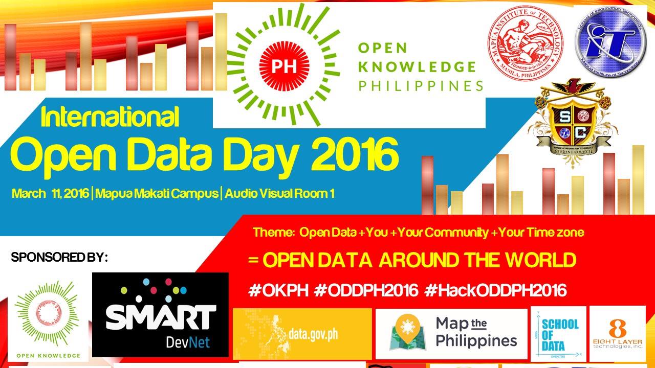
Come join me for Open Data Day Philippines at Mapua Institute of Technology Makati Campus on March 11th from 9am to 5pm. I’ll be speaking about Map the Philippines at 11:30am.
Open Data Day is a gathering of citizens in cities around the world to write applications, liberate data, create visualizations and publish analyses using open public data to show support for and encourage the adoption of open data policies by the world’s local, regional and national governments.
Thrilled to be working on disaster resilient and sustainable livelihood and mapping programs with women, farmers, fishermen and rural poor communities in Davao, Mindanao. With support from the Gerry Roxas Foundation and USAID, we announced the first batches of grantees and launched the Tuason Development Foundation TDFI Campus for micro to medium enterprise.
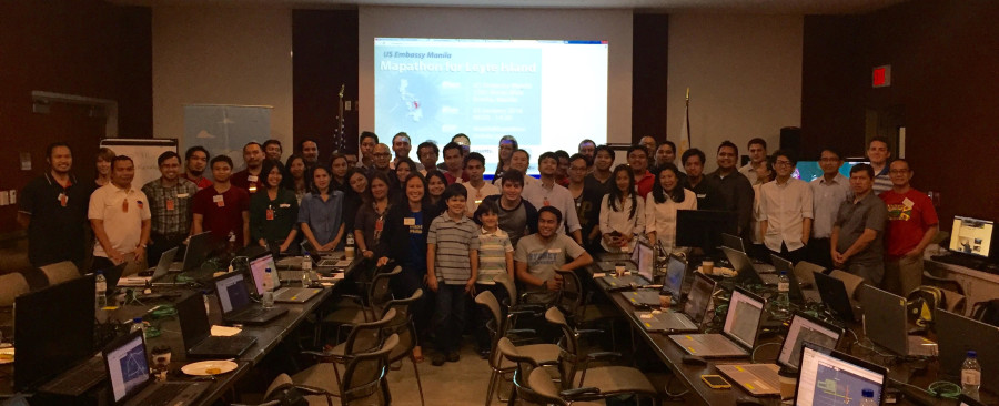
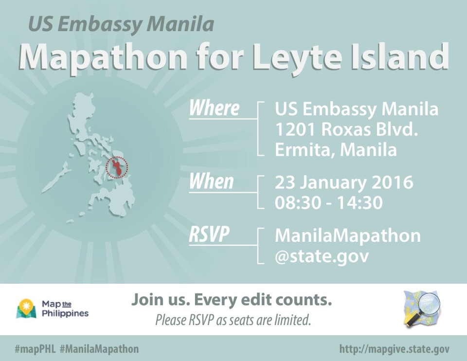
Over 50 participants completed over 28,000 edits at the U.S. Embassy’s Leyte Mapathon on January 23, in partnership with Map the Philippines and OpenStreetMap Philippines. The U.S. State Department’s MapGive program generously provided satellite imagery to improve maps for the Red Cross Typhoon Haiyan Recovery Program in Leyte. They are currently working in 23 barangays or villages on integrated recovery programs including house construction, house repair, community infrastructure, disaster risk reduction, livelihoods and water and sanitation.
Members from Philippine, American, Swiss and French Red Cross teams in Tacloban participated in the mapping workshop. American Red Cross’ Country Representative, Margaret Stansberry and Monitoring and Evaluation Delegate, Will McFall, spoke about how the Leyte mapathon helps create better maps and data for various stakeholders. Many thanks to Erwin, Rally, Eugene and Ervin from OSM-PH for their support.
The Leyte task is 67% complete so we still need your help to edit and verify data. We hope you’ll join us!
This slideshow requires JavaScript.
Gallery photos courtesy United States Public Affairs Office.
The U.S. Embassy, in partnership with Map the Philippines and OpenStreetMap Philippinesinvites you to a mapathon to support the American Red Cross’ Typhoon Haiyan Recovery Program in Leyte. They are currently working in 23 barangays or villages on integrated recovery programs including house construction, house repair, community infrastructure, disaster risk reduction, livelihoods and water and sanitation.
If you’re new to mapping and OpenStreetMap, we’ll teach you the basics of mapping cities and disasters. Everyone is welcome! #mapPHL
Important: Please be sure to register here on Eventbrite with your details by noon on Tuesday, January 19 to clear embassy security.
Saturday, January 23
8:30am to 2:30pm
U.S. Embassy Manila
1201 Roxas Boulevard
Ermita, Manila
*Please bring your laptop, and GPS or smartphone to download mapping apps. 15 computers will be available to those who need it, please note this in your registration. Complimentary pizza lunch will be served.
Many thanks to the MapGive project, the Humanitarian Information Unit (HIU) of the U.S. Department of State is providing the OpenStreetMap community access to updated satellite imagery services to help assist with humanitarian mapping.
WHEN
WHERE
Embassy of the United States of America – 1201 Roxas Boulevard Manila, NCR 1000 PH –View Map
We believe maps and community driven mapping projects can help visualize the needs and opportunities in our neighbourhoods. Maps can serve as the connecting point to coordinate and track efforts across government, business, NGOs and community groups. Which is why we support OpenStreetMap, a free and open source mapping platform supported by a community of over 2.3 million mappers that contribute data about roads, hospitals, restaurants, coffee shops and more from around the world. Learn more about becoming a mapping volunteer.
Learn about OpenStreetMap and how mapping helps visualize community needs and opportunities in disaster, livelihood, arts, heritage preservation and food security.
If you’d like to learn how to map, please bring your own laptop, tablet or GPS.
The event is free and everyone is welcome! Introductions will begin from 1:00-2:00pm.
1:00 to 6:00pm
Mozilla Community Space Manila (MozSpaceMNL)
Roof Deck, Molave Building,
2231 Chino Roces Avenue (Pasong Tamo)
Makati City, Philippines 1233
1. Create a network of food community members from farming, education, government, business NGO and community groups.
2. Outline community needs such as farm to market roads, marketplaces, training programs, funding and other funding needs to support our local food economy.
3. Visualize the network and needs on a map to identify funding opportunities and areas for collaboration across government, business and NGO sectors.
Light snacks will be served, please feel free to bring a platter and showcase your local food products at our community table.
Our goal is to help create more sustainable infrastructure and to provide a space for better cross sector collaboration, transparency and accountability for our communities. Our free online platform launches in early 2016 and provides opportunities for citizens and organizations to share their programs, services, and best practices, and to identify funding needs and connect with other stakeholders.
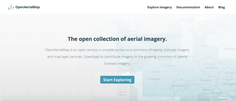
OpenAerialMap is an open service to provide access to a commons of openly licensed imagery and map layer services from around the world. Rather than spending time and resources on expensive imagery, you can search teh repository and download or contribute imagery to the growing commons of openly licensed, non-commercial imagery. This helps governments, NGOs, business and academe access expensive imagery and helps reduce duplicate efforts on high resolution map imagery.
Under the World Bank OpenRoads project, my company and partners were the first to share our Philippine imagery on OpenAerialMap.
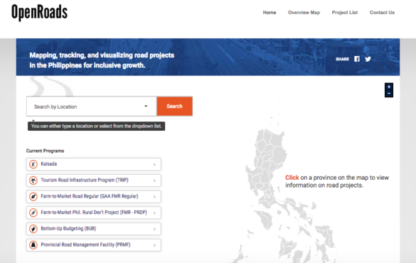
The World Bank’s Open Roads program requested my consulting company to lead mapping training with local government units, business, NGOs, academe and citizens in partnership with the Philippine Department of Budget and Management’s initiative to fast track much need road infrastructure in the country. By using OpenStreetMap’s free online mapping tools, this would enable the national government to more effectively plan and disburse funding for local, regional and national road networks. Road construction is one of the largest sources of corruption in the country, and by using participatory budgeting and open data, communities can request and track the status of roads in their communities.
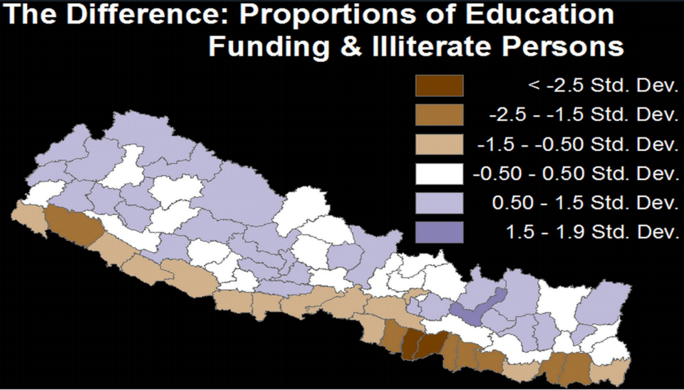
I’ve had the pleasure of hosting five USAID AidData Fellows from June to August 2015 here in Manila to work on several of my Map the Philippines initiatives. This is the first time fellows have been hosted in the Philippines, and we hope to host more fellows in the future. The AidData program helps improve the planning, tracking and delivery of aid of by using maps to visualize where aid has been delivered to a nation. In many cases, aid reporting data tracks the announcement of aid being promised to a nation but doesn’t track the flow down to the region, province, municipality, barangay or village. The process of creating these maps starts with geocoding, where a program or service is assigned a geographic location so that it can be placed on a map. Plotting these locations helps create maps that visualize patterns in the delivery of aid against poverty, disaster risk, hunger and other measures that can help fine tune programming and identify whether there are gaps and overlaps in the flow of aid within and organization, and across sectors. Government, NGOs, Business and citizens provide many programs and services to help communities, but often work independently, and in silos, so mapping can provide opportunities for better coordination, collaboration and monitoring of aid.
Literacy funding (purple areas) mapped against illiteracy levels – brown to dark brown indicating high illiteracy levels.
So far the Fellows have joined me on several community engagements across Manila and Leyte, meeting mayors, students and other community leaders, faced challenges with contacting multiple government agencies for access to data and traveled hours to remote areas with limited road infrastructure for first hand experience on the importance of mapping and open data policies for better planning and accountability across public and private sectors. They’ll compile a summary of their work here by August, stay tuned here for the final report.
The fellows are here until August 12th, and are available to provide a complimentary 1-3 hour presentation or half day geocoding workshop to your organization. Here’s more background on their presentation.
On July 13, I was invited to speak about Map the Philippines and how our mapping initiatives and training programs can create data driven stories on a range of topics including disasters, education, bottom-up budgeting, civil works, business, energy, and elections.
They showcased the results of their work at the November 27 showcase in Manila, where over 100 journalists and civil servants gathered to hear the twelve participating media teams present their work. The Guardian’s Caelainn Barr, Undersecretary Richard Moya (Open Data Task Force Philippines), Kenneth Abante (Department of Finance) and Rogier Van Den Brink (World Bank) were among the keynote speakers.
The Making All Voices Count team will be in Manila for the #Tech4Resilience Pitching Competition on July 8 at Far Eastern University’s Institute of Technology. If you have a disaster or community resilient program or technology, apply to join the Innovation Showcase and meet the Making All Voices Count team. Full details are below. Apply now >>
Initiatives on Disaster Resilience and Response in the Philippines
Doing some interesting work on disaster resilience and response in the Philippines? APPLY today to share your initiatives at the Innovation Showcase on July 8th 2015 at the Far Eastern University and come meet the Making All Voices Count team!
Making All Voices Count is a 12 country programme with the goals of promoting transparency, fighting corruption, empowering marginalized citizens, and harnessing the power of new technologies to make government more effective and accountable.
One of our main program themes for the Philippines is supporting initiatives that use technology and innovation to strengthen disaster resilience and response and engage government in doing so. We would like to get to know you and your work!
Only 20 showcase spots available so please apply ASAP through this form https://goo.gl/S2jRdB today!
I’m partnered with Making All Voices Count on this Philippines #Tech4Resilience Challenge. Anyone can apply! Finalists will be presenting their pitches at my Map the Philippines event June 24, please save the date.
The deadline is on June 17. Good luck!
Making All Voices Count is calling for innovative projects and creative tech solutions that can be implemented in the Philippines under the themes below. The ideas should aim at addressing Making All Voices Count’s overarching goal; transparency, accountability and better governance. Any entity from the Philippines is welcome to apply: companies, government actors, non-profits, for-profits, education establishments, NGOs or individuals.
Themes
New projects that seek to incorporate both ‘offline’ efforts with use of ‘online’/ICT tools are strongly encouraged. The two themes for which you can submit your project idea are listed below. Ideas should seek to address two or more of the guiding points under each theme:
1. Within the theme ‘Strengthening community resiliency and response to disasters’ we seek projects that:
– Use of technology and innovation to strengthen disaster preparedness and response;
– Improve governance at local level for resilience and/or responses to natural disasters;
– Uses technology and innovation to support local communities with strengthening disaster resilience and response;
– Inclusive infrastructure and social program planning and development at community level;
– Make effective use of technology to ‘make all voices count’ through active engagement of women and marginalized groups or communities.
2. Within the theme ‘Improved planning and budgeting for disaster resiliency and response’ we seek projects that:
– Utilizes open-data to facilitate dialogue for change between actors;
– Better integration of planning and/or budgeting across 3 levels of government using technology and innovation;
– Follow the money on resilience/response efforts;
– Improve government coordination that mitigates against humanitarian crisis using technology and innovation;
– Make effective use of technology to ‘make all voices count’ through active engagement of women and marginalized groups or communities in disaster planning and budgeting.
Process and Awards
– Up to 10 finalists will be selected to attend Map the Philippines Unconference – 23-24 June 2015, where they will pitch their idea to a panel of judges;
– 1 – 3 winners of the competition will get incubation support for their ideas from Making All Voices Count, with mentoring. Incubation will include preparation for potential innovation grants of up to GBP 40,000 down the line, depending on (i) the development of a proposal strong enough to warrant a grant and (ii) demonstration of their capacity to successfully implement;
– Winners will have access to mentoring support, international networking and related tools and resources through Making All Voices Count’s South to South Lab.
Key Dates
– Applications open on 25 May and close on 17 June 201523:59 GMT; – Finalists announced on 19 June 2015; – Pitching session and announcement of winners on 24 June 2015
I’m thrilled to have been invited to the first White House Mapathon under the Obama administration on June 21, 2015 where they featured mapping projects like the Nepal earthquake and included my resiliency mapping project in the Philippines. The Philippines mention below links to my 2014 International Conference of Crisis Mapping talk.
The White House Office of Digital Strategy and the Office of Science and Technology Policy are pleased to invite you to the first White House Mapathon to celebrate and actively participate in Open Mapping on Thursday, May 21, 2015 from 1:00 PM to 4:00 PM.
Open Mapping, or crowdmapping, is where participants use a wiki-like approach to contribute to maps of the world. Geospatial data has been a key component of the Administration’s Open Data initiatives.
Increasingly, tools like citizen science and crowdsourcing are permitting the public to contribute to government datasets. In some cases, the public is collaborating to create data that never existed before their involvement, such as the OpenStreetMap response to the West Africa Ebola outbreak. Agencies including the Department of State, the Department of Interior, the U.S. Agency for International Development, the Peace Corps, and the General Services Administration are working on crowdmapping projects.
Crowdmapping projects and participants are part of a growing innovation movement, transforming the relationship between the government and the public, and supported by United States commitments in the Second Open Government National Action Plan. The White House Mapathon will highlight these successes and engage participants in contributing to the rising efforts in Open Mapping.
The Mapathon will start with remarks and lightning talks highlighting the impact of open and crowd-sourced mapping projects. Then we will ask you to choose one of the five mapping projects outlined below and get to work mapping!
Mapathon Projects:MapGive: A public diplomacy program that supports the use ofOpenStreetMap in humanitarian response and development. Participants will contribute to three sub-projects, targeting the Nepalearthquake response, public health initiatives in Botswana, and disaster preparedness and development in the Philippines. Power Service Area Mapping: Participants will contribute to a geospatial database under development by the Department of Energy, by researching public outage information so that disaster-impacted residents, tourists, first responders and relief volunteers can easily get to the information they need on scope and estimated restore times for power outages.Every Kid in a Park: The Every Kid in a Park initiative is a multi-agency effort to open our Nation’s lands and waters to all 4th graders for the 2015-2016 school year. This project will coordinate trail and facility mapping activities, further improving facility information within public lands and waters that have educational activities for kids.
Participatory Mapping with the Municipality of Malvar, Batangas
It’s been a while since I’ve done an update to the crisismappers network since my talk post Typhoon Yolanda/Haiyan at the International Conference on Crisis Mapping, but there are lots of good things happening here in the Philippines. The White House Office of Digital Strategy and the Office of Science and Technology Policy invited me to attend the first White House Mapathon on May 21, so I’ll be in DC until May 23 if folks want to meetup.
We’ve begun my cross sector initiative to provide a comprehensive map of the Philippines on OpenStreetMap. I’ve won a grant from Making All Voices Count to develop an open source, open data platform to provide layers of data from hazards and population, to infrastructure, disaster, community and economic reslilience needs. Some of our data partners include UNOCHA, Department of Interior and Local Government, League of Municipalities, WWF and corporate, NGO and citizen networks. One of the core functions of the platform is to identify gaps and overlaps in community needs versus publicly and privately funded programs. We aim to complete the first modules of the platform over the coming weeks to prepare for the upcoming monsoon season and 7.2 earthquake in Manila. We’re targeting high risk poverty, disaster and illegal fishing and poaching areas for disaster resilient farming projects and will be mapping this data on to the platform. This is a critical time in the Philippines with an upcoming national election in May 2016, meaning a government slow down by October 2015. We want to future proof the platform to ensure our partners are networked and running regardless of the future administration and in preparation for disasters.
The U.S. State Department’s MapGive program is generously providing satellite imagery help us map base layers on OpenStreetMap. I’ve requested Bing imagery to be refreshed countrywide to support our preparations. We would also love to be included on Missing Maps soon to help fast track our mapping.
We’re also providing free OpenStreetMap workshops across the country, including 5-day mapping training series pilots with colleges to learn OSM, JOSM and other free and opensource tools. We have a local drone partner who provide 5cm/pixel imagery for infrastructure, disaster preparedness and monitoring and evaluation and helps visualize infrastructure needs for budget proposals. We’re working with USAID AidData Fellows to work on several of our programs as well.
We’ll be piloting a Map the Philippines initiative to connect local and international mappers to local tourist and at risk area mapping activities. This is in preparation for the International Conference on Crisis Mapping which I am co-organizing in late 2016 and hosting in our new 26,000 square foot arts, tech and disaster resiliency centre. After the conference we are inviting mappers to join mapping events across the country.
Week of June 15th we’ll be organizing a free OSM training in Manila to help provide support for climate change and disaster risk mapping for the Philippines to join global Climathons with ClimateKIC on June 18 for COP21. On June 24 we’ll be hosting a Map the Philippines mapping event with OpenStreetMap Philippines and OSM Founder Steve Coast. This is in partnership with Making All Voices Count and includes a pitching competition on disaster resiliency tech with prize amounts of up to GBP20,000 or US$31K following incubation. We’ll be organizing mapathons for Disaster Resilience Reduction Day on October 13 and World Food Day on October 16.
I’ll have other updates on food security and disaster resilient agriculture soon.
Thank you for all your support so far. We’ll need help with feedback and support during these critical months and hope you can join us online and in country. We’ll have more details online soon.
Under the OpenRoads initiative, the World Bank is supporting the government of the Philippines in advancing a set of policies and tools to improve strategic local road infrastructure for inclusive growth. The starting point for financing and implementation of better local road networks is a strategic map.
OpenStreetMap Philippines conducted a 2-day OpenStreetMap workshop, with SkyEye drone mapping, community consultations and the Local Government Units of Tanauan and Malvar, Batangas. A follow up visit and additional mapping events and tools are planned soon.
Update: our drone imagery is available on CC-BY license on the OpenAerial platform.
I was lucky enough to be Jane Jacob’s neighbour in Toronto and am happy to now be helping organize Jane’s Walk in Manila, and hopefully other cities for the now annual Jane’s Walk on May 1-3. It’ s a terrific way to spend the day exploring the city and learning about the rich stories from our neighbourhoods.
Jane’s Walk is a movement of free, citizen-led walking tours inspired by Jane Jacobs. The walks get people to tell stories about their communities, explore their cities, and connect with neighbours.
Stay tuned for more details!
Learn more about Jane’s Walks taking place all over the world >> http://janeswalk.org/
I’m thrilled to have been invited by RightsCon to design and lead a disaster simulation at their 2015 conference in Manila. RightsCon is a premier event on internet freedom and the future of the internet. I’ll be presenting how our tools and programs begin with disaster response but are designed to help build community resiliency year round through an integrated network connecting cross sector stakeholders and citizens with their government – centered largely around mapping, open data and citizen reporting.
Our session will take place on March 25 from 1:30-2:45pm at the Crown Plaza Manila Galleria Hotel. Register here.
Preparing for the Next Haiyan: Utilizing Technology to Transform Disaster Response
From crisis to community, this session explores innovations in disaster response in the Philippines from Typhoon Haiyan and beyond. The panelists, covering sectors as diverse as telecom industry to citizen media, will share their technology-driven approaches to rebuilding communities following Typhoon Haiyan and to addressing community resiliency all-year-round. Cross-sector data mapping, drones to map and verify citizen reports, new sustainable farming practices, anti-poaching, and internet access technologies are some of the innovations being developed in partnership with local communities. These tools help form a sustainable infrastructure to identify and prioritize local community needs and high-risk areas, and to share best practices across the country.
Moderator
1. Celina Agaton
Managing Director
Cross Sector Mapping|Map the Philippines
Panelists
2. Gil Francis G. Arevalo
Communicating with Communities Officer
United Nations Office for the Coordination of Humanitarian Affairs
3. Felino Castro V
Director III, Information and Communications Technology Management Service
Department of Social Welfare and Development, The Philippines
4. Darwin Flores
Vice President
Community Partnerships
Smart Communications
5. Matthew Cua
CEO, Founder
SkyEye UAV
6. Tanya Zaldarriaga
Program Officer for Membership
CodeNGO
7. Julius M. Bangate
Manager, Remote Sensing and GIS Laboratories
University of the Philippines and
OpenStreetMap Philippines
8. Lory Tan
Vice Chair WWF National Advisory Council
9. Aivon Guanco
Humanitarian Accountability Manager
World Vision
10. Neil Barsch
Fulbright Scholar
Hapinoy Social Enterprise
11. Denise Celdran
Citizen Group
Many thanks to the conference sponsors for making this opportunity possible.
Netsquared City Organizers at the N2Y4 Mobile Challenge Conference in 2010.
Back in 2009, I co-organized Netsquared Toronto, the beginnings of a new life working in the tech for good sector and creating global programs and technology tools and events that enhance cross sector civic and community engagement. More than five years later and half way across the world, I’m back in Manila and excited to help launch Netsquared Manila.
Part of what brought me here was Typhoon Haiyan. Having grown up in Jakarta, Manila and Toronto, the need for networked community infrastructure around disasters inspired me to create a cross sector platform to help map the NGO, government, business and citizen group communities. Visualizing the work of organizations by location helps provide better transparency, accountability and collaboration during disasters, but more importantly helps build and strengthen these relationships year round. The platform includes workshops on how to map using OpenStreetMap, field mapping, drone mapping, sustainable livelihood programs and internet access tools to bring connectivity to at risk communities.
For NGOs, we’re mapping the needs of the sector, helping make community needs more visible to funders and to understand where there are gaps and overlaps in support.
In my role as co-organizer along with Jed Adao and Jake Fadallan, we’re getting to know the NGOs in Manila and creating events to help meet the tech needs of the community through our face to face Meetup group.
Coming soon…Netsquared Manila! We’re bringing all kinds of tech tool goodness to support the wonderful NGO community in Manila, and to connect us with over 80 Netsquared cities worldwide. Stay tuned for more updates! Netsquared is the face to face social purpose tech community meetup of Techsoup Global – a program providing free and discounted software and tools to NGOs around the world.
In 2012, the Bogota Chamber of Commerce engaged us to identify key priorities and engagement strategies during a tumultuous time. Their beloved mayor had completed his two term limit, and the current mayor, along with his brother were on their way to jail for corruption charges.
Around the world our cities are in desperate need of rejuvenation and transformation. Elected officials are scrambling to equip their cities for the 21st century, talking about creating “open,” “networked,” and “smart” cities.
The problems are legion. Mexico City is now one of the most dangerous cities in the world. Megacities such as Sao Paulo and Johannesburg are straining to the point of paralysis from population influx, lack of infrastructure, traffic congestion, pollution and crime.
Many cities in the United States grew rapidly after World War II, but now have dysfunctional urban centers. By separating where we live, work and shop, cities have been divided into downtowns that become ghost towns at night, suburbia where the commute is brutal and the mall where a car is required for all shopping. Detroit has lost more than half of its population and large parts of the city have become a wasteland, populated by wild animals. The median house price is under $10,000.
Fortunately the digital revolution provides a powerful new platform for the transformation of the city. In areas ranging form public safety and transportation to more transparent government operations, the Internet is enabling a new kind of 21st century city.
However, everywhere local government, business and civil society leaders are struggling with the challenges of making change happen. There is a lot of excitement but progress is uneven.
Surprisingly it is a city in the emerging economies that may have discovered a key to success — Bogota the capital of the South American Country of Colombia. And it turns out the best way to transform a city for the digital age is to use those same digital tools to engage the population in reinventing their own municipality.
The beleaguered city has been beset by crime and corruption, but recently residents have become optimistic that improvements are possible. On October 31, Bogota residents elected Gustavo Petro as mayor. He replaced the previous mayor, Samuel Moreno, who had been suspended from office in early May 2011 after charges of bid rigging and accepting kickbacks.
During Moreno’s regime, the city’s coffers had been depleted by massive expenditures in a public transit system. Relatively little work had been completed for the large amounts of money spent. In the wake of the corrupt Moreno mayoralty, there was a crisis of government and a political vacuum. Huge changes were required but it was unclear who would take the lead in achieving it.
The Bogota Chamber of Commerce had been a relatively strong and active organization in the city for many years. Under the leadership of a new CEO Consuelo Caldas, the Chamber wanted to take a more active role in the city’s economic and social development.
With a municipal election scheduled for the end of October, the Chamber saw an opportunity to challenge the mayoral candidates with ideas and proposals to fix the city. But rather than doing the back room lobbying that characterizes municipal politics, it took a different approach. It decided to engage the citizens of Bogota in a process to reinvent their city.
I was fortunate to participate in this process as an adviser, and from my perspective it was an extraordinary exercise that is rich with lessons for anyone wanting to help their own city. The goal was to encourage local businesses, community leaders and citizens to become involved in the city’s affairs.The campaign was called “Set the Hearbeat of Bogota” (HACEMOS LATIR A BOGOTÁ — HLB)
Asia Society Philippines, in cooperation with AIM ASEAN 2015 Project, are hosting Part 3 of their Understanding ASEAN series on Disaster Management on Tuesday, January 13, 4-6PM at the Asian Institute of Management.
ASEAN countries are one of the most vulnerable to the growing impacts of climate change, such as storms, typhoons, and coastal flooding. Super-typhoon Yolanda in the Philippines last November reinforces the urgent need for countries to identify new approaches and ways forward for disaster risk reduction.
On January 13, panelists will discuss the prospects for better climate resiliency and disaster prepararedness for the Philippines in the context of the ASEAN integration.
Speakers:
Undersecretary Alexander P. Pama
Executive Director
National Disaster Risk Reduction and Management Council Office of Civil Defense
Dr. Marqueza Reyes
Technical Advisor, Disaster Risk Reduction
Association of South East Asian Nations (ASEAN)
Ms. Celina Agaton
2013 Google USAID Fellow
International Conference of Crisis Mappers
Mr. Zak Yuson
Director
MovePH Rappler
Mr. Takaaki Kusakabe
Research Coordinator for Earthquake Disaster Prevention
Research Center for Disaster Management,
National Institute for Land and Infrastructure Management
Japan International Cooperation Agency
My talk begins at 29:49 after Nigel Snoad’s introduction.
In November I was a speaker at the 2014 International Conference of Crisis Mappers in New York. It was almost a year after Typhoon Haiyan hit the Philippines, where at the time I was en route to the 2013 conference in Nairobi. So much has happened in the last year, I’ve learned a lot and met some amazing and supportive folks.
The International Network of Crisis Mappers (Crisis Mappers Net) is the largest and most active international community of experts, practitioners, policymakers, technologists, researchers, journalists, scholars, hackers and skilled volunteers engaged at the intersection of humanitarian crises, new technology, crowd-sourcing, and crisis mapping. The Crisis Mappers Network was launched at the first International Conference on Crisis Mapping (ICCM) in 2009. As the world’s premier humanitarian technology forum, we engage 7,400+ members in over 160 countries, who are affiliated with over 3,000 different institutions, including more than 400 universities, 50 United Nations agencies & projects, first responders operating in both the civilian and military space, dozens of leading technology companies, several volunteer & technical community networks and global, national, and local humanitarian and disaster response and recovery organizations.
The UN has activated Micromappers to help tag tweets for Typhoon Ruby. In just one click, you can help classify tweets about typhoon damage, provided humanitarian aid, and requests for help. Micromappers helps the UN and other humanitarian aid groups assess typhoon damage and prioritize help more quickly.
Inspired by the Wikipedia model, OpenStreetMap was created by Steve Coast in the UK in 2004. 10 years, and 1.7 million users later, OpenStreetMap continues to grow and thrive helping citizens navigate neighbourhoods all over the world.
Our speakers included:
Blenn Huelgas from World Food Program Philippines
Sara Terp from Ushahidi
Edgar Illaga from SkyEye drones
Eugene Villar from OpenStreetMap Philippines
Thanks to our friends and partners from World Bank, USAID, British Council, Ateneo Sustainability Institute for attending the event!
Our goal is to map the Philippines for disaster response, community resiliency and better transparency. In partnership with OpenStreetMap Philippines, SkyEye Drones, Humanitarian OpenStreetMap, and the U.S. State Department’s MapGive program, we’re hosting free OpenStreetMap training workshops in cities across the Philippines. We’re also bringing innovative and accessible internet access solutions and communications tools to the communities we partner with. We’ll have more exciting updates soon, please stay tuned.
Here’s a terrific video showcasing 10 years of edits on OpenStreetMap. Thank you mappers!
Micromappers is a great initiative where citizens can help classify disaster damage with just two clicks on your computer. With the deluge of data, social media posts, images and video that arise during natural disasters, humanitarian organizations, governments and business need your help to more quickly assess damaged infrastructure like flooded roadways, unsafe school buildings, and fallen cell phone towers.
Micromappers
For farmers, tracking the damage to destroyed fish pens, farm land and market roads can be time consuming and labour intensive.
So if you have a minute or two and are willing to a lend a helping hand, Micromappers could be a fun and simple way to get involved. Until 9pm Manila time, 8am EST Saturday, December 6, we’re helping launch the global Micromappers Coconut Expedition to help tag damage to coconut tree farms from Philippine Typhoon Glenda using images captured by our drone partners, Skyeye.
It’s a great experience and and teaching tool for kids and families, so I hope you’ll join us!
OpenStreetMap is a collaborative project to create a free editable map of the world. It is supported and updated by 1.7 million registered users worldwide. During the Typhoon Yolanda response, as in other disasters, OpenStreetMap was widely used by the local and international aid community for its accuracy and accessibility with sharing and transferring data.
We want to help map the Philippines through free mapping workshops, citizen reporting and crowdsourced data. We’re creating mapping networks with local community leaders, colleges, government, business and NGOs to help empower Filipinos from across the sectors to collaborate together to map our communities. Our first step is to create a base layer map with roads, rivers and buildings, next we can then add additional layers such as needed infrastructure and social programming like disaster risk and preparedness, food security, health and education needs by location. We’re also bringing innovative and accessible internet access solutions and communications tools to the communities we partner with.
Learn about our exciting mapping projects and how you help become a citizen reporter with just a few clicks!
Please register so we can stay in touch with our mapping news and projects in the Philippines.
We’re partnering with local community leaders, colleges, government, business and NGOs to host OpenStreetMap workshops to help empower Filipinos from across the sectors to work together to help map the Philippines.
OpenStreetMap is a collaborative project to create a free editable map of the world and is supported and updated by 1.7 million registered users worldwide. During the Typhoon Yolanda response, as in other disasters, OpenStreetMap was widely used by the local and international aid community for its accuracy and accessibility with sharing and transferring data. The Humanitarian OpenStreetMap community was critical in providing much needed imagery for unmapped areas devastated by Typhoon Yolanda.
Even businesses like Foursquare, Munch Punch, Craigslist and Mapquest also use OpenStreetMap. OpenStreetMap is a free, open data and open source platform, mapped by the community, for the community.
Our first step is to create a base layer map with roads, rivers and buildings mapped out, then we can then add additional layers like needed infrastructure and social programming like disaster risk and preparedness, health and education needs by location. We’re planning on deploying mapping kits with laptops, GPS and other tools needed for communities to continue updating their maps after our training workshop.
Our Goals:
1. To complete the mapping of the Philippines for its many diverse communities.
2. To have accurate mapping data ready and available for ongoing and future disaster, infrastructure and community needs.
3. To grow the current Philippine OpenStreetMap community to help update our maps.
We’ll be making some exciting announcements at our OpenStreetMap 10th Anniversary Party at the Mind Museum on December 4th from 11am to 2pm. I hope you can join us for our drone showcase, mapping demos and cupcakes!
The Ateneo Institute of Sustainability invites everyone to a forum entitled
“FROM CRISIS TO COMMUNITY: INNOVATIONS FROM THE TYPHOON YOLANDA DISASTER RESPONSE AND BEYOND”
Celina Agaton
19 Nov 2014, 4:30 – 6:00, Venue: Sec B 201
Abstract:
Google USAID ICCM Fellow Celina Agaton shares her community and technology driven approach to rebuilding communities post Typhoon Yolanda and to addressing community resiliency year round. Cross sector data mapping, drones to map and verify citizen reports, new sustainable farming practices and anti-poaching technologies are some of the innovations being developed in partnership with local community leaders, universities and other stakeholders. These tools help form a sustainable infrastructure to identify and prioritize local community needs and high risk areas, and to share best practices across the country.
– See more at: http://www.admu.edu.ph/mob/events/all/%252A?page=61#sthash.9g5RqRv3.dpuf
Happy World Food Day from the Surigao State College of Technology’s agriculture and fisheries program! Spent the day with Mayor Coro touring sustainable food programs and drafting up mapping and livelihood projects. Fortuitous timing for this trip to happen on this day.
Update: Event postponed due to the current situation in Hong Kong.
Thankful to have been invited to the 4th Nobel Laureates Symposium on Global Sustainability next week in Hong Kong. I’ll be joining Nobel Laureates, scientists, policy makers, global and business leaders and sharing our exciting mapping, climate and community resiliency projects here in the Philippines.
I’ll also be conducting a few interviews and writing an article as a member of the Global Solution Networks, a landmark study of the potential of global web-based networks for cooperation, problem solving and governance.
Piers Handling, CEO and Director of the Toronto International Film Festival (TIFF) invited Don Tapscott and myself to lead a consultancy to help TIFF with its strategic planning during its transition into its new home at the TIFF Bell Lightbox.
As a premier cultural institution, TIFF offers screenings, lectures, discussions, festivals, workshops, industry support and the chance to meet filmmakers from Canada and around the world. We helped TIFF understand how to blend accessibility, inclusion and new models of community engagement and technology tools into its programming and mission.
Similar to my work with the Art Gallery of Ontario, I created a unique unconference model to gather feedback from TIFF staff, share insights from the public, and assessed challenges and opportunities with their website and communications tools.
Curated by NextDayBetter, the TFC Speaker Salon took place at the San Francisco Children’s Creativity Museum and featured ideas and inspirations from the Philippines on how technology and creativity can solve today’s most pressing societal challenges.
Here’s a brief description of my talk:
From Crisis to Community: Innovations from the Typhoon Yolanda Disaster Response and Beyond
Google USAID ICCM Fellow Celina Agaton shares her community and technology driven approach to rebuilding communities post Typhoon Yolanda and to addressing community resiliency year round. Cross sector data mapping, drones to map and verify citizen reports, new sustainable farming practices and anti-poaching technologies are some of the innovations being developed in partnership with local community leaders, universities and other stakeholders. These tools help form a sustainable infrastructure to identify and prioritize local community needs and high risk
Here are the other speakers and their topics:
Courtesy NextDayBetter
NextDayBetter will be posting more photos and videos from the event, so I’ll be sharing them here, or check the NextDayBetter site, Facebook Page and Twitter.
People may argue about climate change, but few can ignore the fact that extreme weather events have become increasingly prevalent in recent years. From hurricanes Isaac and Sandy — which wreaked havoc on the United States’ east coast — to the devastating Typhoon Haiyan in the Philippines, it’s clear that urban hubs across the globe need to address the challenge of ensuring they are resilient to future natural disasters.
Tonight in San Francisco, the Pacific Cities Sustainability Initiative, a collaboration between Asia Society and the Urban Land Institute, plays host to Cities at Risk, an event intended to evaluate the efficiency of past resiliency efforts while keeping an eye on future natural disasters. Tonight also marks the official release of a new PCSI report entitled Creating Resilient and Livable Cities, which you can download here.
In anticipation of tonight’s event, Asia Blog spoke to 2013 Google USAID ICCM Fellow Celina Agaton, who specializes in cross-sector community engagement and creating policies for cities as they recover from natural disasters. At PCSI’s forum in Manila earlier this year, Agaton participated in a panel discussion on the role of housing and community networks in creating resilient cities.
Can you tell us how mapping and communications technology has been harnessed to facilitate disaster recovery and reconstruction in the Philippines after the destruction caused by Typhoon Haiyan?
Communication tools are at the core of every disaster response in order to quickly assess damage and verify reports of community needs. The absence of a public cross sector disaster response communications platform combined with damaged or limited cell phone and internet coverage in many areas forced citizens turn to social networks. Facebook, Twitter, Google Docs, and text messaging were used to share and organize information and logistics on missing persons, damaged infrastructure, risk areas and aid needs and deliveries.
Mapping platforms such as Google Crisis Map, OpenStreetMap, and Map Action, among many others provided maps to local and international aid agencies often collaborating with local and national government units and their respective mapping divisions to update information on damage and aid. Portable radio stations and phone hotlines were launched in areas with limited connectivity. Drones are currently being used to provide quicker access to mapping damaged areas, and we’re currently working on establishing a drone network and drone nodes to improve information sharing and to better prepare and provide for ongoing mapping needs.
Even white space technology, which is the use of available television station channels to broadcast widespread broadband internet, was repurposed to provide communications after the typhoon. This was being piloted for the purposes of fisheries registrations in remote communities.
The Pacific Cities Sustainability Initiative with Gawad Kalinga Founder, Tony Meloto and My Shelter/Liter of Light Founder, Illac Diaz
This March, I was invited by the Urban Land Institute and the Rockefellers’ Asia Society to speak at their 2nd Annual Pacific Cities Sustainability Initiative (PCSI) Forum: Creating Resilient and Livable Cities. The PCSI is a collaborative dialogue which aims to foster long-term sharing of urban sustainability strategies between communities across the Pacific Rim. Launched in 2009 with the support of the USC Marshall School of Business and the UCLA Anderson School of Management, the initiative is a joint program of the Asia Society and the Urban Land Institute with support from leading organizations engaged in solving unprecedented challenges associated with rapid urbanization in Asia and across the Pacific Rim. PCSI convenes select thought leaders from business, government, and academia with the express aim of fostering new alliances, sharing innovative strategies, and showcasing effective practices.
Here’s an excerpt from my podcast for Slate’s Future Tense series. Listen to the podcast on Slate:
This week, Drone U features a podcast from Celina Agaton, the Google-USAID fellow for the International Conference on Crisis Mapping. Agaton looks at ways that drones can supplement traditional geographic information systems to help save lives in humanitarian crises.
After Typhoon Yolanda, Agaton has been creating a network of drone volunteers in the Philippines to quickly map areas for damage assessment and rehabilitation projects. She is also working on a first-of-its-kind system to use drones to verify aid reports.
Could emerging economies end up teaching countries like the United States how to best apply drone technology to solve real world challenges?
I’ve enjoyed a long partnership with Lyreco Canada and admire their commitment to the environment. During my time at Volunteer Toronto, I wanted to help Toronto non-profits access more affordable school, art and office supplies with a company committed to the environment. So in 2008 I announced a 70% discount with Lyreco for Volunteer Toronto’s non-profit community, the same discount rate provided to the Ontario government as their official vendor. At the time, they offered 600 green products, and today Lyreco offers over over 1600 green products and has expanded their commitments to sustainable development from environmental packaging to green delivery and green infrastructure.
I’m so pleased to announce that in 2014, we’ve expanded our partnership, and all registered Canadian non-profit organizations can enjoy up to 80% off school and office supplies. Membership is free, comes with online ordering and free delivery.
To sign up, contact:
Wayne McKenna
Strategic Account Manager
Central Canada
My recent interview with the Canadian Broadcasting Corporation (CBC) World News:
Tech savvy population, willingness to try new ideas help country prepare for next disaster
Celina Agaton recently returned to the Philippines, hoping to help out her homeland with her unique set of skills.
“I’m really excited because it’s been about five years since I’ve wanted to do something like this for my home country,” said Agaton.
The Filipino-Canadian, who grew up in Manila and Jakarta but now calls Toronto home, arrived in the devastated southeast Asian country in late November, about two weeks after the typhoon killed more than 6,000 and left 4 million displaced.
Agaton, who’s working in the country as a cross-sector community organizer, is part of a crisis-mapping community that emerged just before the 2010 Haiti earthquake and has transformed in the past three years from a loose group into a more formal entity relied upon by relief agencies in disasters.
The Netquared team and city organizers from around the world.
I co-organized Netsquared Toronto, one of 80 Netsquared city chapters in cities around the world. I was also a global advisor to Netsquared headquarters which is based in San Francisco. Netsquared makes it easy, meaningful, and fun for people and organizations to get the information, visibility and support they need to maximize technology for social good.
It was during this time, during Netsquared’s N2Y4 Mobile Challenge where I learned about crisismapping through Ushahidi and citizen reporting through SeeClickFix.
Every month, the NetSquared Community comes together offline at Net Tuesday events around the world to mix, swap stories and ideas, build new relationships, and collaborate to help the local community. Our local organizers are volunteers dedicated to helping create local opportunities for learning, sharing and using technology to make a difference. In this Organizer Spotlight series we bring you interviews with organizers from around the world.
We’re happy to introduce: Celina Agaton!
Celina is a co-organizer of the Net Tuesday group in Toronto, ON, Canada. You can check out her profile and ways to connect on the Net Tuesday Organizer Team page. Are you in Toronto? Connect to the Net Tuesday group here!
Tell us who you are in less than 140 characters:
Celina Agaton was born and raised in Asia and studied studied psychology, equity studies and photography at the University of Toronto. In 2008, after nine years in marketing and advertising, she joined Volunteer Toronto, a government and United Way charity that helps people find great places to volunteer and supports 400 non-profits in Toronto. She speaks on social innovation and web 2.0 and has published articles in the Canadian Journal for Volunteer Resource Management. She developed a non-profit membership program that provides 21 benefits with community-friendly and sustainable organizations, and created Volunteer Toronto’s Free Movie Night, a community partnership program that screens free social change films.
How do you spend your time when you’re not organizing Net Tuesdays?
I’m working on some exciting projects with Don Tapscott and will be a panelist at the Social Tech Training for Net Change Week. I’m also excited to launch The Great Neighbourhood Food Drive, which is kind of like a food drive 2.0: part neighbourhood exploration, part food drive, part awareness campaign and part online media exhibit. All the tools will be free, replicable and scalable for other communities, so I can’t wait to share that.
What inspired you to organize local Net Tuesday events in your community?
Wanting to spread the word on the awesome social tech community in Toronto.
What’s the hardest part of the job?
We all seem to be launching several projects, so it’s been very busy. Social tech’s really taking off in Toronto, so it’s exciting to be part of the gravitational force.
I was a contributor to Don Tapscott and Anthony D. Williams’ Macrowikinomics: New Solutions for a Connected Planet, the follow up to their international bestseller, Wikinomics. I led the creative direction for this promotional video and wrote the script, visualizing the book concepts from energy and the environment, government, science and finance to healthcare technology and media and more, through a series of illustrated vignettes. Illustrations done by the fabulously talented Liisa Sorsa from ThinkLink Graphics.
We’re up to 10 drones now and are looking at getting live streaming capabilities. The drones are currently being using for disaster mapping but will soon also verify aid delay reports.
Current mapping plans include these areas. We’re looking for volunteer pilots and mappers. Please PM me if you’re interested.
Our current team will be in Panay Island next week December 11 to December 15 our targets are:
A.) Capiz
B.) Aklan River Headwater (Libacao and Banga)
If we finish early we may go to Northern Negros to map some areas there.
December 16 to December 20 we will be in Davao and Compostela Valley
December 21 to December 28 will be in Cagayan De Oro Area (and maybe Zamboanga).
On the Return to manila we will head towards Cebu First and do Northern Cebu Again if we can.
And then we hope to have 20 areas of coverage based on the disaster preparedness and response hubs we’ll be setting up and training in January. If you’re in Manila or available online over the next six months, we’ll need all the help we can get as we’ll be conducting a cross sector community resilience analysis identifying risk areas with logistics and political challenges in preparation for the upcoming monsoon season in June. I’ll set up a sign up sheet to organize contacts, availability, skills and locations soon.
This morning, I joined the Philippine Disaster Recovery Foundation to help announce a new initiative for the private sector and NGO sectors to collaborate together to share relief data, map initiatives and outline capabilities for Typhoon Yolanda, and to lay the groundwork for a national disaster preparedness plan. The PDRF is co-chaired by PLDT and Metro Pacific Investments Corporation Chairman Manuel V. Pangilinan, Ayala Corporation Chairman and CEO Jaime Augusto Zobel de Ayala, and Manila Archbishop Luis Antonio Tagle.
The PDRF will act as a connecting point for the business community with the government, international aid agencies and the NGO community. For the Typhoon Yolanda disaster response, the foundation has identified six sectors for early recovery efforts: Shelter, Livelihood, Education, Environment, Infrastructure, and Water, Sanitation and Health (WASH), which will be focused in the following priority areas:
I’ll be leading the cross sector mapping platform, where we map aid efforts and capabilities across NGOs, government and the private sector along the United Nations Office for the Coordination of Humanitarian Aid (UN OCHA)’s current international humanitarian coordination system of 14 clusters. Two important new channels will be added to the map: citizen groups and citizen reports. There are clusters of large scale, self-organized, citizen groups with access to planes and helicopters and a network of volunteers who quickly mobilize to deploy aid. These groups have been critical in filling the gaps that inevitably emerge in disaster response.
Once the platform is ready, we will be opening a citizen reporting channel via SMS short code where we can begin to more immediately respond to needs by analyzing clusters of verified citizen reports. I’m excited to engage and empower the public to not only help aid groups prioritize aid, but to help add accountability and transparency by tracking and reporting on the status efforts for throughout the relief, recovery and rebuild phase. On the back end, we’re mapping our stakeholder network to receive alerts on verified report clusters, and enabling an SMS and online tasking system to respond to reports.
Right now I’m working on the categorization of aid items with UN OCHA to be able to help standardize the way aid inventories are reported. And then we start the process of asking sectors to share their spreadsheets of delivered and planned aid, capabilities and catchment areas.
2013 Google ICT4Peace Fellows with ICCM sponsors, the U.S. Agency for International Development (USAID)
I’m grateful to be one of ten fellows selected to attend the 5th International Conference of Crisis Mappers (ICCM) in Nairobi, Kenya from November 18-22. The ICCM brings together the most engaged practitioners, scholars, software developers and policymakers at the cutting edge of crisis mapping and humanitarian technology.
I’ve been volunteering as a crisis mapper since the Haiti earthquake, and have helped with the Japan earthquake, Typhoon Pablo and the recent Typhoon Yolanda in the Philippines. Having grown up in Jakarta and Manila, the cycle of devastation, international aid and corruption has been all too familiar. With the power of social media and the tools of crisis mapping, I believe we can develop a platform to track aid not only when it’s pledged in a press release, but through to when it is delivered at the village level. If citizens can participate in sending social media reports of aid delivery delays, then we can identify and track issues and the NGO, government and private sectors can collaborate more quickly and effectively to help communities.
A large part of the Philippines’ emergency response efforts are organized by a robust network of private citizens and their network of fixers who are able to act quickly through email, text and social media, and part of what I’m trying to do is help get their reports included in relief tracking initiatives. Through this network we have been able to update the disaster maps for under mapped and underserved areas. I’ve also connected with the Ateneo de Manila University who are currently using drones to map these areas, and am looking into the use of drones to verify data on aid delivery delays.
We’re also looking to fund the set up of a radio and SMS network in partnership with news networks to help communicate with remote communities.
I’m currently in Manila to help develop and launch this citizen reporting platform, and with anything else I can for the next little while. If you’re interested in donating to help Typhoon Yolanda victims, Gawad Kalinga and Tao Philippines are doing excellent work.